Mexico's Aquatic Treasures: A Journey Through the Nation's Diverse Water Bodies
Mexico's geographic location between two oceans and its rugged topography give it a diverse array of water bodies, from Caribbean beaches to Pacific coasts, volcanic crater lakes, and major rivers. These features are ecologically significant and define its landscape and culture.


 via Wikimedia Commons")
 - via Wikimedia Commons")

Liquid Landscapes: The Water Bodies That Shape Mexico's Geography
Mexico's geographical position, situated between two major oceans and its complex topography, has blessed the nation with an extraordinary array of water bodies that shape both its natural landscape and cultural identity. From the pristine beaches of the Caribbean to the rugged Pacific coastline, from ancient crater lakes nestled in volcanic highlands to mighty rivers carving through tropical forests, Mexico's aquatic features represent some of the most diverse and ecologically significant water systems in North America. The country's hydrological complexity stems from its position straddling multiple climate zones, its volcanic geology, and its extensive coastline that spans over 11,000 km (6,835 mi) along two major oceanic systems.
Coastal Waters and Marine Environments
Pacific Ocean Coastline
Mexico's Pacific coastline stretches approximately 7,338 km (4,559 mi) from the border with California to the border with Guatemala, encompassing a dramatically varied array of marine ecosystems and coastal topographies. The Pacific waters along Mexico's western shores range from the cooler, nutrient-rich waters of Baja California, influenced by the California Current, to the warm tropical zones of the southern states, where the Costa Rica Coastal Current dominates.
The continental shelf varies significantly along the Pacific coast, creating diverse marine habitats. Off Baja California, the shelf extends 20-40 km (12-25 mi) offshore before dropping into oceanic depths exceeding 4,000 m (13,123 ft). Further south, along the coasts of Jalisco and Michoacan, the shelf narrows considerably, with depths plunging rapidly within just a few kilometers of shore.
Major Pacific coastal features include Bahía de Banderas, one of Mexico's largest bays, covering approximately 1,300 sq km (502 sq mi). This bay provides crucial habitat for marine mammals, including humpback whales that migrate here annually for breeding. The Revillagigedo Islands, located 390 km (242 mi) southwest of Cabo San Lucas, represent Mexico's most remote Pacific territories and serve as a critical waystation for trans-Pacific marine migrations.
The Gulf of California, also known as the Sea of Cortez, is one of Mexico's most remarkable marine environments and one of the world's youngest seas, having formed through tectonic rifting over the past 5 to 6 million years. This narrow body of water separates the Baja California Peninsula from the mainland of Mexico, spanning approximately 1,126 km (700 mi) in length and varying in width from 48 km to 241 km (30 to 150 mi). The Gulf reaches maximum depths of 3,292 m (10,801 ft) in its central basins.
UNESCO designated the Gulf of California a World Heritage Site due to its exceptional biodiversity, often referred to as the "Galápagos of Mexico." The Gulf contains over 900 fish species, 32% of which are endemic, and supports populations of endangered vaquita porpoises, the world's smallest cetacean species, with fewer than 30 individuals remaining. The Gulf's unique characteristics result from its semi-enclosed nature, which creates upwelling zones that bring nutrient-rich deep waters to the surface, supporting extraordinary productivity.
Atlantic Ocean and Gulf of Mexico
The eastern coastline faces the Gulf of Mexico and the Caribbean Sea, covering approximately 3,294 km (2,047 mi) of diverse coastal environments. The Gulf of Mexico represents a semi-enclosed oceanic basin covering approximately 1.6 million square kilometers (617,800 square miles), with Mexico controlling roughly 25% of its coastline. The Mexican portion of the Gulf features extensive continental shelves, particularly off the Yucatan Peninsula, where the shelf extends up to 240 km (149 mi) offshore.
The Campeche Sound, a large embayment in the southern Gulf of Mexico, spans approximately 40,000 square kilometers (15,444 square miles) and contains some of Mexico's most significant offshore oil reserves. Water depths in the Sound range from 20 m (66 ft) near shore to over 200 m (656 ft) in its central areas, creating diverse benthic habitats that support commercial fisheries.
The Caribbean coastline of Mexico extends along the eastern Yucatan Peninsula for approximately 865 km (538 mi), featuring the world's second-largest coral reef system. The Mesoamerican Barrier Reef System extends 965 km (600 mi) from the northern tip of the Yucatan Peninsula to the Bay Islands of Honduras, with the Mexican section spanning roughly 400 km (249 mi). The reef system supports over 500 fish species and 65 coral species, making it one of the most biodiverse marine ecosystems in the Western Hemisphere.
Unique features of Mexico's Caribbean coast include the Cozumel Reefs National Park, which protects 11,987 hectares (29,625 acres) of marine habitat, and the Banco Chinchorro Biosphere Reserve, Mexico's largest coral atoll covering 144,360 hectares (356,710 acres). The Yucatan Current, flowing northward along the coast, transports warm Caribbean waters into the Gulf of Mexico, influencing regional climate patterns and marine ecosystems.
Major River Systems
Rio Grande (Rio Bravo)
The Rio Grande forms the natural border between Mexico and the United States for approximately 1,254 miles (2,018 km), making it one of the longest border rivers in the world. Originating in the Colorado Rockies at an elevation of 3,700 m (12,139 ft), the river flows 3,034 km (1,886 mi) in total length before reaching the Gulf of Mexico. The Mexican portion of the watershed spans approximately 225,242 square kilometers (86,967 square miles) across the states of Chihuahua, Coahuila, Nuevo León, and Tamaulipas.
The Rio Grande's flow varies dramatically between seasons and years, ranging from flood stages exceeding 5,000 cubic meters per second (176,573 cubic feet per second) to periods of near-zero flow during droughts. Major tributaries on the Mexican side include the Rio Conchos, which contributes approximately 60% of the Rio Grande's flow below the confluence, and the Rio Salado, which drains extensive semi-arid regions of northern Mexico.
The river supports critical ecosystems, including riparian forests dominated by cottonwoods and willows, which provide habitat for over 400 bird species. The Rio Grande Delta, where the river enters the Gulf of Mexico, once covered over 700 square kilometers (270 square miles) of wetlands but has been reduced to less than 100 square kilometers (39 square miles) due to water diversions and development.
Grijalva-Usumacinta River System
The Grijalva-Usumacinta system represents Mexico's largest river system by volume, draining approximately 83,553 square kilometers (32,260 square miles) of southeastern Mexico, as well as parts of Guatemala and Belize. The combined system discharges an average of 4,500 cubic meters per second (158,957 cubic feet per second) into the Gulf of Mexico, accounting for approximately 30% of Mexico's total surface water runoff.
The Usumacinta River, measuring approximately 1,123 km (698 mi), originates in the highlands of Guatemala and flows through the Lacandon Rainforest of Chiapas before joining the Grijalva in Tabasco. The river's watershed encompasses some of Mexico's most pristine tropical ecosystems, including portions of the Montes Azules Biosphere Reserve, which protects 331,200 hectares (818,350 acres) of primary rainforest.
The Grijalva River, extending 600 km (373 mi) from its source in the Chiapas highlands to its confluence with the Usumacinta, has been extensively dammed for hydroelectric power generation. The Grijalva system comprises major reservoirs, including La Angostura, which spans 518 square kilometers (200 square miles), and Malpaso, covering 295 square kilometers (114 square miles). These dams generate approximately 4,500 megawatts of electricity, representing about 15% of Mexico's total hydroelectric capacity.
The delta region, where the combined rivers meet the Gulf of Mexico, forms one of Mexico's most extensive wetland systems, covering approximately 3,000 square kilometers (1,158 square miles). These wetlands support populations of West Indian manatees, Morelet's crocodiles, and over 300 bird species, including large colonies of wading birds and waterfowl.
Rio Lerma-Santiago
The Lerma-Santiago river system flows westward across central Mexico, covering approximately 1,342 km (834 mi) from its source in the high valleys of the State of Mexico to its mouth at the Pacific Ocean in Nayarit. The system drains about 125,000 sq km (48,263 sq mi) of Mexico's central plateau, making it the country's second-largest watershed by area and crucial for agriculture and urban water supply in the most populated regions.
The Rio Lerma originates from springs in the Toluca Valley at an elevation of 2,600 m (8,530 ft) and flows through a series of natural and artificial lakes before entering Lake Chapala, Mexico's largest natural freshwater body. From Lake Chapala, the river continues as the Rio Santiago, descending dramatically through the Sierra Madre Occidental in a series of spectacular gorges and waterfalls.
Major tributaries include the Rio Laja, which drains agricultural regions of Guanajuato and Querétaro, and the Rio Verde, originating in San Luis Potosí. The system supports over 15 million people and irrigates approximately 400,000 hectares (988,400 acres) of agricultural land, producing corn, wheat, and various cash crops.
The Santiago River's descent from the central plateau creates significant hydroelectric potential, with major installations including the El Cajón Dam, which generates 750 megawatts, and the Aguamilpa Dam, which produces 960 megawatts. The river's total vertical drop exceeds 2,000 m (6,562 ft) from Lake Chapala to sea level, making it one of Mexico's steepest major river gradients.
Rio Balsas
The Rio Balsas system drains approximately 117,406 square kilometers (45,331 square miles) of southern and central Mexico, flowing 771 kilometers (479 miles) from its headwaters in the state of Puebla to its mouth on the Pacific coast of Michoacán. The river system encompasses portions of seven states and represents one of Mexico's most important agricultural watersheds, supporting extensive irrigation systems in the states of Guerrero and Michoacan.
The Balsas basin encompasses a diverse range of elevational zones, extending from over 4,000 m (13,123 ft) in the volcanic highlands to sea level at the Pacific coast. Major tributaries include the Rio Atoyac, which drains the Puebla Valley, and the Rio Cutzamala, a crucial water source for Mexico City that has been extensively diverted through the Cutzamala System of pumps and aqueducts.
The river's flow varies significantly between wet and dry seasons, ranging from over 2,000 cubic meters per second (70,629 cubic feet per second) during peak floods to less than 50 cubic meters per second (1,766 cubic feet per second) during droughts. The Balsas Delta forms important coastal wetlands, covering approximately 100 square kilometers (39 square miles), and supports endemic fish species and migratory bird populations.
Northern Desert Rivers
Mexico's northern regions are characterized by numerous smaller river systems that are well-adapted to arid and semi-arid conditions. The Rio Sonora, extending 421 km (262 mi), originates in the Sierra Madre Occidental and flows north through Sonora to the Gulf of California. Despite its relatively small size, the river supports crucial agricultural areas, including the Hermosillo Coast, one of Mexico's most productive agricultural regions.
The Rio Yaqui system drains 72,540 square kilometers (28,008 square miles) of northwestern Mexico, flowing 410 kilometers (255 miles) from the Sierra Madre Occidental to the Gulf of California. The system includes the Novillo and Oviachic reservoirs, covering 78 sq km (30 sq mi) and 38 sq km (15 sq mi) respectively, which support extensive irrigation networks serving over 225,000 hectares (556,000 acres) of agricultural land.
The Rio Fuerte, flowing 540 km (336 mi) through Sinaloa and Chihuahua, represents another significant northern river system draining 33,590 sq km (12,970 sq mi). The river supports the Los Mochis agricultural district, one of Mexico's most productive farming regions, and includes the Luis Donaldo Colosio reservoir, which spans 124 square kilometers (48 square miles).
Lakes and Inland Water Bodies
Lake Chapala
Lake Chapala, Mexico's largest natural freshwater lake, spans approximately 1,112 square kilometers (429 square miles) at full capacity, although its area fluctuates significantly due to seasonal precipitation and water management decisions. Located at an elevation of 1,524 m (5,000 ft) in the states of Jalisco and Michoacan, the lake reaches maximum depths of about 10.5 m (34 ft) with an average depth of 4.5 m (15 ft).
The lake serves as the primary water source for Guadalajara, Mexico's second-largest metropolitan area, with over 5 million inhabitants, through an extensive system of aqueducts and treatment facilities. Lake Chapala receives water primarily from the Rio Lerma and maintains a surface area that can vary from 900 square kilometers (347 square miles) during droughts to over 1,200 square kilometers (463 square miles) during exceptionally wet periods.
The lake ecosystem supports endemic fish species, including the Chapala chub and various species of goodeid fish, which are found nowhere else in the world. However, the lake faces significant environmental challenges, including pollution, water diversions, and the introduction of invasive species such as water hyacinth and carp, which have altered its native ecosystems.
Historically, Lake Chapala experienced severe water level declines in the early 2000s, when it dropped to less than 20% of its capacity, covering only 200 square kilometers (77 square miles). Recovery efforts and improved water management have restored levels, though the lake remains vulnerable to drought cycles and competing water demands from growing urban populations.
Lake Patzcuaro
Lake Patzcuaro in Michoacan covers approximately 126 sq km (49 sq mi) at an elevation of 2,035 m (6,677 ft), making it one of Mexico's highest major lakes. The lake reaches maximum depths of 11 m (36 ft) with an average depth of 5 m (16 ft), and contains several islands, including Janitzio, which is famous for its Day of the Dead celebrations.
The lake holds profound cultural significance for the Indigenous Purepecha people, who have inhabited the region for over 1,000 years and continue to practice traditional fishing methods using butterfly nets unique to this region. The lake supports endemic fish species, including the Patzcuaro salamander, as well as various native fish species that have declined due to the introduction of non-native species and habitat degradation.
Lake Patzcuaro operates as a closed basin with no surface outlet, making it particularly sensitive to changes in precipitation and groundwater levels. The lake receives water from over 43 small streams draining the surrounding volcanic mountains, with seasonal variations causing water levels to fluctuate by 1-2 m (3-7 ft) annually.
Recent decades have witnessed concerning environmental changes, including eutrophication from agricultural runoff, water level declines resulting from groundwater pumping, and habitat loss due to shoreline development. Conservation efforts focus on watershed management, wastewater treatment, and the restoration of native vegetation in the catchment area.
Crater Lakes and Volcanic Waters
Mexico's extensive volcanic activity has created numerous crater lakes throughout the Trans-Mexican Volcanic Belt and other volcanic regions. The Nevado de Toluca crater lake system, situated at an elevation of 4,200 m (13,780 ft), represents one of the highest lakes in Mexico and North America. The crater contains two separate lakes, known as the Lake of the Sun (Lago del Sol) and the Lake of the Moon (Lago de la Luna), covering a combined area of approximately 1.5 square kilometers (0.6 square miles).
These high-altitude lakes freeze during winter months and support unique cold-adapted ecosystems, including endemic amphipods and specialized algae. The lakes receive water primarily from snowmelt and precipitation, with depths reaching 15 m (49 ft) in the Lake of the Sun and 8 m (26 ft) in the Lake of the Moon.
Lake Cuitzeo, the second-largest natural lake in Mexico, spans 300-400 square kilometers (116-154 square miles), depending on seasonal conditions. Located at an elevation of 1,820 m (5,971 ft) in Michoacán, the lake represents a shallow, endorheic system with maximum depths of only 2 m (7 ft). The lake's high salinity, which can reach two to three times that of seawater during dry periods, creates unique halophytic ecosystems and supports important populations of waterbirds, including flamingos and numerous species of ducks and shorebirds.
The Rincón de Parangueo crater lake in Guanajuato is situated within a maar crater and spans approximately 1.2 square kilometers (0.5 square miles). This unusual lake exhibits extreme alkalinity, with pH levels reaching 11.2, which supports specialized microbial communities and serves as an important research site for extremophile organisms.
Cenotes of the Yucatan
The Yucatan Peninsula boasts over 6,000 documented cenotes, natural sinkholes filled with freshwater that connect to the world's most extensive underwater river system. These geological formations result from the dissolution of limestone bedrock over millions of years, creating a complex network of underwater caves and caverns that extends throughout the peninsula.
The Ring of Cenotes, a semicircular alignment of sinkholes approximately 180 km (112 mi) in diameter, marks the rim of the Chicxulub impact crater formed 66 million years ago by the asteroid impact that likely caused the extinction of dinosaurs. This geological feature demonstrates the direct connection between cosmic events and modern hydrology.
Major cenote systems include Dos Ojos, with over 82 km (51 mi) of surveyed underwater passages, and Sistema Sac Actun, containing 347 km (216 mi) of explored underwater caves, making it one of the longest underwater cave systems in the world. These systems maintain a constant temperature of 24-25°C (75-77°F) year-round and support unique endemic species, including blind cavefish and specialized crustaceans.
The cenotes serve as crucial freshwater sources for the Yucatan Peninsula, which lacks surface rivers due to the porous limestone geology. The underground river system flows from the interior toward the Caribbean coast, creating a massive freshwater lens that floats on denser saltwater. Daily tidal fluctuations in coastal cenotes demonstrate the connection between the underground system and the ocean.
Recent discoveries have revealed that the cenote systems contain some of the oldest water in North America, with radiocarbon dating indicating that some groundwater has been in the system for over 8,000 years. The systems also preserve important archaeological remains, including human skeletons and artifacts from ancient Maya civilizations.
Lagoons and Coastal Water Bodies
Laguna Madre
Laguna Madre stretches along the northeastern coast of Mexico in Tamaulipas, covering approximately 2,174 square kilometers (839 square miles) and representing one of North America's largest coastal lagoons. The lagoon stretches 230 km (143 mi) parallel to the coastline, with widths varying from 3 km to 37 km (2 to 23 mi). The system's shallow waters average only 1 m (3.3 ft) in depth, with maximum depths rarely exceeding 3 m (10 ft).
The lagoon's hypersaline conditions, which often reach 60-80 parts per thousand (nearly twice the normal seawater salinity), result from high evaporation rates and limited freshwater input. These extreme conditions support specialized ecosystems, including extensive seagrass beds dominated by shoal grass and turtle grass, which provide crucial habitat for over 400 bird species.
Laguna Madre serves as a critical stopover site for millions of migratory waterfowl using the Central Flyway, supporting over 80% of the North American population of redhead ducks during winter months. The lagoon also provides nursery habitat for commercially important species, including red drum, spotted seatrout, and brown shrimp.
The system includes several important islands and peninsulas, including the Padre Island barrier system, which extends 182 km (113 mi) and represents the longest undeveloped barrier island in the world. The lagoon is connected to the Gulf of Mexico through Brazos Santiago Pass and several smaller inlets, which regulate water exchange and salinity levels.
Laguna de Términos
Located in Campeche, Laguna de Términos spans approximately 1,800 square kilometers (695 square miles), making it one of Mexico's largest and most productive coastal lagoons. The lagoon measures roughly 70 km (43 mi) east to west and 28 km (17 mi) north to south, with average depths of 2.5 m (8 ft) and maximum depths reaching 4 m (13 ft).
The lagoon connects to the Gulf of Mexico through two major inlets: Puerto Real on the western end and Boca del Carmen on the eastern end. These connections maintain regular tidal exchanges that support diverse marine and estuarine ecosystems, including extensive mangrove forests covering over 60,000 hectares (148,260 acres).
Laguna de Términos supports Mexico's most productive shrimp fishery, annually producing over 15,000 metric tons of white shrimp, brown shrimp, and pink shrimp. The lagoon also serves as a crucial nursery habitat for commercial fish species, including snook, tarpon, and various drum species that support both commercial and recreational fisheries.
The surrounding watershed encompasses portions of the Grijalva-Usumacinta delta system, receiving freshwater inputs that create productivity gradients throughout the lagoon. The system supports over 300 fish species and 400 bird species, serving as a habitat for endangered species, including the West Indian manatee and Morelet's crocodile.
Laguna de Alvarado
Laguna de Alvarado in Veracruz covers approximately 62 sq km (24 sq mi) and represents one of Mexico's most important coastal wetland systems along the Gulf of Mexico. The lagoon receives freshwater from the Papaloapan River system and maintains connections to the Gulf through the Alvarado inlet, creating diverse salinity gradients that support a variety of ecosystems.
The lagoon system comprises extensive freshwater marshes, brackish wetlands, and salt marshes, providing habitat for over 250 bird species, including large populations of neotropical migrants that utilize the site during their spring and fall migrations. The area supports important populations of least grebes, black-necked stilts, and various species of herons and egrets.
Commercial fisheries in Laguna de Alvarado produce significant quantities of blue crab, white shrimp, and various fish species, including mojarra and robalo. The lagoon's productivity stems from nutrient inputs from the Papaloapan River and regular tidal exchanges, which maintain water quality and support a diverse food web.
Pacific Coast Lagoons
Mexico's Pacific coast boasts numerous coastal lagoons with distinct characteristics, shaped by varying climatic and geological conditions. Laguna Ojo de Liebre in Baja California Sur covers approximately 36 sq km (14 sq mi) and serves as one of the world's most important breeding grounds for Pacific gray whales. The lagoon's protected waters provide ideal conditions for whale calving, with over 2,000 whales visiting annually during the winter breeding season.
Laguna San Ignacio, also in Baja California Sur, covers 170 sq km (66 sq mi) and represents another crucial gray whale nursery lagoon. The lagoon's shallow, warm waters and protection from ocean swells create perfect conditions for mother whales to give birth and nurse their calves. The site also supports important populations of marine birds, including brown pelicans, magnificent frigatebirds, and various species of terns and gulls.
Laguna Cuyutlán in Colima extends 37 km (23 mi) parallel to the coast and covers approximately 72 square kilometers (28 square miles). The lagoon supports important salt production facilities that have been in operation for over 500 years, producing approximately 300,000 metric tons of salt annually. The lagoon also provides habitat for numerous waterbird species and supports artisanal fishing communities.
Artificial Reservoirs and Dams
Mexico operates over 4,500 dams of various sizes, creating artificial reservoirs that serve multiple purposes, including hydroelectric power generation, flood control, irrigation, and municipal water supply. These artificial water bodies have fundamentally altered Mexico's hydrological landscape and provide crucial water security for the nation's growing population and economy.
Major International Reservoirs
The Presa de la Amistad (Friendship Dam) on the Rio Grande covers 833 sq km (322 sq mi) when at full capacity and represents the largest international reservoir shared between Mexico and the United States. Completed in 1969, the dam creates a reservoir extending 120 km (75 mi) upstream from the dam site, with a maximum depth of 81 m (266 ft) and a storage capacity of 7.8 billion cubic meters (6.3 million acre-feet).
The reservoir provides flood control for both countries, generates 66 megawatts of hydroelectric power, and supports recreational activities including fishing and boating. The lake contains populations of largemouth bass, catfish, and other sport fish species that support important recreational fisheries on both sides of the border.
Presa Falcon, also on the Rio Grande, covers approximately 350 sq km (135 sq mi) and provides similar multi-purpose benefits. The reservoir extends 60 km (37 mi) upstream and stores 4.3 billion cubic meters (3.5 million acre-feet) of water, serving crucial flood control functions for downstream communities in both Mexico and Texas.
Hydroelectric Reservoirs
Mexico's mountainous topography provides excellent conditions for hydroelectric power generation, with major installations concentrated in the Sierra Madre Occidental, Sierra Madre Oriental, and Trans-Mexican Volcanic Belt. The La Angostura reservoir on the Grijalva River spans 518 square kilometers (200 square miles) and generates 900 megawatts of electricity, making it one of Mexico's largest hydroelectric facilities.
The Chicoasén reservoir, also part of the Grijalva system, spans 42 square kilometers (16 square miles) but reaches depths of 140 meters (459 feet) due to its narrow canyon setting. The facility generates 2,400 megawatts of electricity through a pumped-storage system, providing crucial grid stability for southeastern Mexico.
The El Cajón reservoir on the Santiago River covers 56 sq km (22 sq mi) and generates 750 megawatts through a 186 m (610 ft) tall concrete arch dam. The reservoir extends 28 km (17 mi) upstream through spectacular canyon scenery in the Sierra Madre Occidental.
Agricultural and Municipal Reservoirs
The Vicente Guerrero Dam in Tamaulipas creates a reservoir covering 165 square kilometers (64 square miles) that serves multiple purposes, including irrigation, municipal water supply, and flood control. The reservoir stores 4.1 billion cubic meters (3.3 million acre-feet) of water and irrigates over 120,000 hectares (296,500 acres) of agricultural land in the Rio Bravo irrigation district.
Presa Miguel Alemán on the Temazcal River in Oaxaca covers 54 sq km (21 sq mi) and provides water for the Papaloapan River Commission irrigation projects. The reservoir supports agricultural production in the Papaloapan Basin, one of Mexico's most productive tropical agricultural regions.
The Cutzamala System, comprising seven reservoirs and over 300 kilometers (186 miles) of aqueducts, supplies approximately 25% of Mexico City's water requirements. The system lifts water 1,100 m (3,609 ft) vertically from the Balsas Basin to the Valley of Mexico, representing one of the world's largest water transfer projects.
Springs and Thermal Waters
Mexico's volcanic geology gives rise to numerous hot springs and thermal water systems throughout the country. The Los Azufres geothermal field in Michoacan includes over 200 hot springs with temperatures ranging from 40°C to 95°C (104°F to 203°F). The area generates 188 megawatts of geothermal electricity and supports therapeutic tourism facilities.
The Hierve el Agua formations in Oaxaca create spectacular travertine terraces formed by calcium carbonate deposits from mineral-rich springs. The springs maintain constant temperatures of 22-27°C (72-81°F) and have developed natural infinity pools over thousands of years of mineral deposition.
Aguas Termales de Grutas Tolantongo in Hidalgo features a series of thermal pools and caves formed by hot springs with temperatures reaching 38°C (100°F). The site attracts over 500,000 visitors annually, demonstrating the tourism potential of Mexico's geothermal resources.
Ecological and Economic Significance
Mexico's water bodies support extraordinary biodiversity, with many species found nowhere else on Earth. The country's freshwater systems provide habitat for over 500 endemic fish species, representing one of the highest levels of freshwater endemism in North America. Coastal waters support critical populations of marine mammals, including gray whales, humpback whales, vaquita porpoises, and West Indian manatees.
The economic importance of these water bodies extends far beyond fishing to include tourism, transportation, recreation, and industrial uses. Mexico's coastal tourism industry generates over $13 billion annually, with beach destinations drawing more than 45 million international visitors each year. The fishing industry produces over 1.5 million metric tons of seafood annually, supporting over 300,000 people directly employed in fishing and aquaculture.
Inland water bodies provide crucial irrigation for agriculture, with over 6.5 million hectares (16 million acres) under irrigation producing crops valued at over $15 billion annually. Hydroelectric facilities generate approximately 11% of Mexico's electricity, providing clean, renewable energy equivalent to preventing 15 million metric tons of CO2 emissions annually.
Water Quality and Pollution Challenges
Mexico's water bodies face significant pollution pressures from multiple sources, including industrial discharge, agricultural runoff, urban wastewater, and mining activities. The Rio Santiago system receives untreated industrial waste from the Guadalajara metropolitan area, creating severe pollution problems that have been linked to cancer clusters in downstream communities.
Lake Chapala experiences periodic algae blooms and water quality problems related to nutrient loading from agricultural activities and urban wastewater. Pollution levels have improved significantly since the 1990s, largely due to investments in wastewater treatment; however, challenges persist with diffuse agricultural pollution.
Coastal water quality varies significantly, with some areas experiencing excellent conditions while others face challenges from coastal development, agricultural runoff, and inadequate wastewater treatment. The Caribbean coast generally maintains better water quality due to limited industrial development and the presence of effective marine protected areas.
Climate Change Impacts
Climate change poses significant challenges for Mexico's water resources through altered precipitation patterns, increased evaporation rates, rising sea levels, and more frequent extreme weather events. Many regions experience longer dry seasons and more intense, but less frequent, precipitation events, which stress water supply systems designed for historical climate patterns.
Rising sea levels threaten coastal lagoons and low-lying areas, potentially causing saltwater intrusion into freshwater systems and groundwater supplies. The Yucatan Peninsula faces particular vulnerability due to its low elevation and dependence on groundwater resources that could be contaminated by saltwater intrusion.
Mountain regions may experience reduced snowpack and earlier snowmelt, which can affect seasonal water availability in river systems that rely on gradual snowmelt for dry-season flows. The timing of water availability may shift, requiring adaptations in agricultural practices and water management systems.
Conservation Efforts and Protected Areas
Mexico has established numerous protected areas specifically designed to conserve aquatic ecosystems and water resources. The Upper Gulf of California and Colorado River Delta Biosphere Reserve protects 934,756 hectares (2.3 million acres) of marine and coastal habitat, including critical habitat for the endangered vaquita porpoise.
The Banco Chinchorro Biosphere Reserve protects Mexico's largest coral atoll and surrounding waters, covering 144,360 hectares (356,710 acres) of marine habitat. The reserve maintains strict fishing regulations and has shown success in recovering fish populations and coral health.
Freshwater protected areas include the Cuatrociénegas Biosphere Reserve in Coahuila, which protects unique desert spring systems supporting over 70 endemic species in an area covering 84,347 hectares (208,400 acres). The site represents one of the most important centers of aquatic endemism in North America.
International Cooperation and Transboundary Issues
Mexico participates in numerous international agreements and cooperative efforts related to water resource management. The International Boundary and Water Commission (CILA/IBWC) manages water allocation and quality issues along the US-Mexico border, including the operation of international reservoirs and the coordination of flood control efforts.
The Colorado River system represents a complex transboundary challenge involving Mexico, the United States, and seven US states. Mexico receives an annual allocation of 1.85 billion cubic meters (1.5 million acre-feet) under the 1944 Water Treaty, although actual deliveries vary depending on system conditions and conservation efforts.
Migratory species create additional international connections, with Mexico serving as a crucial habitat for species that range throughout North America. Gray whale conservation involves cooperation between Mexico, the United States, and Canada to protect migration corridors and feeding areas throughout the species' range.
Traditional and Indigenous Water Management
Indigenous communities throughout Mexico maintain traditional water management practices developed over centuries of sustainable resource use. The Purepecha people of Lake Patzcuaro have developed sophisticated fishing techniques and seasonal restrictions that help maintain fish populations and promote the health of the lake ecosystem.
Chinampas, or floating gardens, represent an ancient Aztec agricultural technique still practiced in some areas of the Valley of Mexico. These systems create highly productive agricultural plots in wetland areas while maintaining water quality and providing habitat for aquatic species.
Traditional irrigation systems in arid regions, including qanat-style underground channels and traditional acequia systems, demonstrate sustainable approaches to water management that maximize efficiency while minimizing environmental impacts.
Summary
Mexico's water bodies represent a remarkable diversity of aquatic environments that reflect the country's complex geography, geological history, and climatic variability. From the biodiverse waters of the Gulf of California to the ancient crater lakes of the central highlands, from the mighty Rio Grande to the mysterious cenotes of Yucatan, these water systems provide essential ecological services, economic benefits, and cultural significance that extend far beyond national borders.
The Pacific and Atlantic coastlines offer contrasting marine environments that support different ecosystems and economic activities, while major river systems, such as the Grijalva-Usumacinta and Lerma-Santiago, drain vast watersheds that support millions of people and numerous species. Natural lakes, artificial reservoirs, coastal lagoons, and unique features like cenotes further complicate Mexico's hydrological landscape, creating a mosaic of aquatic habitats that rank among the most diverse in the world.
Understanding and protecting these aquatic treasures remains crucial for Mexico's environmental health, economic prosperity, and cultural heritage. The challenges facing these water bodies, including pollution, climate change, overexploitation, and habitat loss, necessitate comprehensive management strategies that strike a balance between human needs and ecological conservation. Success in maintaining these systems depends on continued scientific research, international cooperation, sustainable development practices, and recognition of the intrinsic value of aquatic ecosystems.
The future of Mexico's water bodies will depend largely on how effectively the nation can integrate traditional knowledge with modern conservation science, balance economic development with environmental protection, and adapt to changing climatic conditions while maintaining the ecological integrity that makes these systems so remarkable. As Mexico continues to grow and develop, the preservation of its aquatic heritage represents both a tremendous challenge and an unprecedented opportunity to demonstrate sustainable water resource management for the benefit of current and future generations.
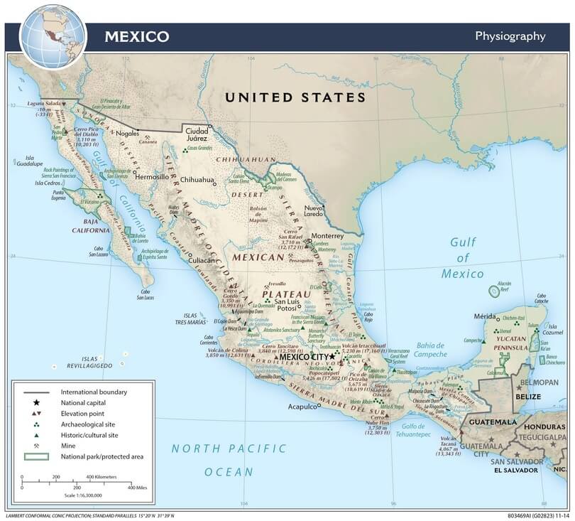
Mexico physiographic map.
Notable Water Bodies of Mexico
Oceans and Seas
- Pacific Ocean - Western coastline, 7,338 km (4,559 mi) of coastline
- Gulf of California (Sea of Cortez) - Between Baja California and the mainland, 1,126 km (700 mi) long, 48-241 km (30-150 mi) wide, max depth 3,292 m (10,801 ft)
- Gulf of Mexico - Eastern coastline, 3,294 km (2,047 mi) of Mexican coastline, basin area 1.6 million sq km (617,800 sq mi)
- Caribbean Sea - Southeastern coastline, 865 km (538 mi) along the Yucatan Peninsula
- Bahía de Banderas - Major Pacific bay, 1,300 sq km (502 sq mi)
- Campeche Sound - Gulf of Mexico embayment, 40,000 sq km (15,444 sq mi)
Major Rivers
- Rio Grande (Rio Bravo) - US-Mexico border, 2,018 km (1,254 mi) Mexican section, total length 3,034 km (1,886 mi), watershed 225,242 sq km (86,967 sq mi)
- Usumacinta River - Chiapas/Tabasco, 1,123 km (698 mi), combined system discharge 4,500 m³/s (158,957 ft³/s)
- Grijalva River - Southeastern Mexico, 600 km (373 mi), major tributary to Usumacinta
- Rio Lerma-Santiago - Central to western Mexico, 1,342 km (834 mi), watershed 125,000 sq km (48,263 sq mi)
- Rio Balsas - Southern Mexico, 771 km (479 mi), watershed 117,406 sq km (45,331 sq mi)
- Rio Sonora - Northwestern Mexico, 421 km (262 mi)
- Rio Panuco - Eastern Mexico, 510 km (317 mi)
- Rio Papaloapan - Veracruz/Oaxaca, 354 km (220 mi)
- Rio Conchos - Chihuahua, 560 km (348 mi), major Rio Grande tributary
- Rio Yaqui - Northwestern Mexico, 410 km (255 mi), watershed 72,540 sq km (28,008 sq mi)
- Rio Fuerte - Sinaloa/Chihuahua, 540 km (336 mi), watershed 33,590 sq km (12,970 sq mi)
- Rio Verde - San Luis Potosí, 350 km (217 mi)
- Rio Nazas - Durango/Coahuila, 560 km (348 mi)
- Rio Aguanaval - Zacatecas/Durango, 450 km (280 mi)
- Rio Salado - Northeastern Mexico, 675 km (419 mi)
- Rio San Juan - Nuevo León/Tamaulipas, 344 km (214 mi)
- Rio Soto la Marina - Tamaulipas, 416 km (259 mi)
- Rio Tuxpan - Veracruz, 150 km (93 mi)
- Rio Coatzacoalcos - Veracruz, 325 km (202 mi)
- Rio Tonalá - Veracruz/Tabasco, 82 km (51 mi)
- Rio San Pedro - Tabasco, 180 km (112 mi)
- Rio Candelaria - Campeche, 150 km (93 mi)
- Rio Champotón - Campeche, 185 km (115 mi)
- Rio Hondo - Quintana Roo/Belize border, 209 km (130 mi)
Natural Lakes
- Lake Chapala - Jalisco/Michoacan, 1,112 sq km (429 sq mi), max depth 10.5 m (34 ft), elevation 1,524 m (5,000 ft)
- Lake Patzcuaro - Michoacan, 126 sq km (49 sq mi), max depth 11 m (36 ft), elevation 2,035 m (6,677 ft)
- Lake Cuitzeo - Michoacan, 300-400 sq km (116-154 sq mi), max depth 2 m (7 ft), elevation 1,820 m (5,971 ft)
- Nevado de Toluca Crater Lakes - State of Mexico, 1.5 sq km (0.6 sq mi) combined, elevation 4,200 m (13,780 ft)
- Lake Yuriria - Guanajuato, 80 sq km (31 sq mi)
- Lake Zirahuén - Michoacan, 9.8 sq km (3.8 sq mi), max depth 40 m (131 ft)
- Lake Zempoala - Morelos, 0.8 sq km (0.3 sq mi), elevation 2,800 m (9,186 ft)
- Rincón de Parangueo - Guanajuato, 1.2 sq km (0.5 sq mi), alkaline crater lake
- Lake Texcoco - State of Mexico, historically 1,500 sq km (579 sq mi), now largely drained
- Lake Xochimilco - Mexico City, remnants cover 15 sq km (6 sq mi)
- Laguna de Sayula - Jalisco, 140 sq km (54 sq mi), seasonal saline lake
- Laguna Babícora - Chihuahua, 145 sq km (56 sq mi), seasonal
- Laguna de Bustillos - Chihuahua, 80 sq km (31 sq mi), seasonal
- Laguna de Palau - Chihuahua, 60 sq km (23 sq mi)
- Laguna del Mayrán - Coahuila, 100 sq km (39 sq mi), seasonal
- Laguna de Santiaguillo - Durango, 65 sq km (25 sq mi)
Coastal Lagoons
- Laguna Madre - Tamaulipas, 2,174 sq km (839 sq mi), 230 km (143 mi) long, avg depth 1 m (3.3 ft)
- Laguna de Términos - Campeche, 1,800 sq km (695 sq mi), 70 km × 28 km (43 × 17 mi)
- Laguna de Alvarado - Veracruz, 62 sq km (24 sq mi)
- Laguna del Carmen - Campeche, 32 sq km (12 sq mi)
- Laguna Ojo de Liebre - Baja California Sur, 36 sq km (14 sq mi), gray whale nursery
- Laguna San Ignacio - Baja California Sur, 170 sq km (66 sq mi), gray whale breeding area
- Laguna Cuyutlán - Colima, 72 sq km (28 sq mi), 37 km (23 mi) long
- Laguna de Tamiahua - Veracruz, 900 sq km (347 sq mi)
- Laguna de Pueblo Viejo - Veracruz, 125 sq km (48 sq mi)
- Laguna de Mandinga - Veracruz, 25 sq km (10 sq mi)
- Laguna de Sontecomapan - Veracruz, 8.5 sq km (3.3 sq mi)
- Laguna de Celestún - Yucatan, 22 sq km (8.5 sq mi)
- Laguna de Chautengo - Guerrero, 46 sq km (18 sq mi)
- Laguna de Tres Palos - Guerrero, 16 sq km (6.2 sq mi)
- Laguna de Coyuca - Guerrero, 35 sq km (14 sq mi)
- Laguna del Marqués - Guerrero, 18 sq km (7 sq mi)
- Laguna de Mitla - Guerrero, 12 sq km (5 sq mi)
- Laguna Potosí - Guerrero, 20 sq km (8 sq mi)
- Laguna de Agua Dulce - Veracruz, 15 sq km (6 sq mi)
- Laguna Machona - Tabasco, 45 sq km (17 sq mi)
- Laguna de Carmen - Tabasco, 30 sq km (12 sq mi)
- Laguna Redonda - Tabasco, 22 sq km (8.5 sq mi)
- Sistema Lagunar Nichupté - Quintana Roo, 65 sq km (25 sq mi)
- Laguna Colombia - Quintana Roo, 12 sq km (5 sq mi)
- Laguna Bacalar - Quintana Roo, 42 sq km (16 sq mi), 55 km (34 mi) long
Artificial Reservoirs
- Presa de la Amistad - Rio Grande, 833 sq km (322 sq mi), capacity 7.8 billion m³ (6.3 million acre-ft)
- Vicente Guerrero Dam - Tamaulipas, 165 sq km (64 sq mi), capacity 4.1 billion m³ (3.3 million acre-ft)
- Presa Falcon - Tamaulipas, 350 sq km (135 sq mi), capacity 4.3 billion m³ (3.5 million acre-ft)
- La Angostura - Chiapas, 518 sq km (200 sq mi), 900 MW generation
- Malpaso - Chiapas, 295 sq km (114 sq mi), 1,080 MW generation
- Chicoasén - Chiapas, 42 sq km (16 sq mi), 2,400 MW generation, depth 140 m (459 ft)
- Peñitas - Chiapas, 88 sq km (34 sq mi), 420 MW generation
- El Cajón - Nayarit, 56 sq km (22 sq mi), 750 MW generation
- Aguamilpa - Nayarit, 65 sq km (25 sq mi), 960 MW generation
- El Caracol - Guerrero, 28 sq km (11 sq mi), 600 MW generation
- La Villita - Michoacan, 35 sq km (14 sq mi), 60 MW generation
- Infiernillo - Michoacan/Guerrero, 290 sq km (112 sq mi), 1,120 MW generation
- Zimapán - Hidalgo, 32 sq km (12 sq mi), 292 MW generation
- Huites - Sinaloa, 78 sq km (30 sq mi), 422 MW generation
- Luis Donaldo Colosio - Sinaloa, 124 sq km (48 sq mi), 433 MW generation
- Adolfo López Mateos - Sinaloa, 45 sq km (17 sq mi), 240 MW generation
- Miguel Hidalgo - Sinaloa, 64 sq km (25 sq mi), 300 MW generation
- Presa Miguel Alemán - Oaxaca, 54 sq km (21 sq mi), 65 MW generation
- Cerro de Oro - Oaxaca, 48 sq km (19 sq mi), 300 MW generation
- Temascal - Oaxaca, 92 sq km (36 sq mi), 354 MW generation
- Novillo - Sonora, 78 sq km (30 sq mi)
- Oviachic - Sonora, 38 sq km (15 sq mi)
- Mocúzari - Sonora, 24 sq km (9 sq mi)
- El Molinito - Sonora, 15 sq km (6 sq mi)
- Alvaro Obregón - Sonora, 52 sq km (20 sq mi)
- Plutarco Elías Calles - Sonora, 45 sq km (17 sq mi)
- Lázaro Cárdenas - Michoacan, 28 sq km (11 sq mi)
- Ignacio Allende - Guanajuato, 42 sq km (16 sq mi)
- Solís - Guanajuato, 18 sq km (7 sq mi)
- Valle de Bravo - State of Mexico, 18.6 sq km (7.2 sq mi)
- Villa Victoria - State of Mexico, 16.8 sq km (6.5 sq mi)
- Colorines - State of Mexico, 5.2 sq km (2 sq mi)
- Chilesdo - State of Mexico, 3.8 sq km (1.5 sq mi)
- Tuxpango - State of Mexico, 2.4 sq km (0.9 sq mi)
- Iztapantongo - State of Mexico, 1.8 sq km (0.7 sq mi)
- El Bosque - State of Mexico, 2.2 sq km (0.8 sq mi)
- Requena - Hidalgo, 12 sq km (5 sq mi)
- Endó - Hidalgo, 8 sq km (3 sq mi)
- Tejocotal - Hidalgo, 6 sq km (2 sq mi)
- La Goleta - Hidalgo, 4 sq km (2 sq mi)
- Dendhó - Hidalgo, 3 sq km (1 sq mi)
- Taxhimay - Hidalgo, 2.8 sq km (1.1 sq mi)
Cenotes (Major Systems)
- Ring of Cenotes - Yucatan Peninsula, 180 km (112 mi) in diameter, marks the Chicxulub crater rim
- Sistema Sac Actun - Quintana Roo, 347 km (216 mi) underwater passages
- Dos Ojos Cenote System - Quintana Roo, 82 km (51 mi) surveyed passages
- Sistema Ox Bel Ha - Quintana Roo, 270 km (168 mi) underwater passages
- Sistema Komal - Quintana Roo, 86 km (53 mi) passages
- Cenote Azul - Quintana Roo, 90 m (295 ft) depth
- Cenote Angelita - Quintana Roo, 60 m (197 ft) depth
- Gran Cenote - Quintana Roo, 25 m (82 ft) depth
- Cenote Calavera - Quintana Roo, 15 m (49 ft) depth
- Cenote Cristalino - Quintana Roo, 8 m (26 ft) depth
- Cenote Chac Mool - Quintana Roo, connected to an underwater cave system
- Cenote Kukulcan - Quintana Roo, 18 m (59 ft) depth
- Cenote Manatí - Quintana Roo, 14 m (46 ft) depth
- Cenote Ponderosa - Quintana Roo, 30 m (98 ft) depth
- Cenote Taj Mahal - Quintana Roo, 14 m (46 ft) depth
- Cenote Zacil-Ha - Quintana Roo, 10 m (33 ft) depth
- Cenote X'keken - Yucatan, an underground cenote with stalactites
- Cenote Samula - Yucatan, underground cenote, 40 m (131 ft) depth
- Cenote Sagrado - Yucatan, Chichen Itza sacred cenote, 20 m (66 ft) depth
- Cenote Xlacah - Yucatan, Dzibilchaltún, 44 m (144 ft) depth
- Cenote Dzitnup - Yucatan, an underground cenote with root formations
- Cenote Ik Kil - Yucatan, 26 m (85 ft) depth, near Chichen Itza
- Cenote Suytun - Yucatan, an underground cenote with a light beam
- Cenote Oxman - Yucatan, 15 m (49 ft) depth
- Cenote Hubiku - Yucatan, underground cenote, 35 m (115 ft) depth
Waterfalls and Springs
- Hierve el Agua - Oaxaca, travertine formations, mineral springs 22-27°C (72-81°F)
- Agua Azul - Chiapas, a series of waterfalls and pools
- Misol-Há - Chiapas, 30 m (98 ft) waterfall
- El Chiflón - Chiapas, a series of waterfalls up to 120 m (394 ft)
- Cascada de Tamul - San Luis Potosí, 105 m (344 ft) waterfall
- Salto de la Novia - Chihuahua, 100 m (328 ft) waterfall
- Cascadas de Cusárare - Chihuahua, 30 m (98 ft) waterfall
- Basaseachi Falls - Chihuahua, 246 m (807 ft), Mexico's tallest waterfall
- Los Azufres - Michoacan, geothermal field with 200+ hot springs, 40-95°C (104-203°F)
- Aguas Termales de Grutas Tolantongo - Hidalgo, thermal pools 38°C (100°F)
- Aguas Termales de Ixtapan de la Sal - State of Mexico, thermal springs 38°C (100°F)
- Aguas Termales de San José Purúa - Michoacan, thermal springs 40°C (104°F)
Estuaries and Deltas
- Rio Grande Delta - Tamaulipas, reduced from 700 to <100 sq km (270 to <39 sq mi)
- Grijalva-Usumacinta Delta - Tabasco, 3,000 sq km (1,158 sq mi) wetlands
- Colorado River Delta - Baja California/Sonora, 7,800 sq km (3,012 sq mi) historical
- Lerma-Santiago Delta - Nayarit, 500 sq km (193 sq mi)
- Balsas Delta - Michoacan, 100 sq km (39 sq mi)
- Papaloapan Delta - Veracruz, 300 sq km (116 sq mi)
Protected Marine Areas
- Upper Gulf of California and Colorado River Delta Biosphere Reserve - 934,756 hectares (2.3 million acres)
- Banco Chinchorro Biosphere Reserve - 144,360 hectares (356,710 acres), coral atoll
- Cozumel Reefs National Park - 11,987 hectares (29,625 acres)
- Arrecifes de Puerto Morelos National Park - 9,067 hectares (22,402 acres)
- Cabo Pulmo National Park - 7,111 hectares (17,570 acres)
- Bahía de Loreto National Park - 206,581 hectares (510,495 acres)
- Revillagigedo National Park - 14.8 million hectares (36.6 million acres)
- Espíritu Santo National Park - 48,655 hectares (120,227 acres)