The Corredor Biológico Nevados de Chillán - Laguna del Laja: A Sanctuary of Biodiversity at the Gateway to Patagonia
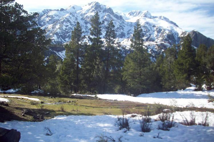
Corredor Biológico Nevados de Chillán - Laguna del Laja Biosphere Reserve Is located in the northern part of Chile's Patagonia region. The biological corridor connects three core areas: Ñuble National Reserve, Laguna del Laja National Park and the Los Huemules de Niblinto National Reserve.
Bridging Ecosystems: The Nevados de Chillán Biological Corridor as a Model for Landscape Conservation
In the heart of Chile's south-central Andes, where the temperate forests begin their transition toward the wilds of Patagonia, lies one of South America's most significant conservation achievements: the Corredor Biológico Nevados de Chillán - Laguna del Laja. This UNESCO Biosphere Reserve represents a triumph of ecological connectivity, linking diverse ecosystems across a landscape of extraordinary biological and geological importance. Encompassing 641,403 hectares (1.58 million acres) and spanning altitudes from 500 to 3,585 meters (1,640 to 11,762 feet) above sea level, this biological corridor serves as a critical refuge for endangered species while demonstrating innovative approaches to landscape-scale conservation.
Geographic Context and Physical Characteristics
The Corredor Biológico is strategically positioned in Chile's Ñuble and Biobío regions, bridging multiple administrative units including the communes of Antuco, Coihueco, El Carmen, Pemuco, Pinto, Tucapel, San Fabián, and Yungay. This expansive territory encompasses three core protected areas that form the backbone of the corridor: the Ñuble National Reserve, Laguna del Laja National Park, and the Los Huemules de Niblinto National Reserve.
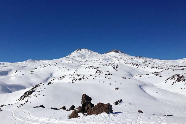
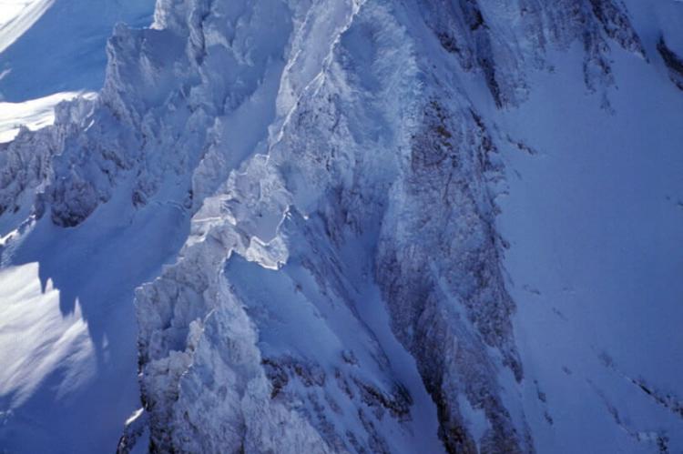
The landscape is dominated by the volcanic complex of Nevados de Chillán, a group of stratovolcanoes that rank among Chile's most active volcanic systems. This geological centerpiece consists of three overlapping peaks: Cerro Blanco (Volcán Nevado) at 3,212 meters (10,538 feet), Volcán Viejo (Volcán Chillán) at 3,089 meters (10,135 feet), and the intermediate Volcán Nuevo. The volcanic activity has shaped not only the physical geography but also the ecological patterns that define the region, creating a mosaic of habitats that range from lowland temperate forests to high-altitude alpine zones.
The corridor's strategic position places it at the northern margin of the Valdivian temperate forests ecoregion, which extends from approximately 35°S to 48°S latitude. This biogeographically significant location makes the corridor a critical transition zone, where the world's second-largest temperate rainforest ecosystem gives way to Chile's central Chilean Matorral (sclerophyllous vegetation). The Valdivian ecoregion represents a unique assemblage of ancient species that persist as remnants of the supercontinent Gondwanaland, making the corridor's forests living museums of evolutionary history. At these latitudes, the tree line occurs at approximately 2,400 meters (7,874 feet) altitude, with temperate forests disappearing at higher elevations and being replaced by high Andean vegetation.
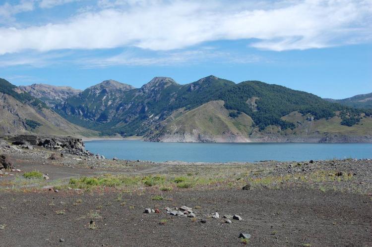
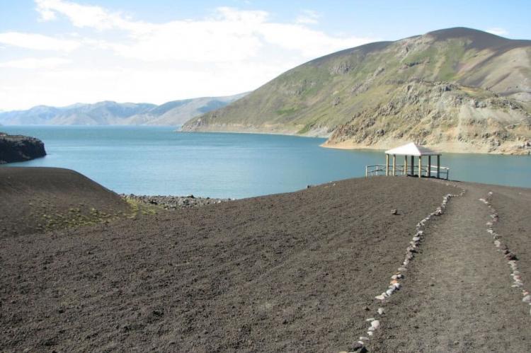
The pristine Laguna del Laja serves as another focal point of the reserve, its glacial waters reflecting the snow-capped peaks while providing critical habitat for migratory waterfowl and endemic aquatic species. The lake's position within the Andean cordillera makes it a vital stopover point for birds following the Pacific flyway, contributing significantly to the area's ornithological importance.
Ecological Significance and Biodiversity
The biological corridor's location at the northern edge of Chile's Patagonian region places it at a crucial biogeographical intersection. This positioning creates exceptional conditions for biodiversity conservation, as the area serves as a refuge for species at the limits of their distribution ranges while facilitating genetic exchange between otherwise isolated populations.
Perhaps the most emblematic species protected within the corridor is the huemul (Hippocamelus bisulcus), Chile's national animal and one of South America's most endangered cervids. The corridor represents the northernmost extent of the huemul's current range, making its protection here particularly critical for the species' long-term survival. Research conducted within the reserve has revealed the importance of native Andean flora in supporting huemul populations, highlighting the interconnected nature of conservation in this ecosystem.
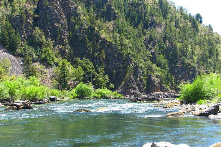
The corridor's diverse elevational gradient supports multiple forest types, from the dense temperate rainforests of the lower elevations to the sparse high-altitude scrublands approaching the treeline. These forests represent the easternmost extension of the Valdivian temperate forests ecoregion into the Andean cordillera, where they encounter the continental climate conditions that limit their further inland penetration. The forests harbor significant populations of southern beech (Nothofagus) species, including the ancient and slow-growing monkey puzzle trees (Araucaria araucana), which have survived in these mountains for millions of years and now face pressure from climate change and human activities. The presence of these Gondwanan relict species underscores the corridor's role in preserving evolutionary heritage that extends back to when South America was part of the ancient supercontinent.
The avian diversity of the corridor is particularly noteworthy, with the area designated as an Important Bird Area by BirdLife International. The varied habitats support both resident species adapted to the Andean environment and seasonal visitors that depend on the corridor's resources during migration or breeding periods. The presence of large raptors, including the Andean condor (Vultur gryphus), underscores the ecosystem's health and its role in supporting apex predators that require vast territories and abundant prey bases.
Conservation Framework and Management
The designation of the Corredor Biológico as a UNESCO Biosphere Reserve reflects its global significance and the innovative conservation approach it represents. As part of UNESCO's Man and the Biosphere Programme, the reserve operates under a model that seeks to balance biodiversity conservation with sustainable human development. This framework recognizes that effective conservation cannot be achieved in isolation from local communities but must integrate social, economic, and cultural considerations.
The biological corridor concept represents an evolution in conservation thinking, moving beyond the traditional approach of protecting isolated reserves to create connected landscapes that allow for species movement and genetic exchange. This connectivity is particularly crucial in the face of climate change, as it provides pathways for species to track suitable habitats as conditions shift over time.
The management structure of the corridor involves multiple stakeholders, including government agencies such as the Corporación Nacional Forestal (CONAF), research institutions like the Pontificia Universidad Católica de Valparaíso, and local communities whose traditional knowledge and sustainable practices contribute to conservation outcomes. This collaborative approach ensures that conservation strategies are both scientifically sound and socially viable.
Core Conservation Areas: The Pillars of the Corridor
The Corredor Biológico Nevados de Chillán - Laguna del Laja derives its conservation strength from three strategically positioned core protected areas, each contributing unique ecological characteristics and management approaches to the broader landscape connectivity goals. These protected areas form the backbone of the biological corridor, providing secure habitat for endangered species while serving as stepping stones for wildlife movement across the landscape.
Ñuble National Reserve: A Botanical Treasure Trove
Established on November 24, 1978, the Ñuble National Reserve spans the borders between the Pinto commune in Ñuble Region and the Antuco commune in Biobío Region. With 75,078 hectares of protected Andean landscape, this reserve stands as one of Chile's most botanically significant protected areas, harboring 12% of Chile's plant diversity despite its relatively modest size.
The reserve's vegetation represents a remarkable transition zone between the Chilean Matorral of central Chile and the temperate rainforests of the south, positioning it at the northern edge of the globally significant Valdivian temperate forests ecoregion. This biogeographical transition zone showcases how the Valdivian ecoregion's influence extends eastward into the Andean mountains, creating unique forest assemblages that combine coastal temperate rainforest elements with montane adaptations as they transition from the Mediterranean-climate Chilean Matorral to the north. The diverse forest composition includes lenga, ñirre, lleuque, and mountain cypress, while smaller specimens include radales, avellanos, coigües, lleuques and cypresses. This botanical diversity reflects not only the reserve's position at a critical biogeographical transition but also its role in preserving Valdivian forest communities at their altitudinal and continental limits, where they interface with the Chilean Matorral ecoregion's Mediterranean-climate-adapted species, giving way to the cold-temperate Patagonian flora.
The reserve's fauna is equally impressive, supporting 14% of the bird species described for Chile, along with populations of huemul and puma. The presence of these apex predators indicates the ecosystem's integrity and its capacity to support complex food webs. The reserve's challenging access conditions, resulting from poor road conditions and limited available information, have inadvertently contributed to its conservation value by limiting human disturbance and maintaining relatively pristine habitats.
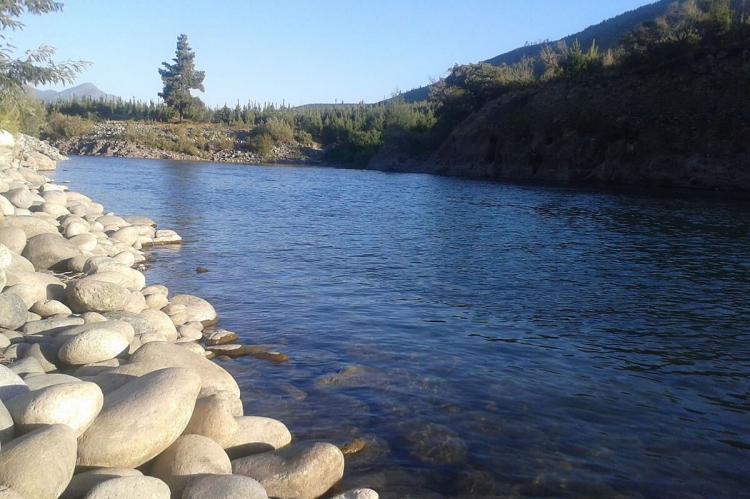
Natural features within the reserve include the spectacular Blanquillo waterfalls, the pristine Hermoso Valley, the Los Peucos River, the Vega Larga wetlands, natural springs, and mountain lagoons, creating a diverse array of aquatic and terrestrial habitats that support the reserve's remarkable biodiversity.
Laguna del Laja National Park: Volcanic Landscapes and Alpine Wilderness
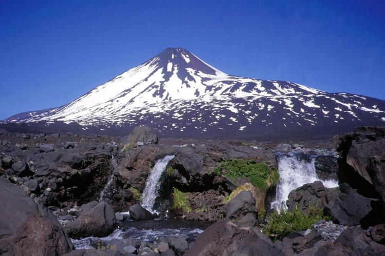
Located between 37°22' and 37°28' south latitude and 71°16' and 71°26' west longitude, Laguna del Laja National Park showcases spectacular mountain landscapes dominated by the Antuco Volcano, Sierra Velluda and the glacial Laguna del Laja. Established in 1958 and located 93 kilometers (58 miles) east of the city of Los Angeles, this park serves as the southern anchor of the biological corridor.
The park's dramatic topography ranges from 976 meters (3,202 feet) elevation at its lowest point to 3,585 meters (11,762 feet) at Sierra Velluda, creating an extraordinary elevational gradient that supports diverse ecological zones from temperate forests to high-alpine environments. The centerpiece Antuco Volcano, while bearing relatively little snow compared to the major summits to its south, remains an active geological feature that continues to shape the landscape through ongoing volcanic processes.
The park's namesake, Laguna del Laja, represents one of Chile's most pristine high-altitude lakes, formed by glacial processes and maintained by snowmelt from the surrounding peaks. While the lake only borders the park, rather than lying entirely within it, it serves as a critical water source and habitat for aquatic species, providing spectacular scenic value that draws visitors from around the world.
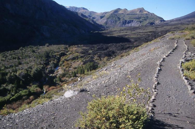
The park's accessibility via a two-hour drive from Los Angeles, with the final thirty minutes (48 kilometers/30 miles) on a gravel road, allows for visitor access while maintaining the pristine character of the high-altitude zones. The park offers several hiking trails with views of waterfalls and Volcán Antuco, providing opportunities for environmental education and eco-tourism that support both conservation awareness and local economic development.
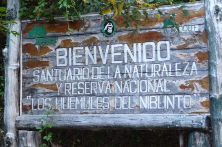
Los Huemules de Niblinto National Reserve: Sanctuary for Chile's National Animal
Los Huemules de Niblinto National Reserve occupies a strategic position close to the northwest end of the Nevados de Chillán, within the upper Niblinto River basin. This reserve holds particular significance within the biological corridor as it protects the northernmost population of South Andean deer, making it absolutely critical for the long-term survival of Chile's national animal.
The reserve's primary conservation focus on huemul populations reflects the species' precarious status throughout its range. The reserve protects groups of huemuls that are showing incipient population increases, although they remain in sites of difficult access, making them challenging to observe. This limited accessibility, while presenting challenges for research and monitoring, provides essential protection for huemul populations that might otherwise face disturbance from human activities.
The establishment of this reserve specifically for huemul conservation represents recognition of the species' critical conservation needs and the importance of protecting habitat at the northern edge of its range. Huemul populations in this area face particular pressures as they represent isolated groups far from the main population centers in Patagonia, making genetic connectivity and habitat protection especially crucial for their survival.
The reserve's location within the upper watershed of the Niblinto River provides high-quality habitat that includes the mixed forest and shrubland environments preferred by huemuls. The riparian corridors and adjacent slopes offer diverse foraging opportunities and escape terrain that huemuls require. At the same time, the reserve's protected status ensures these habitats remain undisturbed by livestock grazing, logging, or other human activities that have historically threatened huemul populations.
Synergistic Conservation Through Corridor Connectivity
The three core protected areas function synergistically within the biological corridor framework, with each contributing unique conservation values while collectively providing landscape-scale habitat connectivity. The Ñuble National Reserve's exceptional botanical diversity provides seed sources for forest regeneration throughout the corridor, while its diverse bird populations contribute to pollination and seed dispersal services that maintain ecosystem function across the landscape.
Laguna del Laja National Park's high-elevation environments serve as climate refugia that may become increasingly important as global temperatures rise. The park's volcanic landscapes also provide unique geological habitats that support specialized plant and animal communities found nowhere else in the corridor. The park's visitor infrastructure and accessibility make it a vital hub for environmental education and public engagement with conservation issues.
Los Huemules de Niblinto National Reserve serves as the corridor's flagship for endangered species conservation, demonstrating how targeted protection can support the recovery of critically threatened populations. The reserve's success in protecting huemul populations provides hope for similar conservation efforts throughout the species' range and serves as a model for landscape-scale approaches to recovering endangered species.
Together, these three protected areas create a conservation network that exceeds the sum of its parts, providing the ecological connectivity and habitat diversity necessary to maintain ecosystem integrity in the face of climate change, habitat fragmentation, and other contemporary conservation challenges.
Cultural Heritage and Indigenous Connections
The Corredor Biológico is not merely a repository of biological diversity; it is also a landscape rich in cultural heritage that reflects millennia of human interaction with the natural environment. Archaeological sites scattered throughout the reserve provide evidence of Indigenous occupation dating back thousands of years, revealing sophisticated systems of resource management that allowed human communities to thrive while maintaining ecological integrity.
Contemporary Indigenous communities maintain connections to the land through traditional practices and cultural ceremonies that emphasize the spiritual significance of natural features such as the volcanic peaks and pristine lakes. These cultural traditions often incorporate detailed ecological knowledge that complements scientific understanding and contributes to more effective conservation strategies.
The recognition of cultural values within the biosphere reserve framework acknowledges that conservation success depends not only on protecting biological processes but also on maintaining the cultural practices and knowledge systems that have historically supported sustainable relationships between humans and nature.
Geological Heritage and Scientific Value
The geological diversity of the Corredor Biológico represents a significant component of its overall heritage value. The volcanic complex of Nevados de Chillán provides exceptional opportunities for understanding Andean geological processes, volcanic hazards, and the relationship between geological activity and ecosystem development. The presence of multiple calderas, ignimbrite sheets, and diverse volcanic landforms creates a natural laboratory for earth sciences research.
Recent studies have focused on identifying and quantifying the geological heritage of the southern portion of the reserve, recognizing geosites of particular scientific value that warrant special protection measures. This geological patrimony includes not only spectacular landforms but also important fossil localities and mineral deposits that contribute to understanding regional geological history.
The ongoing volcanic activity within the corridor creates both challenges and opportunities for conservation management. While volcanic eruptions can temporarily disrupt ecosystems and pose risks to human communities, they also contribute to the long-term renewal of landscapes and the creation of new habitats. Understanding these dynamic processes is essential for developing adaptive management strategies that can respond effectively to both predictable and unexpected environmental changes.
Climate Change Implications and Adaptive Management
The Corredor Biológico faces significant challenges from climate change that threaten both its biodiversity and its effectiveness as a conservation landscape. Rising temperatures are already causing shifts in species distributions, with montane species moving upslope in search of suitable thermal conditions. The corridor's elevational gradient provides some resilience against these changes, offering potential refugia at higher elevations, but the rate of climate change may exceed the ability of many species to adapt or migrate.
Changes in precipitation patterns pose additional challenges, particularly for forest ecosystems that depend on specific moisture regimes. The potential for increased frequency and intensity of droughts could stress forest communities and increase fire risk, while changes in snowpack duration and timing could affect water availability in lakes and streams.
The corridor's management framework includes provisions for adaptive management that can respond to changing conditions through monitoring, research, and flexible policy implementation. This approach acknowledges that conservation strategies must adapt as environmental conditions shift and new insights emerge from ongoing research programs.
Research and Education Initiatives
The Corredor Biológico serves as an important platform for scientific research and environmental education, hosting studies that range from basic ecological research to applied conservation science. Universities and research institutions collaborate with management agencies to conduct long-term monitoring programs that track ecosystem health, species populations, and environmental changes.
Educational programs within the reserve target multiple audiences, ranging from local schoolchildren to international visitors, promoting an understanding of ecological processes and conservation principles. These programs often emphasize the connections between local actions and global environmental challenges, helping to build support for conservation initiatives and sustainable development practices.
The reserve's role as a research and education center extends beyond its boundaries through partnerships with other protected areas and conservation organizations. These collaborative networks facilitate knowledge exchange and help develop best practices for biological corridor management that can be applied in other regions facing similar conservation challenges.
Future Challenges and Opportunities
Looking ahead, the Corredor Biológico faces both significant challenges and promising opportunities. Increasing human population pressure in surrounding areas creates demands for land conversion and resource extraction that could fragment the corridor and reduce its conservation effectiveness. Climate change continues to pose threats to species and ecosystems, requiring innovative adaptation strategies and potentially costly management interventions.
However, growing recognition of the corridor's value creates opportunities for enhanced protection and sustainable financing. International attention to ecosystem services, carbon sequestration, and biodiversity conservation may provide new funding mechanisms that support both conservation goals and local economic development.
The corridor's success will ultimately depend on maintaining the delicate balance between conservation and development that defines the biosphere reserve model. This requires continued collaboration among diverse stakeholders, adaptive management approaches that can respond to changing conditions, and sustained commitment to the principles of sustainable development that make long-term conservation possible.
Conclusion
The Corredor Biológico Nevados de Chillán - Laguna del Laja represents a remarkable achievement in landscape-scale conservation, demonstrating how protected areas can be designed and managed to address the complex challenges facing biodiversity in the 21st century. By connecting diverse ecosystems across an elevational gradient that spans from temperate forests to high alpine zones, the corridor provides essential habitat for endangered species while maintaining the ecological processes that sustain landscape-level biodiversity.
The reserve's significance extends far beyond its boundaries, serving as a model for the development of biological corridors and a testing ground for innovative conservation approaches. Its integration of scientific research, cultural heritage preservation, and sustainable development demonstrates that effective conservation must address human needs alongside ecological requirements.
As environmental challenges continue to intensify, the lessons learned from the Corredor Biológico become increasingly valuable for conservation efforts worldwide. The corridor's success in protecting the huemul at the northern edge of its range, maintaining forest connectivity across a volcanic landscape, and balancing conservation with sustainable development provides hope that well-designed and carefully managed protected areas can continue to serve as bastions of biodiversity in an increasingly human-dominated world.
The future of this remarkable landscape depends on sustained commitment from local communities, government agencies, and the international conservation community. With continued support and adaptive management, the Corredor Biológico Nevados de Chillán - Laguna del Laja will continue to serve as a sanctuary for Chile's natural heritage and a beacon of hope for conservation efforts throughout the Neotropics.
