
The Tumbes-Chocó-Magdalena Biodiversity Hotspot: Nature's Last Stand on South America's Pacific Coast
Along South America's Pacific coast from Panama to northern Peru lies the Tumbes-Chocó-Magdalena Biodiversity Hotspot, a roughly 275,000 sq km strip that runs from the wettest rainforests on Earth to South America's last coastal dry forests. It holds an estimated 11,000 vascular plant species, about a quarter of them found nowhere else, and has lost more than 70% of its original habitat.
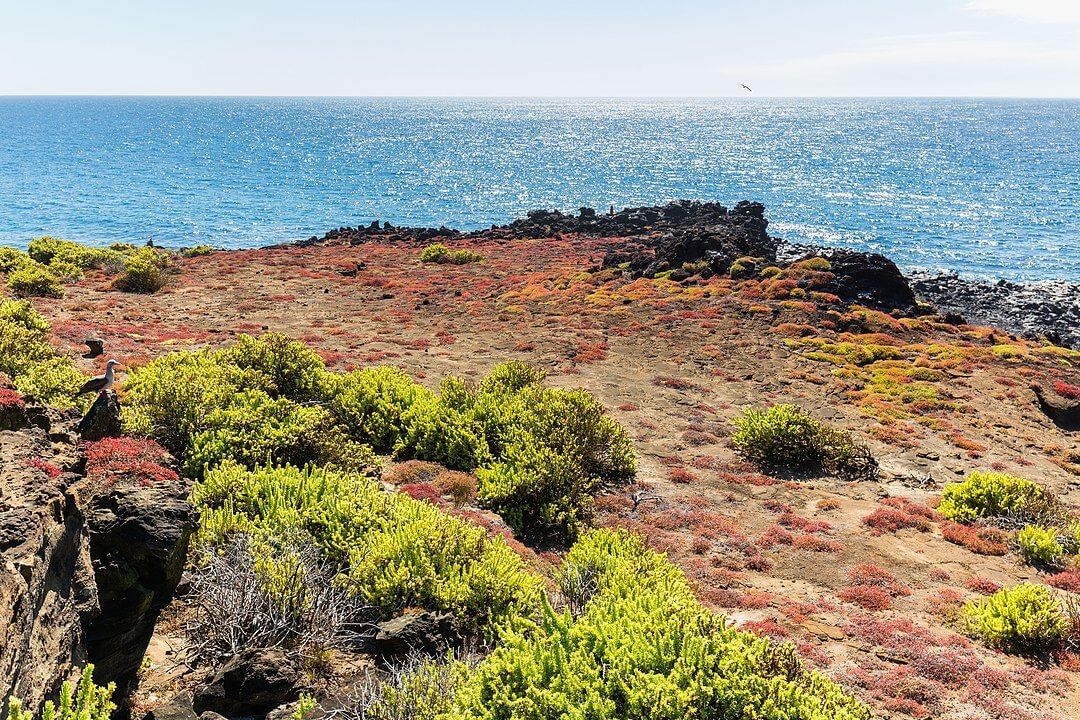
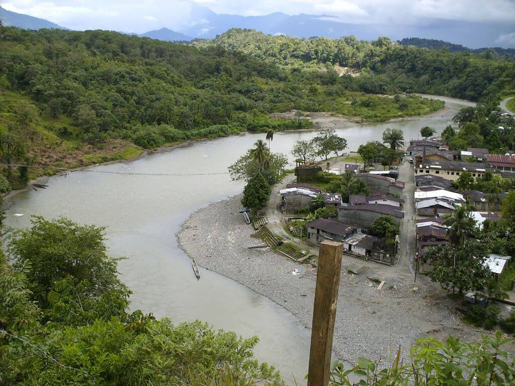
From Panama to Peru: Understanding the Tumbes-Chocó-Magdalena Biodiversity Crisis
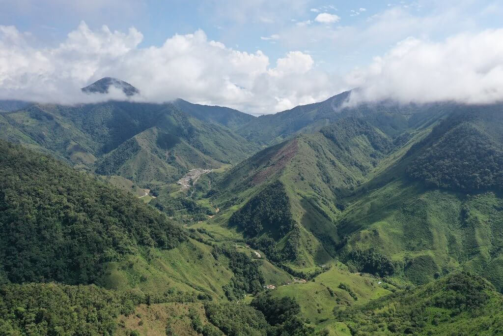
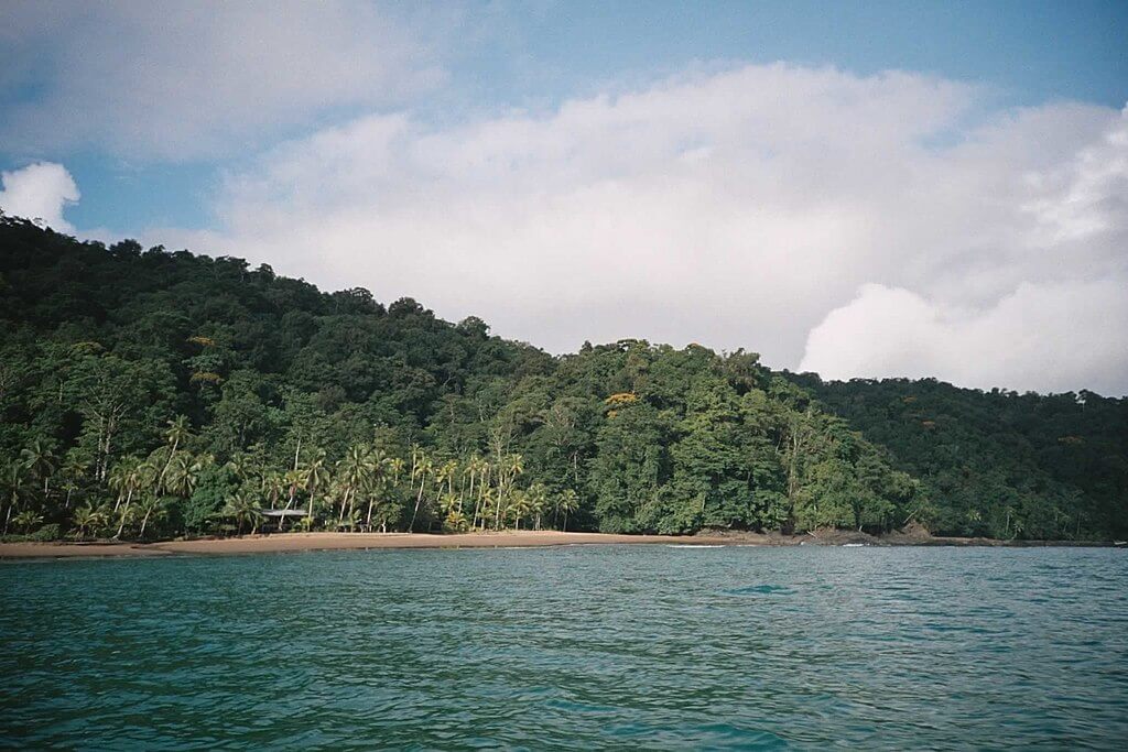
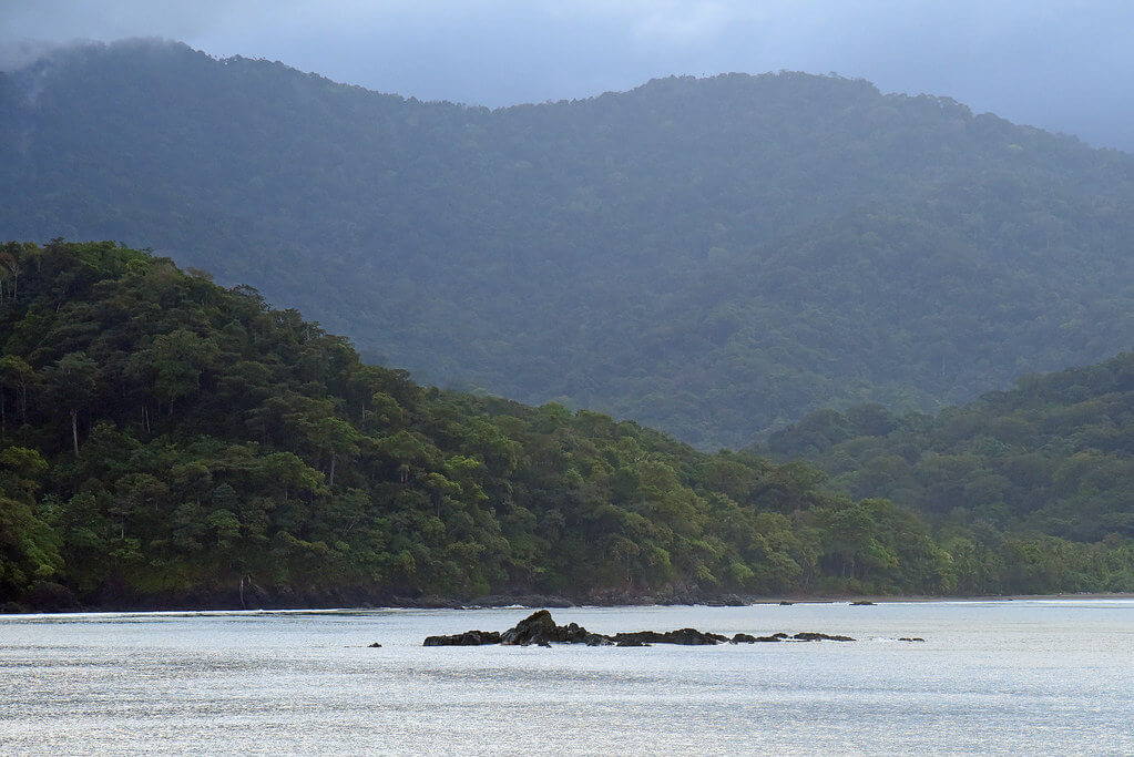
Along the Pacific coast of South America, stretching like a verdant ribbon from Panama to northern Peru, lies one of Earth's most extraordinary and endangered natural regions: the Tumbes-Chocó-Magdalena Biodiversity Hotspot. It covers 274,597 sq km (106,000 sq mi) along a strip about 1,500 km (930 mi) long, and it is a refuge for countless endemic species, a natural laboratory of evolution, and a critical front in the global effort to preserve biodiversity.
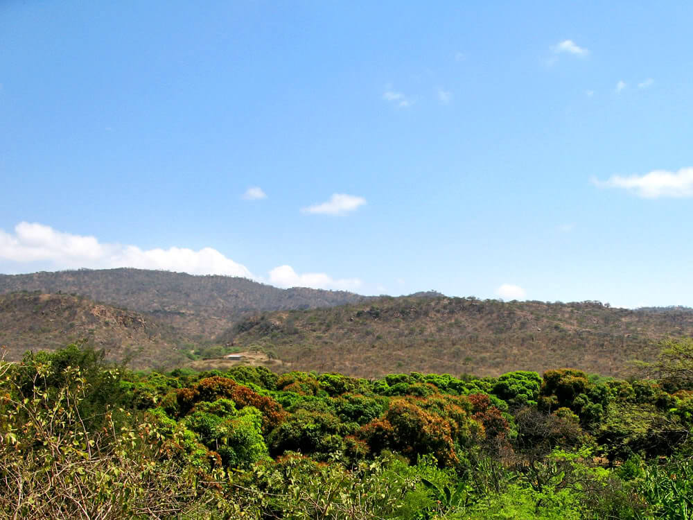
The concept of biodiversity hotspots, introduced by British ecologist Norman Myers in 1988, identifies regions that harbor exceptional concentrations of endemic species while simultaneously facing severe habitat loss. To qualify, a region must contain at least 1,500 endemic vascular plant species and have lost at least 70% of its original habitat. The Tumbes-Chocó-Magdalena Hotspot meets both criteria, combining two extremes rarely found so close together: the Colombian Chocó, whose rainforests are among the wettest on Earth, and the dry forests of southern Ecuador and northern Peru, the last remaining coastal dry forests in South America.
Historical Context and Scientific Recognition
Scientists originally designated the hotspot as the Chocó-Darién-Western Ecuador hotspot. It was later expanded to include several new areas, most notably Colombia's Magdalena Valley, reflecting a growing understanding of the biological connections between previously separated ecoregions. The region's natural wealth drew early scientific attention: Alexander von Humboldt's travels through Colombia, Ecuador, and Peru between 1799 and 1804 helped introduce European science to it, and Charles Darwin's 1835 visit to the Galápagos Islands, now included within the hotspot's boundaries, fundamentally changed our understanding of evolution.
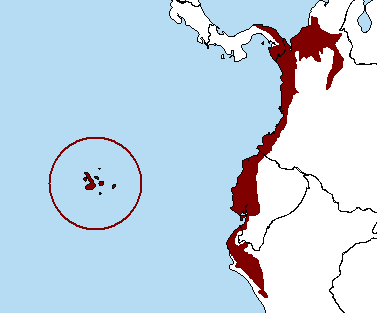
The Tumbes-Chocó-Magdalena Hotspot.
Geographical Scope and Physical Characteristics
The hotspot extends from Panama's Darién Province and the vicinity of the Panama Canal, together with Colombia's Magdalena Valley, south through Ecuador to the coastal deserts of northern Peru. It encompasses portions of four countries, Panama, Colombia, Ecuador, and Peru, along with the Galápagos Islands, which belong to Ecuador. Its eastern boundary follows the western flanks of the Andes Mountains, creating a transition zone from coastal lowlands through Andean foothills and lower montane slopes.
The landscape ranges from mangrove-lined estuaries and beaches to cloud-wrapped mountain slopes and isolated volcanic islands. The Magdalena River Valley in Colombia, the Guayas River system in Ecuador, and numerous smaller watersheds support wetlands and floodplain forests that serve as wildlife corridors and breeding grounds.
The climate is tropical and subtropical, with sharp regional contrasts. The northern Colombian Chocó receives some of the highest rainfall on Earth, exceeding 10,000 mm (about 400 in) a year in places, while the southern portions along the Peruvian coast, shaped by the cold Humboldt Current and the Andes' rain shadow, are far drier. This gradient, from hyperhumid rainforest to arid scrub over relatively short distances, is a major reason for the region's ecological diversity, and periodic El Niño events add cycles of extreme weather.
Ecoregions: A Mosaic of Habitats
The hotspot is a mosaic of ecoregions. The Chocó-Darién moist forests of Panama and Colombia are the hotspot's wet heart, receiving 4,000 to 9,000 mm of rain a year across most of the ecoregion and far more in its wettest zones. They support an estimated 8,000 to 10,000 vascular plant species, about 20% of them strictly endemic, and their central portion remains largely intact. Farther south, the Western Ecuador moist forests, shared between Ecuador and southern Colombia, tell the opposite story: most of their original habitat has been destroyed, and by some estimates about 98% of the native forest of coastal Ecuador has been cleared, making it one of the most threatened tropical forests in the world.
Toward the south and inland, the Tumbes-Piura dry forests of Ecuador and Peru and the Ecuadorian dry forests hold South America's only remaining coastal dry forests, with pronounced wet and dry seasons that produce drought-deciduous trees and specialized wildlife. They shelter the Critically Endangered white-winged guan (Penelope albipennis), found only in the dry forests at the hotspot's southern extreme. In Colombia, the Magdalena-Urabá moist forests and the Magdalena Valley montane forests extend the hotspot into the country's interior and Caribbean lowlands.
Along the coast, mangrove ecoregions, including the Gulf of Guayaquil-Tumbes, Manabí, and Piura mangroves, and the Guayaquil flooded grasslands provide wetland habitat. The Galápagos Islands add their own xeric scrub and scrubland ecoregions: they hold nearly 700 vascular plant species, about a quarter of them endemic, including six endemic genera of flowering plants, and half of the hotspot's endemic species live on the archipelago.
Biodiversity: A Global Treasure Trove
The hotspot holds an estimated 11,000 vascular plant species, about 25% of them, roughly 2,750, found nowhere else on Earth, making it one of the most plant-rich regions in the Americas. Palms, orchids, bromeliads, and ferns are especially diverse in the wet forests, and the persistent moisture and varied topography have allowed both the survival of ancient lineages and rapid speciation.
Nearly 900 bird species inhabit the hotspot, about 110 of them found nowhere else, alongside significant populations of harpy eagles, crested eagles, guans, and curassows that depend on extensive, intact forest. Threatened species include the white-winged guan, presumed extinct until its rediscovery in 1977, and the long-wattled umbrellabird (Cephalopterus penduliger), a Vulnerable species of the Colombian and Ecuadorian Chocó.
Among mammals, the hotspot is best known for its primates, including three species of spider monkey and three species of bare-faced tamarin. The brown-headed spider monkey (Ateles fusciceps fusciceps) of northwestern Ecuador is one of the world's 25 most endangered primates, and Baird's tapir (Tapirus bairdii), the region's largest terrestrial mammal, is an important seed disperser that has declined due to hunting and habitat loss. On the Galápagos, the Endangered Galápagos fur seal (Arctocephalus galapagoensis) and the endemic rice rats of the genus Nesoryzomys are among the archipelago's distinctive mammals.
The hotspot holds more than 320 reptile species, nearly 100 of them endemic, including more than 20 on the Galápagos, where the giant tortoises and marine iguanas (Amblyrhynchus cristatus) that helped shape Darwin's theory of evolution live. Amphibian diversity exceeds 200 species, about 30 of them endemic, and new species are being discovered faster than scientists can formally describe them. Poison dart frogs (Dendrobatidae) are the best known; among them is the golden poison frog (Phyllobates terribilis), confined to the Saija River basin in the southern Chocó and one of the most poisonous vertebrates on Earth. Many endemic amphibians are restricted to tiny habitat patches, making them especially vulnerable to habitat loss and climate change.
Ecosystem Services and Human Benefits
The hotspot's forests store large quantities of carbon in biomass and soil, and mangroves are particularly efficient carbon sinks. Forest cover regulates regional rainfall through evapotranspiration and protects the watersheds that supply water to millions of people, while mangroves and other coastal ecosystems buffer coastlines against storms and rising seas. The region's plant diversity is also a largely uninvestigated reservoir of potential medicinal and agricultural resources, much of it already central to the traditional knowledge of Indigenous peoples.
Indigenous Peoples and Traditional Knowledge
The hotspot has been home to numerous Indigenous peoples for thousands of years, each with distinct languages and environmental knowledge developed through generations of hunting, fishing, agriculture, and resource use. Traditional agroforestry systems often maintain high biodiversity while providing food and materials for subsistence and trade, and Indigenous territories frequently retain more forest cover than surrounding lands, making recognition of territorial rights one of the most effective conservation strategies available. These communities face ongoing pressure from extractive industries and territory loss, even as growing recognition of their rights opens new opportunities for collaborative conservation.
Threats to Biodiversity: A Crisis in Progress
The main threats are farming encroachment, deforestation, illegal crops, and population growth, which together have cost the hotspot more than 70% of its original habitat. The damage is uneven. The Panamanian and Colombian portions of the hotspot remain relatively intact, while coastal Ecuador has lost nearly all of its native forest. Agricultural conversion, including oil palm plantations, cattle ranching, and export crops, is the primary driver, compounded by road construction and urban expansion around cities such as Guayaquil, as well as legal and illegal logging that targets the largest trees. Gold mining, including small-scale artisanal operations, often contaminates rivers and soils with mercury.
Overhunting has reduced populations of large mammals and birds, undermining the seed dispersal they provide, and the illegal wildlife trade continues to threaten many species. Climate change compounds these pressures: rising temperatures threaten high-elevation endemics restricted to narrow temperature bands, and sea-level rise threatens mangroves and coastal forests that development often blocks from migrating inland. Agricultural runoff and urban and industrial pollution further degrade terrestrial and aquatic ecosystems.
Conservation Efforts: Hope in Action
Major protected areas include Colombia's Los Katíos National Park and the Galápagos National Park, one of the world's best-known protected areas and a demonstration of how ecotourism can help fund conservation. Much of the recent work has come through the Critical Ecosystem Partnership Fund (CEPF), which has supported reserves such as El Pangan in Colombia, created with the bird-conservation group ProAves, and the Mache Chindul Ecological Reserve in Ecuador, where a biological assessment recorded 491 bird species and 136 mammal species, about 37% of all mammals in the country. In Ecuador, private reserves such as Río Canandé and Jama-Coaque protect threatened primates, birds, amphibians, and endemic plants, including habitat for the brown-headed spider monkey.
Community-based conservation, particularly the recognition of Indigenous territories, remains one of the region's most effective strategies, since these lands often provide habitat corridors connecting formal protected areas. Restoration efforts, including native-species reforestation and mangrove restoration with local fishing communities, work to reconnect fragmented habitat, while ongoing biodiversity surveys continue to reveal new species and show that existing protected areas do not yet represent the region's full diversity. International organizations, including Conservation International, provide funding, technical assistance, and coordination.
Conclusion
The Tumbes-Chocó-Magdalena Hotspot spans some of the planet's most contrasting habitats, from the wettest rainforests on Earth to South America's last coastal dry forests and the volcanic islands of the Galápagos. It holds an estimated 11,000 plant species, a quarter of them endemic, and nearly 900 bird species, yet it has already lost more than 70% of its original habitat. Its future looks very different from one end to the other: the Chocó's central forests remain largely intact, while coastal Ecuador's have nearly vanished. What the region can still offer is visible in Indigenous territories that keep their forest, in reserves that protect the last dry-forest and cloud-forest fragments, and in community-led restoration. Whether those efforts scale up before the remaining forests are lost will decide the fate of one of the world's most biologically important regions.
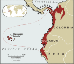
Map with the Tumbes-Chocó-Magdalena hotspot highlighted.