Venezuela's Aquatic Diversity: A Complete Guide to the Nation's Water Bodies
Venezuela's water bodies shape its geography and ecology, relying mainly on two watersheds—one into the Atlantic, the other into the Caribbean. Key resources include the Orinoco River, Lake Maracaibo, mountain lakes, and wetlands, supporting ecosystems, driving economic growth, and benefiting millions.


The Aquatic Realm of Venezuela: Rivers, Lakes, and Coastal Waters
Venezuela, the sixth-largest country in South America, encompasses a spectacular array of water bodies that define its geographical character and ecological diversity. Covering 912,050 square kilometers (352,144 square miles), the nation extends from the Caribbean Sea in the north to the Amazon Basin in the south, creating a hydrographic network of extraordinary complexity and importance. The Venezuelan drainage network consists almost entirely of two watersheds, the largest of which empties into the Atlantic Ocean, and the other into the Caribbean Sea. From the mighty Orinoco River system to the ancient Lake Maracaibo, from pristine mountain lakes to extensive coastal wetlands, Venezuela's aquatic resources support diverse ecosystems, drive economic development, and sustain millions of inhabitants across varied geographical regions.
The Orinoco River: Venezuela's Liquid Highway
The Orinoco is by far the most important of the more than 1,000 rivers in the country. Flowing more than 2,500 kilometers to the Atlantic from its source in the Guiana highlands at the Brazilian border, the Orinoco is the world's eighth-largest river and the largest in South America after the Amazon. The river flows in a giant arc for some 1,700 miles (2,740 km) from its source in the Guiana Highlands to its mouth on the Atlantic Ocean.
The Orinoco's seasonal variations are dramatic, with the high water level in August exceeding the low levels of March and April by as much as thirteen meters. During its journey, the river traverses diverse landscapes, from highland forests to vast grasslands, supporting navigation, transportation, and commerce throughout much of Venezuela's interior.
The Orinoco Delta: A Living Ecosystem
As the Orinoco approaches the Atlantic Ocean, it forms a massive delta spanning over 40,000 square kilometers (15,400 square miles). This fan-shaped delta, located in eastern Venezuela, splits the river into a network of distributaries known locally as caños. The Orinoco branches off into over 60 caños (waterways) and 40 rivers, which diffuse through 41,000 km² of forested wetlands, creating one of South America's most biodiverse environments.
The delta continues to expand, with approximately 1,000 km² added to the delta over the last century alone. This expansion extends into the Atlantic at a rate of 40 m per year along its entire 360 km coastline. This dynamic ecosystem serves as home to the Warao people, one of Venezuela's largest Indigenous groups, who have adapted their traditional lifestyle to the delta's unique aquatic environment.
Lake Maracaibo: Ancient Waters and Modern Challenges
Spanning 13,000 square kilometers (5,000 square miles) in northwestern Venezuela, Lake Maracaibo is one of South America's largest lakes and one of the oldest in the world. Connected to the Gulf of Venezuela through a narrow channel, although it was filled with freshwater thousands of years ago, Maracaibo is now an estuarine lake, connected to the Gulf of Venezuela, which creates brackish water conditions that support unique aquatic ecosystems.
The lake has played a crucial role in Venezuela's oil industry, with extensive petroleum extraction operations conducted both onshore and offshore. However, this industrial activity has created significant environmental challenges, as the lake faces pollution from oil spills, urban runoff, and industrial waste, affecting water quality and aquatic life.
Lake Valencia: The Endorheic Basin
Second in importance among Venezuela's hundreds of lakes is Lake Valencia (369 square kilometers, or 142 square miles), located southwest of Caracas in the heart of the country's most fertile agricultural lands. The lake represents a unique hydrological feature, as originally, this lake drained southward toward the Orinoco. However, forest clearing on surrounding mountain slopes and overplanting of adjacent level ground caused its waters to subside, leaving it without a surface outlet.
This transformation into an endorheic basin has created water management challenges, as the lake now relies entirely on precipitation and groundwater input while losing water only through evaporation. The surrounding agricultural activities have contributed to water quality issues, making Lake Valencia a focus for environmental restoration efforts.
The Caroní River and Hydroelectric Power
The Caroní is the longest wholly within Venezuela, flowing entirely within the country's borders from the Guiana Highlands to its confluence with the Orinoco River. The Caroní system has been extensively developed for hydroelectric power generation, with multiple dams creating a series of reservoirs that provide electricity for much of Venezuela.
The largest of these installations is the Guri Dam, which creates Lake Guri, an artificial reservoir formed by the Guri Dam on the Caroní River in southeastern Venezuela. It is one of the largest reservoirs in the world and a crucial source of hydroelectric power for the country. The reservoir system has transformed the region's landscape while providing renewable energy resources.
Angel Falls: The World's Highest Waterfall
Among Venezuela's most spectacular water features is Angel Falls, the world's tallest uninterrupted waterfall, with a height of 979 meters (3,212 feet) and a plunge of 807 meters (2,648 feet). The waterfall drops over the edge of the Auyán-tepui mountain in the Canaima National Park, a UNESCO World Heritage Site in the Gran Sabana region of Bolívar State.
Angel Falls is located on the Churún River, a tributary of the Caroní, 160 miles (260 km) southeast of Ciudad Bolívar. The falls represent not only a natural wonder but also a significant source of freshwater that contributes to the broader Orinoco River system.
Coastal Waters and Marine Environment
Venezuela's extensive coastline encompasses both the Caribbean Sea and the Atlantic Ocean, resulting in diverse marine environments. The Caribbean coast features numerous bays, peninsulas, and offshore islands, while the Orinoco Delta's wetland systems dominate the Atlantic coastline.
The nation's coastal waters support important fisheries, including commercial species such as tuna, sardines, and various shellfish. Coral reefs along the Caribbean coast provide habitat for diverse marine life while supporting tourism activities and protecting shorelines from erosion.
Lagoons and Coastal Wetlands
Beyond the major rivers and lakes, Venezuela contains numerous smaller water bodies, including coastal lagoons, mountain lakes, and seasonal wetlands. These ecosystems serve as crucial habitats for migratory birds, endemic species, and aquatic wildlife. Many of these areas face pressure from urban development, agriculture, and the impacts of climate change.
The Llanos region, Venezuela's vast grassland plains, features extensive seasonal wetlands that flood during the rainy season and dry up during the dry season. These cyclical flooding patterns support unique plant and animal communities adapted to alternating wet and dry conditions.
Groundwater Resources
Venezuela's groundwater resources remain less extensively studied compared to surface waters, but significant aquifer systems exist throughout the country. These underground water sources provide crucial backup supplies during dry seasons and support rural communities where access to surface water is limited.
The northern coastal ranges and the Guiana Highlands contain important groundwater reserves that supplement surface water supplies for major urban centers, including Caracas and Valencia.
Environmental Challenges and Conservation
Venezuela's water bodies face numerous environmental challenges, including pollution, deforestation, the impacts of mining, and the effects of climate change. The combination of industrial activities, urban growth, and agricultural expansion has created water quality issues in many areas, particularly around Lake Maracaibo and Lake Valencia.
Conservation efforts focus on protecting watershed areas, controlling pollution sources, and maintaining ecological flows in major river systems. The extensive protected area network, including national parks and biosphere reserves, helps preserve critical aquatic habitats and their associated biodiversity.
Economic and Cultural Significance
Water resources form the foundation of Venezuela's economy through multiple sectors. Hydroelectric power generation provides a significant portion of the country's electricity, while rivers serve as vital transportation corridors for goods and people. The fishing industry depends on both freshwater and marine resources, supporting coastal and riverine communities.
Cultural connections to water run deep in Venezuelan society, with many Indigenous communities maintaining traditional relationships with aquatic environments. The Warao people of the Orinoco Delta exemplify this connection, having developed sophisticated water-based transportation and fishing techniques over the course of centuries.
Summary
Venezuela's water bodies constitute a vast and complex network that encompasses some of South America's most significant aquatic features. From the mighty Orinoco River system with its expansive delta to the ancient Lake Maracaibo, from the world's tallest waterfall to extensive coastal wetlands, these water resources define the nation's geography and support its ecological diversity. The interconnected nature of these systems, spanning from Caribbean coastal waters to Amazonian tributaries, creates a hydrographic network of continental importance. While facing environmental challenges from human activities and climate change, Venezuela's aquatic resources continue to provide essential services, including electricity generation, transportation, fisheries, and support for its ecosystems. The sustainable management of these water bodies remains crucial for maintaining the ecological integrity and economic vitality of this water-rich nation, ensuring that future generations can benefit from these remarkable aquatic treasures.
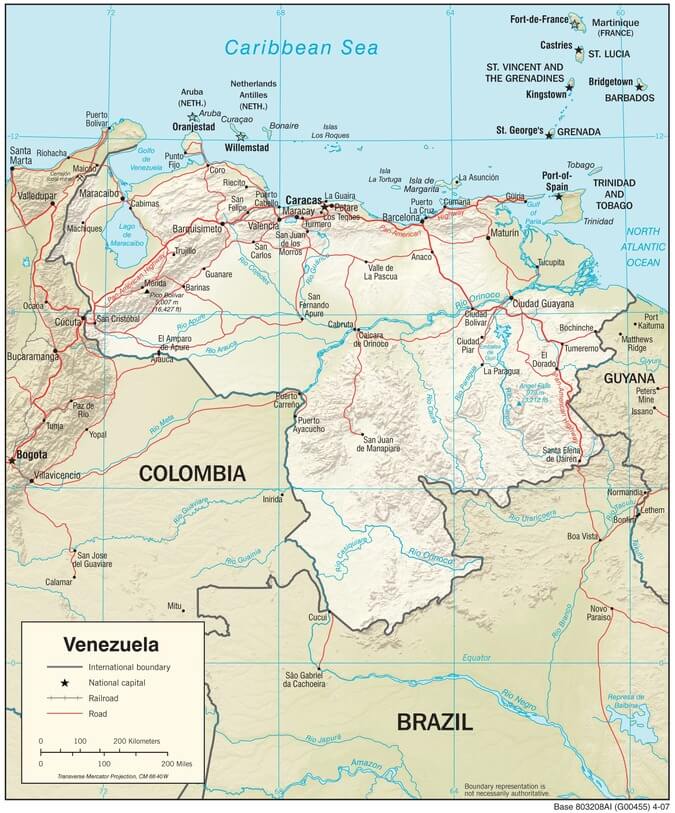
Venezuela physiographic map.
Notable Water Bodies of Venezuela
Rivers
- Orinoco River - 2,740 km (1,700 miles) total length; Flows from the Guiana Highlands to the Atlantic Ocean
- Caroní River - 952 km (591 miles) length; Tributary of Orinoco, entirely within Venezuela
- Río Negro - 2,250 km (1,400 miles) total length; Forms part of Venezuela-Brazil border
- Apure River - 1,038 km (645 miles) length; Major tributary of the Orinoco from the Colombian border
- Meta River - 1,200 km (746 miles) total length; Forms Venezuela-Colombia border
- Arauca River - 1,050 km (652 miles) total length; Northern tributary of Orinoco
- Ventuari River - 520 km (323 miles) length; Southern tributary of Orinoco
- Catatumbo River - 350 km (217 miles) length; Flows into Lake Maracaibo
- Churún River - 80 km (50 miles) length; Location of Angel Falls
- Portuguesa River - 500 km (311 miles) length; Central Venezuela, a tributary of the Apure
Lakes
- Lake Maracaibo - 13,000 km² (5,019 sq mi); Northwestern Venezuela, brackish water
- Lake Valencia - 369 km² (142 sq mi); North-central Venezuela, endorheic basin
- Lake Guri - 4,250 km² (1,641 sq mi); Artificial reservoir on Caroní River
- Laguna de Tacarigua - 39 km² (15 sq mi); Caribbean coast national park
- Laguna de Unare - 40 km² (15 sq mi); Northeast coast, important bird habitat
Artificial Reservoirs
- Guri Reservoir - 4,250 km² (1,641 sq mi); Caroní River, largest hydroelectric facility
- Caruachi Reservoir - 200 km² (77 sq mi); Caroní River system
- Macagua Reservoir - 55 km² (21 sq mi); Lower Caroní River
- Uribante-Caparo Reservoir - 85 km² (33 sq mi); Andean region
Waterfalls
- Angel Falls - 979 m (3,212 ft) height; Canaima National Park, the world's tallest
- Kukenan Falls - 610 m (2,001 ft) height; Canaima National Park
- Roraima Falls - 457 m (1,499 ft) height; Mount Roraima region
Deltas and Estuaries
- Orinoco Delta - 41,000 km² (15,830 sq mi); Atlantic coast, extensive wetland system
- Lake Maracaibo Channel - 55 km (34 miles) in length; Connects the lake to the Gulf of Venezuela
Coastal Waters
- Caribbean Coastline - 2,800 km (1,740 miles); Northern coast from Colombia to Trinidad
- Atlantic Coastline - 1,008 km (626 miles); Eastern coast including Orinoco Delta
- Gulf of Venezuela - 3,000 km² (1,158 sq mi); Shared with Colombia
- Gulf of Paria - 7,800 km² (3,012 sq mi); Shared with Trinidad and Tobago