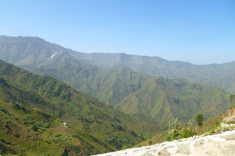
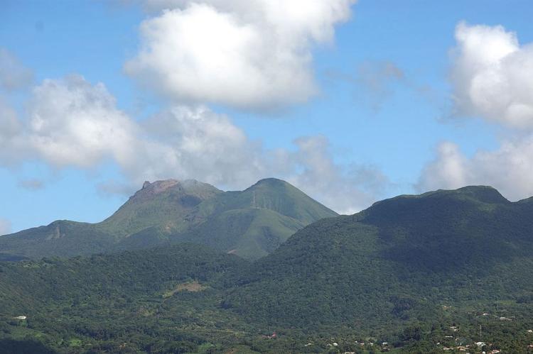
The Caribbean's Majestic Mountain Landscapes: From Sea to Summit
The Caribbean archipelago features a striking geological tapestry of volcanic peaks and ancient mountain ranges. These landscapes, rising from crystalline waters, represent millions of years of tectonic activity and volcanic eruptions that have shaped a geographically diverse region.
Volcanic Peaks and Tropical Highlands: The Mountain Ranges of the Caribbean Islands
The Caribbean archipelago presents a striking geological tapestry where volcanic peaks pierce azure skies and ancient mountain ranges form the dramatic backbone of tropical islands. These elevated landscapes, rising from crystalline waters to heights exceeding 3,000 m (9,840 ft), represent millions of years of tectonic activity, volcanic eruptions, and erosional processes that have sculpted one of the world's most geographically diverse regions. From Cuba's revolutionary Sierra Maestra to Jamaica's coffee-growing Blue Mountains, from Dominica's pristine rainforest peaks to the Dominican Republic's towering Cordillera Central, the Caribbean's mountain ranges create microclimates that support extraordinary biodiversity while serving as cultural landmarks that have shaped the history and identity of island nations throughout the region.
Geological Foundation and Formation
The Caribbean's mountainous terrain reflects the complex geological processes that have spanned millions of years. The region sits at the intersection of multiple tectonic plates, where the Caribbean Plate interacts with the North American and South American plates, creating the Lesser Antilles volcanic arc and influencing the formation of mountain systems throughout the archipelago. Volcanic activity remains active across many islands, with stratovolcanoes, dormant peaks, and geothermal features continuing to shape landscapes. Limestone formations, particularly prominent in Cuba and other islands of the Greater Antilles, create a distinctive karst topography characterized by steep-sided hills, underground cave systems, and unique erosional features that contribute to the region's diverse mountain landscapes.
The Greater Antilles: Massive Mountain Systems
Cuba: Revolutionary Peaks and Limestone Ranges
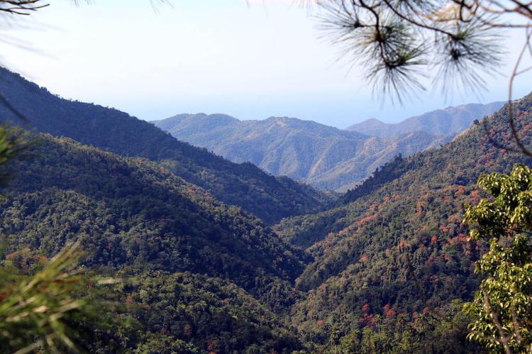
Cuba, the Caribbean's largest island, contains several significant mountain ranges that define its diverse topography and historical narrative. The Sierra Maestra dominates southeastern Cuba with its rugged terrain, which served as a stronghold during the Cuban Revolution. Pico Turquino, the range's highest point at 1,974 m (6,476 ft), stands as Cuba's tallest peak and a symbol of the island's natural grandeur.
Western Cuba is home to the Cordillera de Guaniguanico, which stretches across Pinar del Río and Artemisa provinces. The range is divided into two distinct sections: the Sierra del Rosario, designated as a UNESCO Biosphere Reserve, is known for its lush vegetation and rich biodiversity, and the Sierra de los Órganos, famous for its distinctive limestone formations that resemble organ pipes. The Sierra de los Órganos encompasses the iconic Viñales Valley, where steep, dome-shaped limestone hills called mogotes create some of Cuba's most recognizable landscapes, supporting unique ecosystems and traditional tobacco cultivation.
Dominican Republic: Caribbean's Highest Peaks
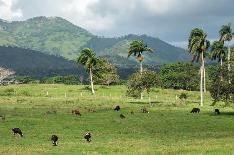
The Dominican Republic hosts the Caribbean's most extensive mountain systems, including the region's highest peaks. The Cordillera Central runs east-west across the country's center as the largest and most prominent range. Pico Duarte, at 3,098 m (10,164 ft), is the highest point in both the Dominican Republic and the entire Caribbean, supporting temperate ecosystems unique to the region's tropical setting.
The Cordillera Septentrional parallels the central range along the northern coast, providing dramatic backdrops to coastal communities while creating distinct climatic zones. In southwestern regions near the Haitian border, the Sierra de Baoruco contains the country's third-highest peak and supports dry forest ecosystems adapted to rain shadow conditions created by the larger mountain systems.
Jamaica: The Blue Mountain Heritage
Jamaica's Blue and John Crow Mountains represent one of the Caribbean's most ecologically and culturally significant mountain systems. Located in eastern Jamaica, these ranges have been designated as a UNESCO World Heritage site for their exceptional biodiversity and cultural significance to the Maroon communities. Blue Mountain Peak, rising to 2,256 m (7,401 ft), stands as the highest point in Jamaica and supports cloud forests that create ideal conditions for the world-famous Blue Mountain coffee cultivation.
The mountains create multiple climatic zones, ranging from tropical lowlands to temperate highlands, which support endemic species found nowhere else on Earth. The ranges serve as critical watersheds for Jamaica's freshwater resources while providing habitat for endangered species, including the Jamaican blackbird and numerous endemic plant species.
Haiti: Biodiversity Hotspots and Historic Fortresses
Haiti's mountain ranges include some of the Caribbean's most biodiverse and historically significant landscapes. The Massif de la Selle, situated along the Dominican border, features Pic La Selle, which stands at approximately 2,680 m (8,793 ft), making it Haiti's highest peak. The range supports montane forests and endemic species adapted to high-altitude tropical conditions.
The Massif du Nord in northern Haiti includes Pic Pictet as the country's second-highest peak and encompasses the historic Citadelle Laferrière, a mountaintop fortress designated as a UNESCO World Heritage site. The Massif de la Hotte in southwestern Haiti, designated as a UNESCO Biosphere Reserve, supports exceptional biodiversity, featuring numerous endemic species within its Macaya Mountain Range component.
The Lesser Antilles: Volcanic Island Peaks
Puerto Rico: Tropical Mountain Ecosystems
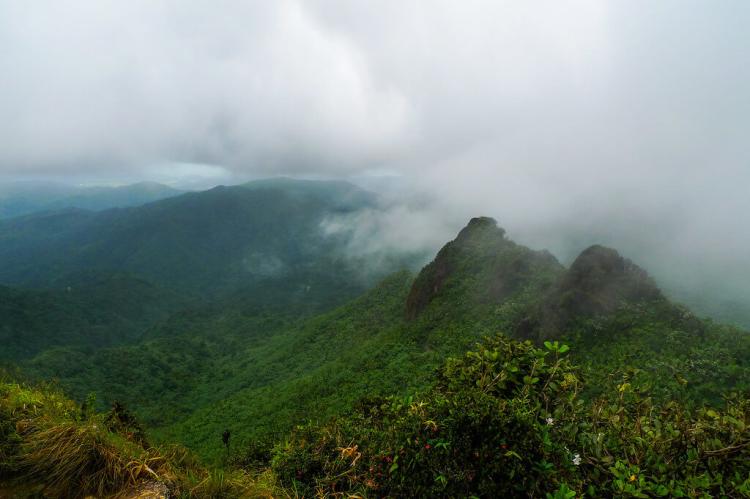
Puerto Rico's mountain ranges include the Cordillera Central, which runs diagonally across the island from southwest to northeast, forming the island's mountainous backbone. Cerro de Punta, at 1,338 m (4,389 ft), is Puerto Rico's highest point and supports subtropical highland forests. The Sierra de Luquillo in northeastern Puerto Rico includes El Yunque National Forest, the only tropical rainforest in the United States National Forest System, where El Yunque Peak and the surrounding mountains create unique cloud forest ecosystems.
The Sierra de Cayey features rolling hills and scenic landscapes in southeastern regions, while the Sierra Bermeja in southwestern Puerto Rico supports dry forest ecosystems, demonstrating the diverse climatic conditions created by the island's varied topography.
Dominica: The Nature Island's Volcanic Peaks
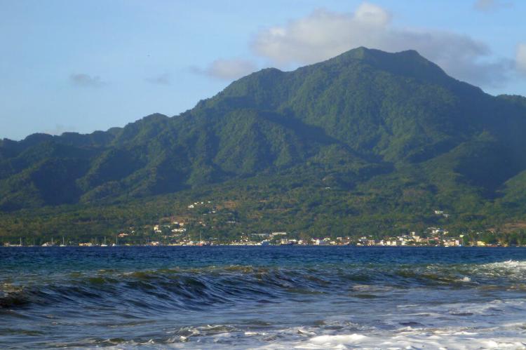
Dominica, known as the "Nature Island of the Caribbean," features multiple mountain ranges that support the region's most pristine rainforest ecosystems. The Morne Diablotins Range includes the island's highest peak, Morne Diablotins, at 1,447 m (4,747 ft), covered in dense rainforest within Morne Diablotin National Park.
The Morne Trois Pitons range in southern Dominica encompasses a UNESCO World Heritage Site featuring unique geological attractions, including Boiling Lake, Valley of Desolation, and numerous waterfalls. Northern, Central, and Southern Mountain Ranges create additional topographic diversity, with volcanic peaks and valleys supporting exceptional biodiversity and endemic species found nowhere else in the Caribbean.
Volcanic Peaks of the Windward Islands
Saint Lucia's iconic Pitons represent two volcanic peaks, Gros Piton and Petit Piton, that rise dramatically from the sea and are designated as UNESCO World Heritage Sites, symbolizing the island's natural beauty. These twin peaks create stunning landscapes while supporting unique ecosystems adapted to steep volcanic slopes.
Saint Vincent features La Soufrière, an active volcano dominating the northern landscape as part of the Lesser Antilles volcanic arc. Guadeloupe's La Grande Soufrière, reaching 1,467 m (4,813 ft), stands as an active stratovolcano and the island's highest peak, creating geothermal features and supporting lush rainforests in Guadeloupe National Park.
Grenada's Mount Saint Catherine rises to 840 m (2,756 ft) as the island's highest point, while Martinique's Mount Pelée, though not forming a range, represents one of the Caribbean's most historically significant volcanoes following its devastating 1902 eruption.
Smaller Islands and Territories
Trinidad and Tobago's Northern Range stretches across northern Trinidad, including El Cerro del Aripo as the country's highest point, while the Central Range creates additional mountainous terrain through the island's center. Montserrat's Soufrière Hills volcano has dramatically reshaped the island's landscape through recent eruptions, illustrating the ongoing volcanic processes in the region.
The Virgin Islands, comprising both U.S. and British territories, feature the Virgin Islands Hill Range, which encompasses hilly terrain that, although lower in elevation than other Caribbean mountains, creates important topographic diversity and watershed functions for these smaller islands.
Ecological Significance and Biodiversity
Caribbean mountain ranges create extraordinary biodiversity through elevational gradients that compress multiple climate zones within short distances. These ranges support the evolution of endemic species in isolated highland environments, serving as refugia during climate fluctuations. Cloud forests, particularly abundant on windward mountain slopes, capture moisture from trade winds and support unique plant communities including numerous epiphytes, ferns, and endemic flowering plants.
Many Caribbean peaks support relict populations of species that once occurred more widely, while highland areas provide critical habitat for endangered species, including various endemic birds, reptiles, and invertebrates. The mountains serve as important migration corridors and breeding areas for both resident and migratory species, contributing to regional biodiversity conservation.
Cultural and Economic Importance
The Caribbean mountain ranges have a profound influence on regional culture, agriculture, and tourism. Highland areas provide ideal conditions for specialty crop cultivation, most notably Jamaica's Blue Mountain coffee and various spice crops throughout the Lesser Antilles. Many ranges hold deep cultural significance for indigenous peoples and the descendants of enslaved people who escaped and established Maroon communities in remote mountain areas.
Mountain watersheds provide freshwater resources essential for local communities and agriculture, while scenic mountain landscapes drive eco-tourism industries. Historical sites, including Haiti's Citadelle Laferrière and various revolutionary hideouts, illustrate the strategic significance of mountainous terrain in Caribbean history and the independence movements.
Climate Regulation and Environmental Services
The mountain ranges of the Caribbean play crucial roles in regional climate regulation and environmental services. Highland areas create orographic precipitation patterns that support both mountain ecosystems and lowland agriculture through watershed functions. Mountains influence trade wind patterns and create microclimates that moderate temperatures and provide refuge from tropical storms.
Forest-covered mountain slopes prevent erosion, protect coral reef systems from sedimentation, and maintain water quality in streams and rivers flowing to coastal areas. These elevated landscapes also serve as carbon sinks through forest conservation, providing natural barriers against extreme weather events.
Conservation Challenges and Opportunities
Caribbean mountain ranges face various conservation challenges, including deforestation, agricultural expansion, climate change impacts, and development pressures. Rising temperatures threaten high-elevation ecosystems, while changing precipitation patterns impact cloud forest communities that rely on consistent moisture levels. Hurricane impacts can cause significant forest damage, though natural regeneration processes have adapted to periodic disturbances.
Conservation efforts throughout the region focus on establishing protected areas, promoting sustainable tourism, and supporting local communities dependent on mountain resources. UNESCO World Heritage Sites, Biosphere Reserves, and national parks provide frameworks for mountain conservation while supporting research and education programs that highlight the importance of these unique ecosystems.
Summary
The mountain ranges of the Caribbean Islands form a magnificent geological and ecological foundation that defines the character and diversity of this tropical archipelago. From Cuba's limestone karst landscapes and revolutionary peaks to the Dominican Republic's towering Cordillera Central, from Jamaica's globally renowned Blue Mountains to the pristine volcanic peaks of the Lesser Antilles, these elevated terrains create the dramatic topography that makes each Caribbean island unique. Rising from sea level to heights exceeding 3,000 m (9,840 ft), these ranges support extraordinary biodiversity in compressed elevational gradients while providing essential environmental services, including watershed protection, climate regulation, and carbon storage.
The mountains serve as cultural landmarks that have shaped regional history, from Maroon communities seeking freedom in remote highlands to revolutionary movements using mountain strongholds as bases of operation. As centers of endemic species evolution, providers of specialty agricultural products, and destinations for eco-tourism, Caribbean mountain ranges represent invaluable natural and cultural heritage that continues to influence the social and economic development of island nations throughout the region.
The volcanic peaks, limestone formations, and cloud-draped summits of the Caribbean stand as a testament to the dynamic geological processes that continue to shape these island landscapes, while supporting some of the world's most biodiverse and culturally rich mountain ecosystems. These elevated landscapes require continued conservation efforts to preserve their ecological integrity and cultural significance for future generations, ensuring that the Caribbean's mountainous heritage remains a source of natural wonder, economic opportunity, and cultural identity for the diverse communities that call these tropical highlands home.
