
The Altiplano–Puna Plateau and Basin: A High-Altitude Geological Wonderland in South America
The Altiplano–Puna is the widest stretch of the Andes: a high plateau spanning Bolivia, Peru, Chile, and Argentina—the wetter, grassier "Altiplano" proper surrounding Lake Titicaca gives way southward to the drier, more volcanic "Puna," whose salt flats now anchor the global lithium triangle.

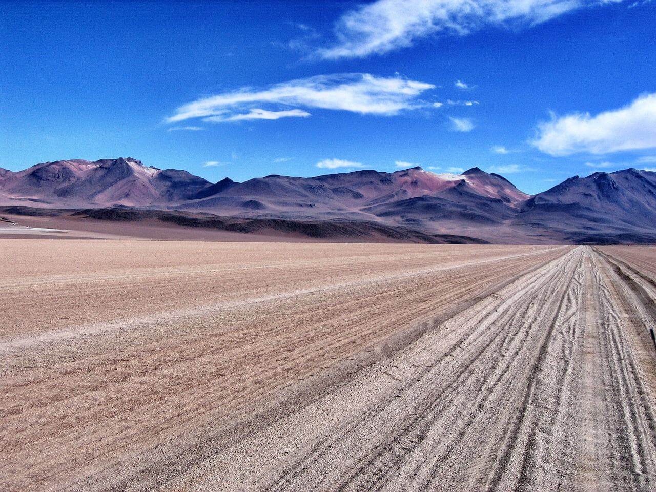
The Altiplano and the Puna: Two Names for South America's Widest Andes
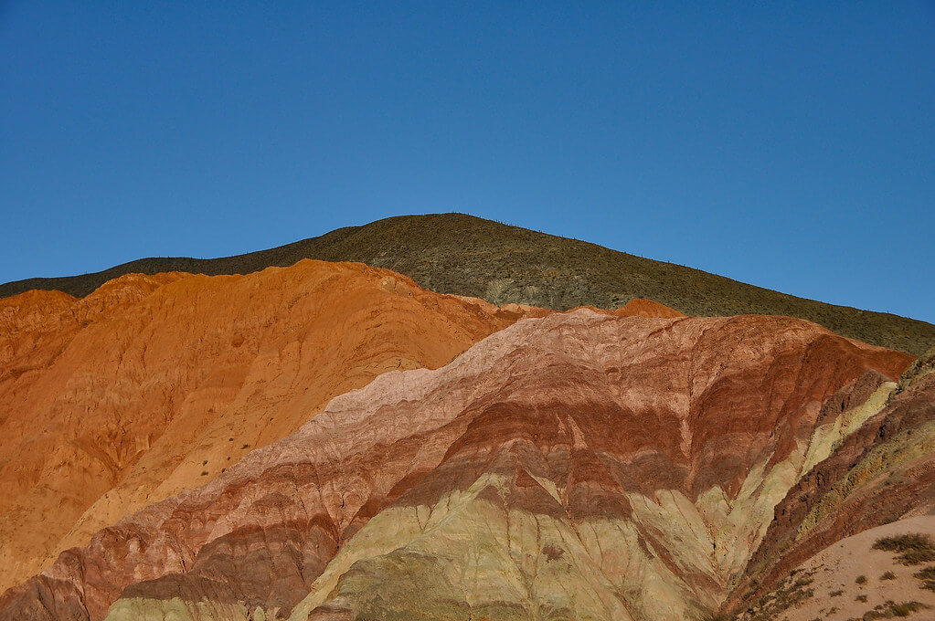
The Altiplano–Puna plateau is a remarkable, expansive, high-altitude region in west-central South America, where the Andes Mountains reach their greatest width. Spanning Bolivia, Peru, Chile, and Argentina, this vast expanse is the most extensive high plateau on Earth outside the Tibetan Plateau, sitting at an average elevation of around 3,650 m (12,000 ft) as a series of intermontane basins bounded by the towering Cordillera Occidental and Cordillera Oriental.
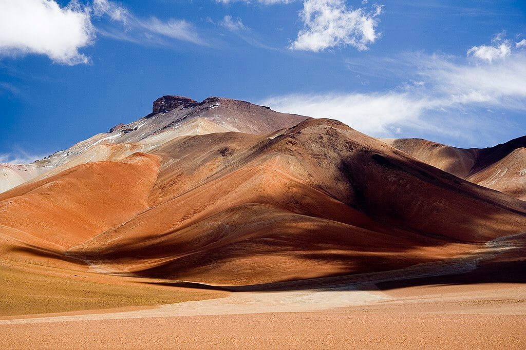
Although often used interchangeably, "Altiplano" and "Puna" describe two related but distinct halves of this same plateau system. The Altiplano proper refers to the northern portion, centered on the Bolivia-Peru border, a comparatively wetter and grassier landscape dominated by Lake Titicaca and its surrounding basin. The Puna refers to the plateau's southern extension into Chile and Argentina, a drier, more volcanically active, and more thinly populated landscape defined by salt flats, saline lakes, and towering stratovolcanoes. Geographers and geologists sometimes draw the boundary between the two around 21°S latitude, near the Bolivia-Chile-Argentina border region, though usage varies and the terms are frequently applied loosely to the plateau as a whole.
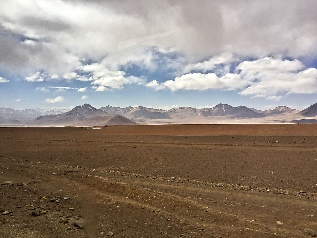
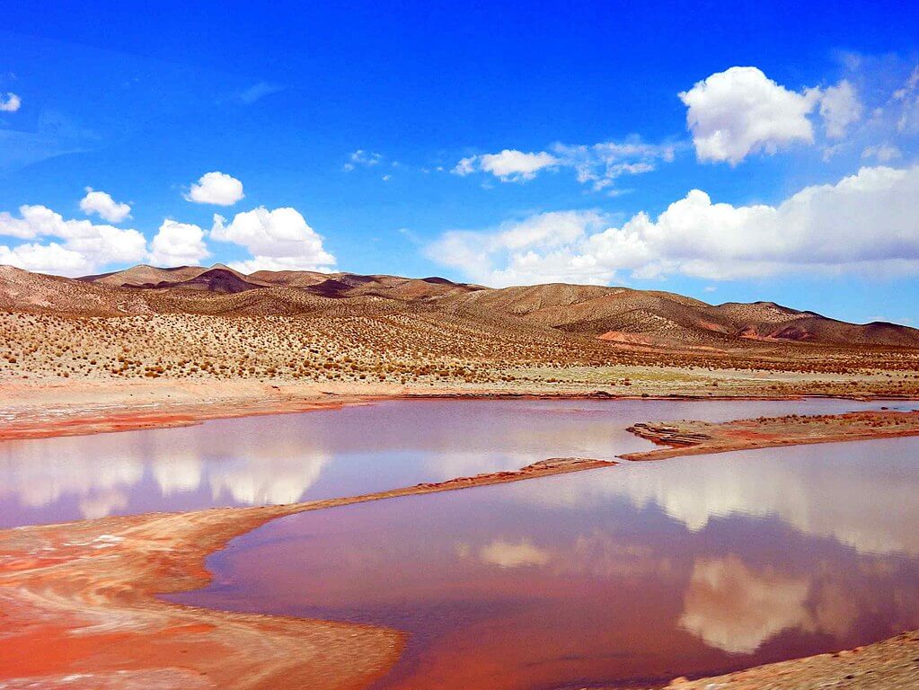
To the southwest, the plateau is flanked by the Atacama Desert, one of the driest regions on Earth, while to the east it is separated from the humid Amazon Rainforest by the Cordillera Oriental. The northern Altiplano is dominated by Lake Titicaca, a large, high-altitude freshwater lake shared by Peru and Bolivia, while further south the landscape gives way to salt flats, including the massive Salar de Uyuni, the world's largest salt flat, remnants of ancient lakes that dried up and left their mineral-rich deposits behind.
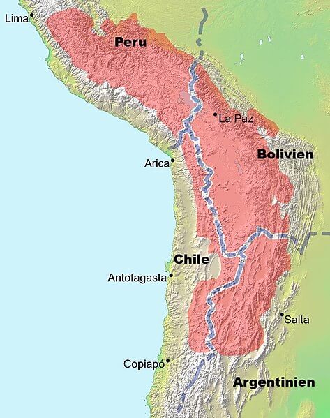
Map showing the location of the Altiplano-Puna plateau in South America.
The Altiplano Basin: A Complex Sedimentary Feature
The Altiplano Basin, located between the Cordillera Occidental and Cordillera Oriental, is a vast sedimentary basin covering approximately 154,176 sq km (59,528 sq mi), shaped over geological time by the horizontal shortening of the Earth's crust. The Cordillera Occidental overrides the basin's northern portion along the Pasani Fault, while the Cordillera Oriental has overridden its northern edge along the Ayaviri Fault; further south, the largely buried Coniri Fault defines the basin's boundary with the Cordillera Oriental block. The basin's great sediment thickness results primarily from erosion of the Cordillera Oriental, and these deposits provide a valuable record of the region's geological history, shaped by the complex, ongoing interplay between the two bounding mountain ranges.
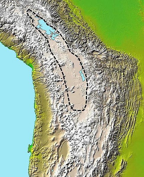
Map depicting the approximate extent of the sedimentary basin in the Altiplano.
Volcanic Activity and Tectonic Processes
The Altiplano–Puna plateau is a geologically active region shaped by the ongoing tectonic processes building the Andes. The plateau's western edge is dominated by the massive, active volcanoes of the Central Volcanic Zone, including Ampato, Tutupaca, Parinacota, Guallatiri, Paruma, Uturunku, and Licancabur. The southern Puna is particularly notable for the Altiplano-Puna Volcanic Complex, a significant caldera and silicic ignimbrite field whose ongoing activity continues to drive uplift and deformation across the plateau.
The Lithium Triangle
The same arid basins that define the southern Puna, where Bolivia, Chile, and Argentina meet, now hold more than half of the world's known lithium reserves, concentrated in the brine beneath the Salar de Uyuni, Chile's Salar de Atacama, and Argentina's Salar del Hombre Muerto and Salinas Grandes. This so-called lithium triangle has drawn intensifying international investment as global demand for battery materials accelerates, transforming what was until recently one of the most sparsely populated and economically overlooked corners of South America into a resource of major geopolitical significance, even as extraction raises concerns over the brine-rich groundwater that both fragile Puna ecosystems and local Indigenous communities depend on.
Human Settlement and Economic Activities
Despite its harsh, high-altitude environment, the Altiplano–Puna has been home to human settlements for thousands of years. Pre-Columbian cultures including the Chiripa, Tiwanaku, and later the Inca Empire thrived here, leaving behind a rich cultural legacy that remains visible across the plateau today.
Today, the region is home to several major cities, including El Alto and La Paz, which together form one of the largest and highest-altitude urban agglomerations on Earth, along with Oruro in Bolivia and Puno in Peru. The Altiplano-Puna economy rests on a combination of activities: llama (Lama glama) and vicuña (Vicugna vicugna) herding for wool, meat, and as pack animals; mining, now increasingly centered on lithium extraction as described above alongside longer-established tin, silver, and other mineral operations; and the urban services that sustain La Paz, El Alto, and the plateau's other major population centers. The dominant vegetation across the plateau consists of hardy grasses and shrubs adapted to extreme aridity, cold, and intense solar radiation, sustaining not only wild vicuña and guanaco (Lama guanicoe) but also the domesticated llama and alpaca (Vicugna pacos), both of which have remained central to Andean livelihoods for thousands of years.
The Significance of the Altiplano–Puna
The Altiplano–Puna plateau is a remarkable and unique geographical and geological feature, shaped by the dynamic interplay of tectonic forces, volcanic activity, and the erosion of the surrounding mountain ranges, and inhabited by Indigenous cultures for millennia. Today, it remains vital to South America's economy and ecosystems alike, a role that only intensifies as the lithium beneath its southern reaches becomes increasingly central to the global energy transition. Understanding the complex geological history that formed the Altiplano–Puna, and the equally complex human and economic pressures now reshaping it, is essential to understanding both the broader Andes and the evolving relationship between resource extraction and the communities and ecosystems of the high plateau.