
Documenting the natural and cultural landscapes of the Latin American and Caribbean regions
Search LAC Geo
The Editor
Latest posts
Featured
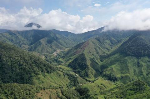
The Tumbes-Chocó-Magdalena Biodiversity Hotspot: Nature's Last Stand on South America's Pacific Coast
Along the Pacific coast of South America, stretching like a verdant ribbon from Panama to northern Peru, lies one of Earth's most extraordinary and endangered natural regions: the Tumbes-Chocó-Magdalena Biodiversity Hotspot. It covers 274,597 sq km along a strip about 1,500 km long, and it is a refuge for countless endemic species, a natural laboratory of evolution, and a critical front in the global effort to preserve biodiversity.
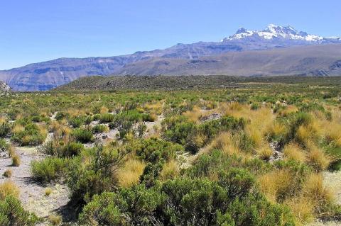
The Puna: Whispers of Wind Across the Roof of the Andes
The Puna, a beautiful and ecologically significant high-elevation grassland, spans the Central Andes, where life adapts to thin air, strong sun, and cold. This landscape extends from northern Peru through western Bolivia into northern Chile and Argentina. Marked by treeless grasslands, wetlands, and salt flats, the Puna exemplifies nature's resilience at extreme altitudes, supporting exceptional biodiversity and playing a crucial role in the Central Andes' hydrological balance.
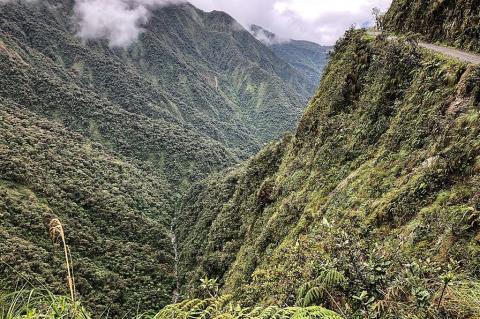
The Yungas: A Sanctuary of Mist and Life in the Heart of South America
The Yungas is a remarkable, biodiverse subtropical forest belt that drapes the eastern slopes of the Andes, stretching across Peru, Bolivia, and northern Argentina. This unique natural region serves as a crucial ecological transition zone, linking the high-altitude Andean highlands to the humid eastern lowland forests and creating a vibrant haven for an extraordinary array of plant and animal life amid a warm, humid, subtropical climate.
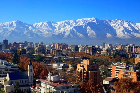
The Southern Cone: Harmony and Diversity in South America
Occupying the southernmost reaches of the South American continent, encompassing Argentina, Chile, and Uruguay, with the Pacific Ocean to the west and the Atlantic Ocean to the east, the Southern Cone unravels as a rich mosaic of history, diverse landscapes and thriving economies. Beyond its recognized nations, this subregion extends its influence to Brazil's southern states and Paraguay, reflecting shared histories and geographical connections.
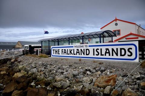
The Falkland Islands: Navigating History, Identity, and Nature in the South Atlantic
The Falkland Islands, or Islas Malvinas in Spanish, are a British Overseas Territory in the South Atlantic Ocean. This remote archipelago, located approximately 500 kilometers east of Argentina's southern coast, consists of two main islands—East and West Falkland—and hundreds of smaller islands and islets. The Falklands have garnered international attention due to their complex political history, unique cultural identity, and rich biodiversity.
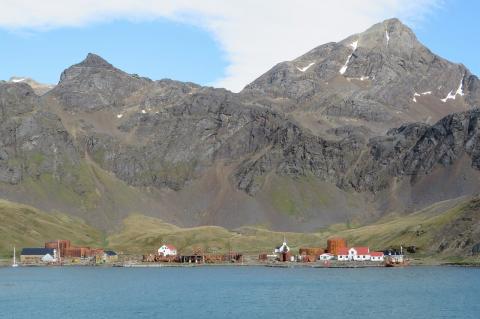
South Georgia and the South Sandwich Islands: A Haven of Pristine Wilderness and Scientific Discovery
South Georgia and the South Sandwich Islands (SGSSI) is a British Overseas Territory in the southern Atlantic Ocean. Comprising two main island groups, this remote and uninhabited territory is renowned for its ecological significance and historical heritage. Managed by a commissioner based in the Falkland Islands, approximately 1,390 km east-southeast of South Georgia, SGSSI is a vital destination for scientific research and ecotourism and forms part of the wider Scotia Arc system.
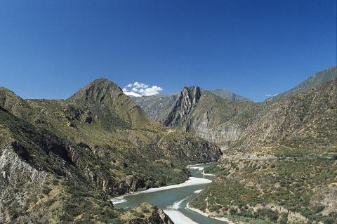
The Altiplano–Puna Plateau and Basin: A High-Altitude Geological Wonderland in South America
The Altiplano–Puna plateau is a remarkable, expansive, high-altitude region in west-central South America, where the Andes Mountains reach their greatest width. Spanning Bolivia, Peru, Chile, and Argentina, this vast expanse is the most extensive high plateau on Earth outside the Tibetan Plateau, sitting at an average elevation of around 3,650 m and consisting of a series of intermontane basins bounded by the towering Cordillera Occidental and Cordillera Oriental.
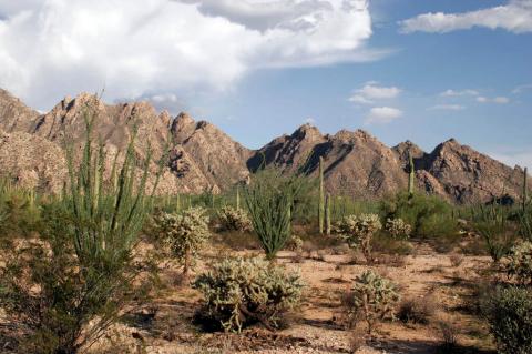
The Sonoran Desert: Oasis of Resilience
Spanning northwestern Mexico and the southwestern United States lies one of Earth's most biodiverse deserts, the Sonoran Desert. Known in Spanish as the Desierto de Sonora, and encompassing the more specific Desierto de Altar within its western reaches, this extraordinary ecosystem challenges every preconception about desert life. Here, towering saguaro and cardón cacti create forests in the sky, desert bighorn sheep navigate rocky outcrops, and brief winter rains transform barren landscapes into carpets of wildflowers.
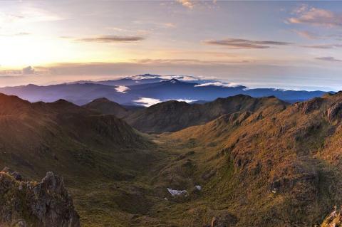
Costa Rica's Magnificent Mountain Ranges: Volcanic Giants and Biodiversity Hotspots
Costa Rica, though small in size, possesses one of the most remarkable and geologically active mountain systems in Central America. Multiple mountain ranges traverse the nation as part of the Central American Volcanic Arc, creating a dramatic landscape of active volcanoes, cloud forests, and alpine ecosystems. These mountain ranges not only define Costa Rica's topography but also underpin its legendary biodiversity, climate regulation, and cultural identity.
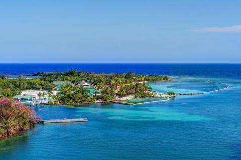
The Caribbean Sea: Ocean Dynamics and Marine Ecosystems of the American Mediterranean
The Caribbean Sea stands as one of the world's most fascinating semi-enclosed marine basins. This tropical oceanic realm bridges two vast continents and harbors extraordinary biodiversity within its azure waters. Covering approximately 2.75 million square kilometers, this remarkable sea stretches between North and South America, creating a unique marine environment that has shaped maritime history, supported diverse ecosystems, and continues to influence regional climate patterns.
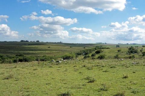
The Pampas: South America's Verdant Canvas
The Pampas is a vast and remarkably fertile lowland plain in South America that extends from the Atlantic Ocean westward toward the Andes Mountains. This expansive biome encompasses the heartland of Argentina, all of Uruguay, and the southernmost Brazilian state of Rio Grande do Sul. Beyond its sheer size, the Pampas represents a complex interplay of ecological diversity, a rich tapestry woven by the iconic gaucho culture, and a dynamic landscape undergoing modern transformations.
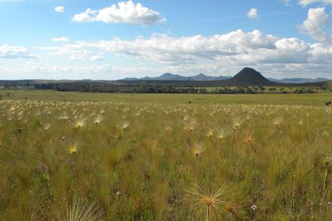
The Cerrado: Brazil's Burning Heart, A Savanna of Astonishing Secrets
The Cerrado, a sprawling savanna ecoregion that blankets the heart of Brazil and spills over into eastern Bolivia and northeastern Paraguay, represents a realm of breathtaking biodiversity and ecological complexity often overshadowed by its more famous Amazonian neighbor. Far from being a uniform expanse of grasslands, this vast landscape is a captivating mosaic of habitats, ranging from dense gallery forests lining waterways to open grasslands dotted with gnarled, fire-adapted trees and seasonally flooded wetlands.
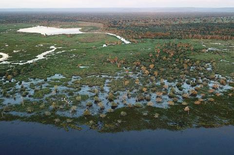
The Pantanal: A Wetland Eden of Unrivaled Biodiversity
The Pantanal, the world's largest tropical wetland, unfolds as a colossal seasonal floodplain predominantly situated in Brazil's Center-West Region. However, its expansive reach extends into northeastern Paraguay and southeastern Bolivia, creating an ecological masterpiece that captivates with its diverse landscapes and vibrant ecosystems. This remarkable wetland, a dynamic region with distinct hydrological, geological, and ecological features, supports a rich array of wildlife and plant species.

The Caatinga: Brazil's Dry Forest Ecosystem
In the heart of northeastern Brazil lies the Caatinga, a unique and resilient dry forest ecosystem that covers approximately 800,000 sq km (309,000 sq mi), roughly 11% of Brazil's total land area. Found nowhere else on Earth, this semi-arid biome is characterized by its striking adaptation to extreme climatic conditions, extraordinary biodiversity, and deep human history stretching back tens of thousands of years.
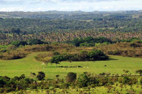
The Llanos: A Grassland Realm Forged by Water, Teeming with Life
Stretching across the expansive lowlands east of the towering Andes Mountains in northwestern South America, the Llanos, also known as Los Llanos, emerge as a vast tropical grassland plain of remarkable ecological dynamism. Spanning much of Colombia and Venezuela, this ecoregion of seasonally flooded savannas and gallery forests offers a vivid portrait of natural grandeur shaped by the powerful Orinoco River system and dramatic shifts between wet and dry seasons.
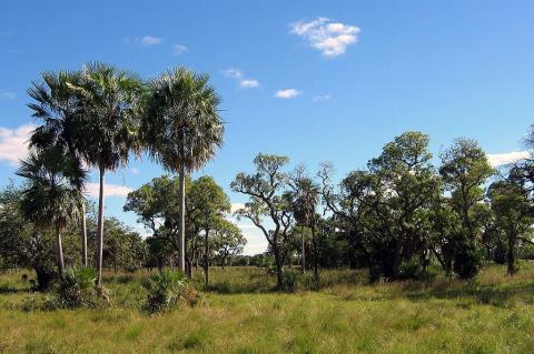
The Gran Chaco: Exploring the Wild Heart of South America
Stretching across the heart of south-central South America, the Gran Chaco is the continent's second-largest forested biome after the Amazon, a vast semi-arid lowland covering over 1 million sq km (386,000 sq mi) across Argentina, Paraguay, Bolivia, and a small part of Brazil. Bounded to the west by the towering Andes and framed by the Paraguay and Paraná rivers to its east, the Gran Chaco divides broadly into the arid Dry Chaco to the west and the wetter Humid Chaco to the east.
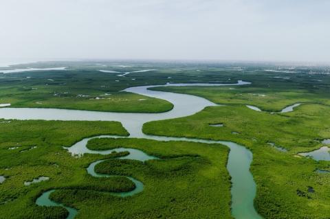
The Amazon Basin: Earth's Greatest Watershed
The Amazon Basin represents Earth's largest river drainage system, encompassing 6.3 million sq km (2.4 million sq mi) of interconnected waterways, floodplains, and terrestrial ecosystems. This immense watershed—equivalent in size to the contiguous United States—collects rainfall and runoff across 40% of South America, channeling this vast flow through the world's mightiest river system to the Atlantic Ocean.
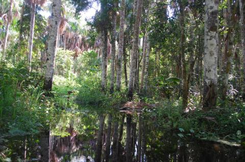
The Amazon Biome: A Tapestry of Interconnected Ecosystems
The Amazon biome extends far beyond the iconic rainforest, encompassing a spectacular mosaic of 53 distinct ecosystems across 6.7 million sq km (2.6 million sq mi). This continental-scale biome is the world's largest tropical biome complex, where dense rainforests give way to seasonal savannas, montane cloud forests, and vast wetlands, each supporting specialized plant and animal communities found nowhere else on Earth.
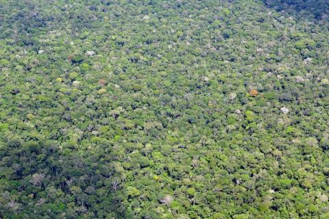
The Amazon Rainforest: Nature's Most Complex Living System
The Amazon Rainforest, a cornerstone of the vast Amazônia region, stands as nature's most intricate and sophisticated ecosystem, a living masterpiece spanning across the heart of South America. This verdant expanse represents over half of Earth's remaining rainforest. It comprises the most biodiverse tract of tropical forest on the planet, harboring an estimated 390 billion individual trees representing 16,000 distinct species.
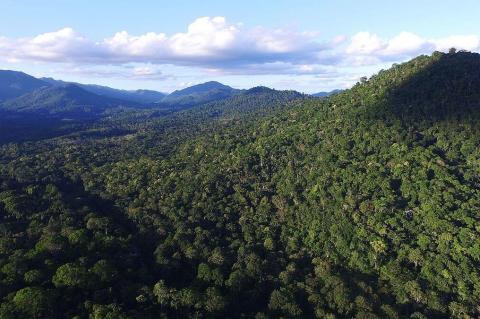
The Atlantic Forest: Brazil's Most Endangered Biodiversity Hotspot
The Atlantic Forest, or Mata Atlântica, showcases extraordinary biological richness and severe human impact. Once a vast verdant tapestry stretching along Brazil's eastern and southeastern coastline, with tendrils extending into northeastern Argentina and eastern Paraguay, this unique biome has been drastically reduced by centuries of relentless deforestation driven by agricultural expansion, logging, industrial development, and urbanization, leaving behind a highly fragmented mosaic of isolated forest patches.
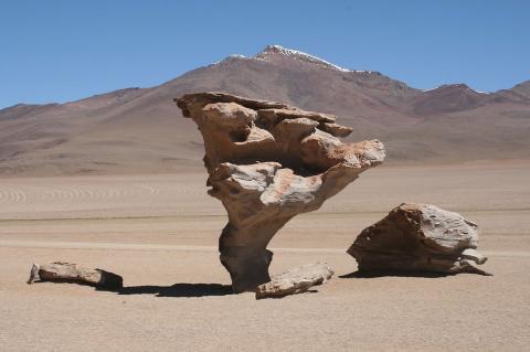
The Atacama Desert: Earth's Most Arid Frontier
The Atacama Desert, stretching along Chile's Pacific coast, is Earth's most arid non-polar environment, where some weather stations have never recorded measurable rainfall. Despite its reputation as a lifeless wasteland, the Atacama supports remarkable biodiversity, unique geology, and Indigenous cultures that have adapted to survive here for millennia, while its pristine skies and mineral wealth have made it a global center for astronomy, mining, and the ongoing tension between resource extraction and conservation.
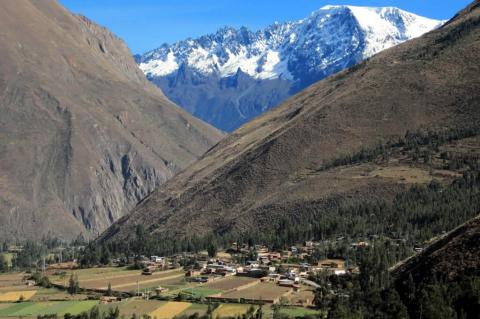
The Andes: Spine of a Continent, Home to Its Peoples
The Andes Mountains, also known as Cordillera de los Andes, are renowned as the world's longest continental mountain range, extending in a grand trajectory along the western coast of South America. This extraordinary geographical feature not only delineates a slender western coastal area from the remaining expanse of the continent but also claims the distinction of being the tallest mountain range globally outside of Asia.
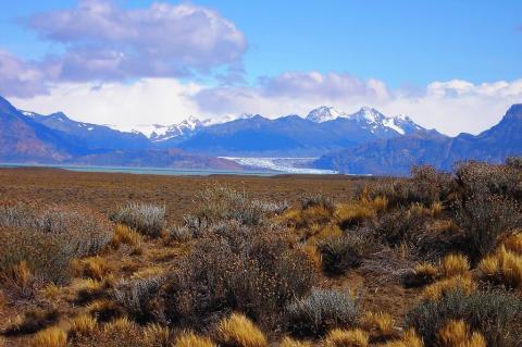
Argentine Patagonia: Land of Endless Horizons
Stretching across the southern cone of South America like a vast natural amphitheater, Argentine Patagonia extends from the Colorado River in the north to the Drake Passage in the south, forming a landscape so diverse and dramatic that it has captivated explorers, scientists, and adventurers for centuries. From the ice-carved peaks of the Andes to the windswept Atlantic coast, Patagonia offers an unparalleled tapestry of natural wonders that continues to define Argentina's identity as a nation of extraordinary geographical diversity.
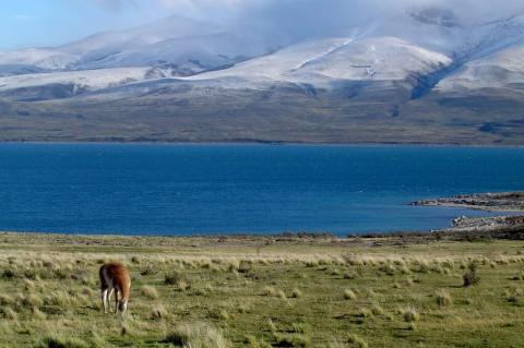
Chilean Patagonia: Realm of Fire and Ice
Rising from the tempestuous waters of the Drake Passage to the glaciated peaks of the Southern Andes, Chilean Patagonia encompasses one of Earth's most spectacular and pristine wilderness regions. Stretching across Chile's southernmost territories, the region extends from the Bío Bío River in the north to Cape Horn in the south, creating a landscape of such dramatic beauty and ecological complexity that it has earned recognition as one of the planet's last great wilderness frontiers.
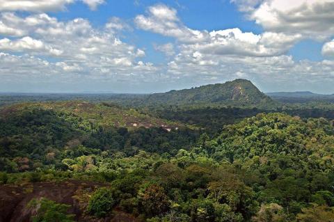
Amazônia Unveiled: A Journey Through Nature's Crown Jewel
Amazônia—encompassing the Amazon rainforest, biome, basin, and river system—represents Earth's most magnificent and ecologically vital tropical region. This interconnected complex harbors unparalleled biodiversity while serving as a critical regulator of global climate and weather patterns. Often called "the lungs of the Earth," the four components of this vast region form a self-sustaining, complex ecosystem that has evolved over millions of years.
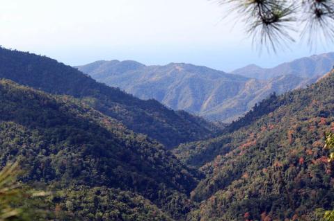
The Greater Antilles: Crossroads of Caribbean History, Culture, and Nature
The Greater Antilles form the dominant landmass of the Caribbean, comprising the islands of Cuba, Hispaniola (shared by Haiti and the Dominican Republic), Puerto Rico, Jamaica, and the Cayman Islands. Together, these islands account for nearly 90% of the total land area of the West Indies, making them the geographic heart of the region and home to its most diverse array of cultures, ecosystems, and historical legacies.
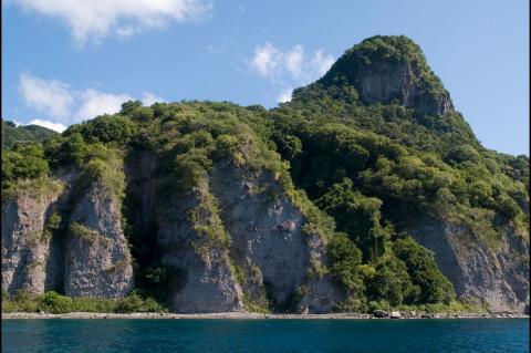
The Caribbean Archipelago: Where Tectonic Forces Shaped a Cultural Crossroads
Nestled within the Caribbean Sea, the Caribbean Archipelago is a sprawling and diverse region composed of thousands of islands. This archipelago is more than just a collection of landmasses; it is a dynamic mosaic of natural beauty and cultural richness where geological evolution and human history are intricately interwoven. From its geographical features, climatic patterns, and biodiversity to its deep-rooted history and cultural diversity, this region offers a fascinating microcosm of human existence and ecological diversity.
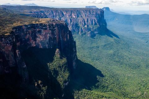
South America: Continent of Extremes, Cradle of Civilizations
From the snow-capped peaks of the Andes to the vast steaming Amazon, from the driest desert on the planet to wetlands the size of France, South America defies easy characterization. This landmass—the world's fourth-largest continent—stretches from the Caribbean shores of Colombia to the windswept channels of Tierra del Fuego, encompassing every climatic zone. Home to nearly 440 million people, South America is a crucible where Indigenous civilizations, European colonization, the African diaspora, and waves of global migration have forged societies as diverse as the landscapes they inhabit.
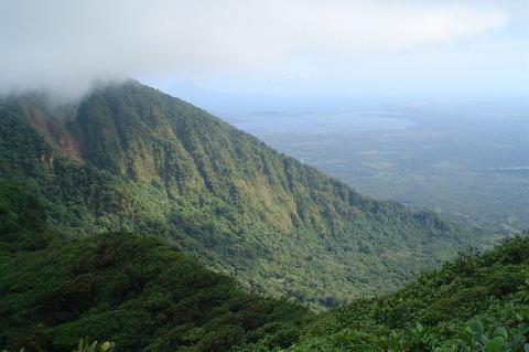
The Central American Isthmus: Land Bridge of the Americas
The Central American Isthmus is a narrow strip of land connecting North and South America that fundamentally altered Earth's biological and climatic systems when it formed 3 million years ago. Despite occupying less than 1% of the world's land area, this remarkable region harbors 7% of the planet's biodiversity and serves as a critical corridor for global commerce via the Panama Canal. Today, Central America exemplifies both the opportunities and challenges of sustainable development, leading innovative conservation efforts while facing unprecedented threats from climate change and environmental degradation.
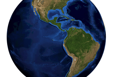
The Americas: One Hemisphere, Countless Worlds
The Americas, often called "America" broadly, include all lands of the Western Hemisphere from the Canadian Arctic to the Amazon rainforests and Patagonian plains. This vast region features diverse climates, landscapes, peoples, languages, and traditions, defined by geographic diversity, complex histories, and cultural identities. Over millennia, Indigenous civilizations like Mesoamerica and the Andes rose, followed by European colonization and African migration. These legacies create a rich tapestry of societies still influential today.
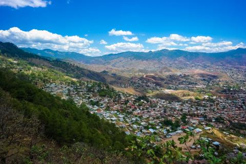
The Latin American Region: A Mosaic of Geography, Biodiversity, Climate, and Culture
Latin America, often described as a rainbow of diversity, is a mesmerizing region that stretches from the southern border of the United States to the southernmost tip of South America. This expansive territory encompasses an astonishing array of countries, cultures, and ecosystems, including the enchanting islands of the Caribbean Archipelago, the captivating landscapes of the Central American Isthmus, the multifaceted expanse of Mexico, and the diverse wonders of the South American Continent.
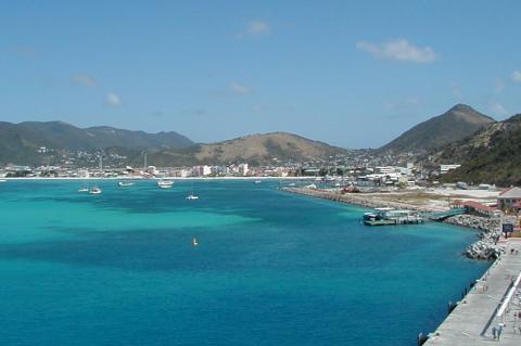
Saint Martin: One Island, Two Nations, and a World of Natural Wonders
Saint Martin is a small but remarkably diverse island in the northeastern Caribbean shared by two sovereign nations — the French Collectivity of Saint-Martin in the north and the Dutch country of Sint Maarten in the south. First settled by Arawak-speaking peoples, the island has been shaped by centuries of colonial rivalry, plantation agriculture, and cultural mixing. Today, it offers an exceptional range of experiences and a culinary and cultural scene that reflects its uniquely layered French, Dutch, and Caribbean heritage.
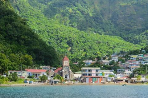
The Windward Islands: Volcanic Archipelago of the Southern Caribbean
The Windward Islands, a prominent region in the southeastern Caribbean Sea, form part of the Lesser Antilles. This group of islands presents a diverse array of landscapes, from volcanic terrains to lush rainforests, and a rich cultural heritage shaped by historical events and geographical features. Each island contributes uniquely to the Windward Islands' collective identity, reflecting its historical developments, geographical characteristics, environmental significance, and cultural traditions.

The Leeward Islands: History, Sovereignty, and Natural Heritage
The Leeward Islands are in the northeastern Lesser Antilles from the Virgin Islands to Guadeloupe. Named for their position on the lee — the sheltered side — of trade winds, they have calmer anchorages, attracting early European colonisers seeking safe harbours along transatlantic routes. They include a dozen political entities under British, French, Dutch, and American control, plus two independent nations. Few areas of similar size rival their diversity in governance, ecology, language, and culture.
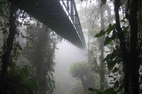
The Natural Geography of Central America: A Land Bridge Between Two Worlds
Central America is one of the most biologically rich regions on Earth — a narrow land bridge connecting two continents and separating two oceans. Its natural geography is shaped by a chain of active volcanoes running the length of the isthmus, creating dramatic contrasts between the dry Pacific slope and the rainforest-covered Caribbean lowlands. From the cloud forests of the Talamanca range to the vast jungle of the Petén and the wilderness of the Darién, Central America's landscapes are as varied as they are irreplaceable.
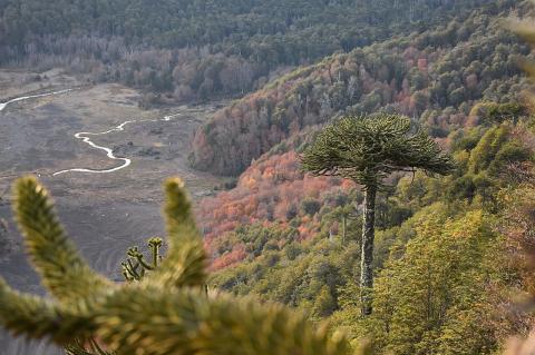
CONAF to Sernafor: Chile's Conservation Agency Enters a New Era
For over five decades, Chile's National Forest Corporation—known as CONAF (Corporación Nacional Forestal)—has stood as the principal guardian of the nation's forests, protected areas, and natural heritage. It manages South America's extensive protected system and faces severe wildfire threats due to climate change. In 2025, it transformed from a private corporation to a fully public agency—the National Forestry Service (Sernafor)—marking a new conservation chapter.
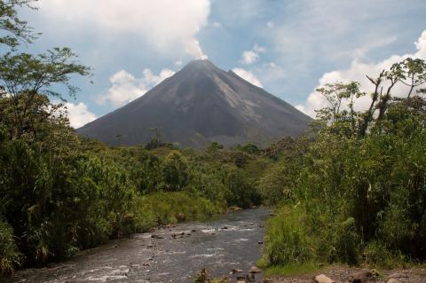
SINAC: Costa Rica's Blueprint for Conservation Success
Costa Rica has achieved what many nations only aspire to—transforming itself from a country experiencing rapid deforestation in the 1980s into a global conservation leader. At the heart of this remarkable transformation stands SINAC, the National System of Conservation Areas. This innovative framework protects over 26% of Costa Rica's territory, manages extraordinary biodiversity, and demonstrates that economic prosperity and environmental protection can advance together.
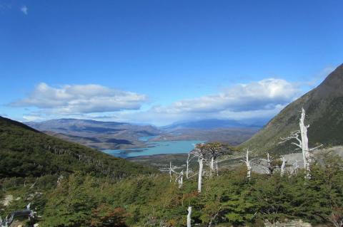
Chile's National Park System and the Route of Parks of Patagonia
Chile's national park system is one of the most extensive and well-managed in the world and a testament to its unwavering commitment to preserving its remarkable natural heritage. Chile's protected areas provide refuge for diverse ecosystems and abundant biodiversity. Administered by the National Forest Corporation (CONAF), this system is dedicated to conserving and managing the nation's natural treasures, with a crown jewel being the famous Route of Parks of Patagonia.
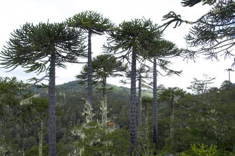
The Andean Patagonian Forest: Earth's Southernmost Temperate Woodland
Nestled on the Andes' steep slopes in southern South America, the Andean Patagonian Forest is Earth's southernmost forest. Extending across southern Chile and Argentina along the cordillera, it is one of the few relatively undisturbed temperate forests left on Earth. This narrow strip of greenery covers mountain slopes between the Pacific and the arid Patagonian Desert. However, it faces increasing threats from climate change, invasive species, and habitat fragmentation, endangering a unique ecosystem without an equivalent elsewhere.
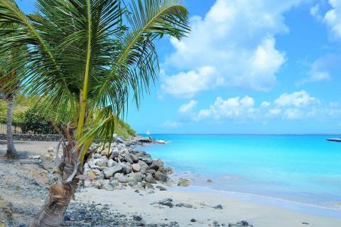
The West Indies: Arc of Islands Between Two Seas
The West Indies forms a spectacular crescent-shaped archipelago of over 7,000 islands, cays, and islets that separates the Gulf of Mexico and Caribbean Sea from the Atlantic Ocean. This geologically complex island system represents one of Earth's most biodiverse and culturally dynamic regions, where active volcanoes rise alongside ancient limestone plateaus, where coral reefs teem with marine life, and where the cultural legacies of Indigenous peoples, European colonizers, and African diaspora communities have fused into vibrant societies found nowhere else on the planet.
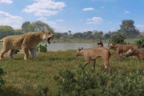
Bridging the Americas: The Great American Biotic Interchange
For millions of years, North and South America existed as isolated landmasses, separated by a vast oceanic expanse. Each continent evolved its own unique assemblage of species, shaped by distinct environmental pressures and evolutionary pathways. However, approximately 3 million years ago, a transformative geological event changed the course of biological history across both continents: the formation of the Central American Isthmus created a permanent land bridge, triggering one of the most spectacular mass migrations in Earth's history.
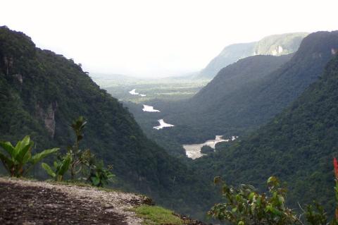
The Mountain Ranges of the Guianas: Ancient Highlands
The Guianas—comprising Guyana, Suriname, and French Guiana—rise from South America's northeastern coast as guardians of one of Earth's most ancient geological formations. Here, atop the 1.7-billion-year-old Guiana Shield, dramatic mountain ranges pierce tropical skies with their distinctive flat-topped summits, creating a landscape that seems lifted from prehistory itself. These mountains, born from Precambrian bedrock and sculpted by eons of weathering, stand as living monuments to the planet's earliest chapters while harboring some of the world's most extraordinary biodiversity.
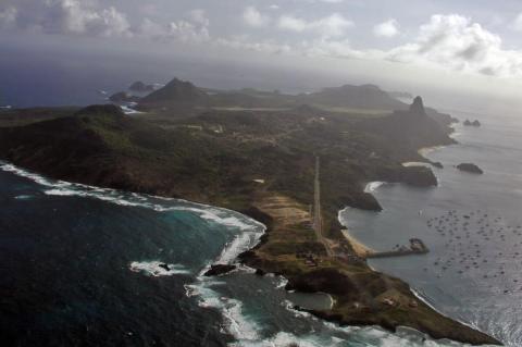
Brazil's Islands and Archipelagos: Atlantic Jewels and River Giants
Along Brazil's expansive coastline and within its vast river systems, a remarkable collection of islands and archipelagos reveals the country's extraordinary natural diversity and rich maritime heritage. From volcanic peaks rising from the deep Atlantic to lush river islands nestled within the Amazon Basin, these scattered jewels offer glimpses into unique ecosystems where endemic species thrive, ancient cultures flourish, and conservation efforts protect some of South America's most pristine marine environments.
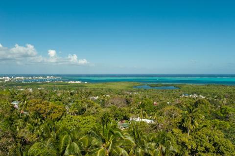
Colombia's Islands and Archipelagos: Maritime Crown Jewels of the Caribbean and Pacific
In the crystalline waters where the Caribbean Sea meets Colombia's northern shores and the Pacific Ocean embraces its western coast, a constellation of islands and archipelagos beckons with their pristine beauty and extraordinary biodiversity. These maritime territories, scattered across thousands of square kilometers of ocean, represent some of Colombia's most spectacular natural treasures, each harboring unique ecosystems, rich cultural heritage, and stories that span centuries of human history.
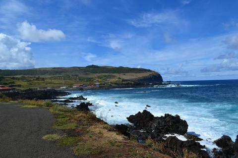
Chile's Islands and Archipelagos: From Pacific Outposts to Patagonian Wilderness
Chile's islands and archipelagos stretch from remote Easter Island with its iconic moai statues to the pristine wilderness of Tierra del Fuego, encompassing diverse ecosystems that harbor endemic species, UNESCO sites, and Indigenous communities. These Pacific territories include the Robinson Crusoe-inspiring Juan Fernández Islands, the culturally rich Chiloé Archipelago with its distinctive wooden churches, and critical wildlife refuges supporting penguins, fur seals, and unique flora across one of the world's most extensive coastlines.
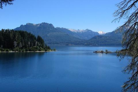
Argentina's Islands and Archipelagos: A Geographic and Cultural Journey
Argentina's islands and archipelagos span from the windswept Tierra del Fuego in the south to the subtropical Paraná Delta in the north, encompassing diverse ecosystems, rich cultural heritage, and significant wildlife refuges. These maritime territories include South America's largest island, thousands of river delta islets, glacial lake islands, and disputed territories such as the Malvinas, reflecting Argentina's complex geographical identity and the challenges it faces in conservation.
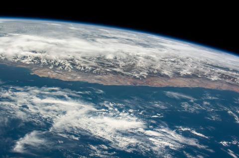
The South Pacific Ocean: Earth's Largest Marine Realm and Climate Engine
The South Pacific Ocean is Earth's largest ocean and one of its most influential marine systems, holding nearly half of the world's ocean water. Stretching from the equator south to the Antarctic Convergence and from the western coasts of the Americas to the International Date Line, this vast ocean greatly influences global climate patterns, marine ecosystems, and human societies across many continents, acting as Earth's main climate engine, shaping weather patterns that impact billions of people worldwide.
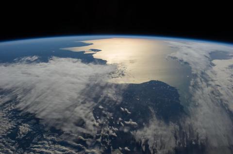
The South Atlantic Ocean: A Critical Component of Global Ocean Systems
The South Atlantic Ocean is one of Earth's most dynamic and influential oceanic regions, serving as a crucial link between the Atlantic's northern and southern hemispheres and connecting South America and Africa across vast expanses of blue water. This remarkable body of water is far more than a geographic boundary between continents. The South Atlantic is vital for global ocean circulation, climate, and marine biodiversity.
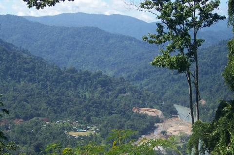
The Mesoamerican Biological Corridor: Central America's Lifeline for Wildlife Conservation
From the emerald canopies of Mexico's Lacandon rainforest to Panama's pristine cloud forests, an extraordinary conservation network spans the heart of the Americas. The Mesoamerican Biological Corridor represents one of the world's most ambitious biodiversity preservation initiatives, weaving together a living tapestry of ecosystems across eight nations. This transnational conservation marvel connects fragmented habitats, creating vital pathways for wildlife movement while protecting some of Earth's most biodiverse regions.
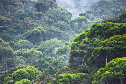
Latin America's Web of Life: Continental-Scale Connectivity Corridors
From the tropical forests of Mexico to the grasslands of Patagonia, Latin America is connected by an intricate network of natural corridors that function like a continental circulatory system for wildlife. These connectivity corridors, stretching across diverse landscapes, represent one of the world's most ambitious conservation challenges and greatest success stories. They connect ancient rainforests with modern cities, link mountain peaks with ocean shores, and bridge national boundaries to create pathways that support the movement of millions of species across the world's most biodiverse region.
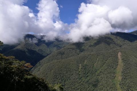
From Andes to Amazon: High-Altitude Connectivity Corridors
High-altitude connectivity corridors, connecting the Andes Mountains to the Amazon Rainforest, serve as vital wildlife routes that link snow-covered peaks to the humid rainforests. Key corridors safeguard important migration paths for spectacled bears, mountain tapirs, jaguars, and hundreds of bird species. These corridors facilitate the movement of wildlife, genetic exchange, and climate adaptation, while also providing essential ecosystem services. Threatened by roads, agriculture, and climate change, protecting these corridors is crucial for South America's biodiversity.
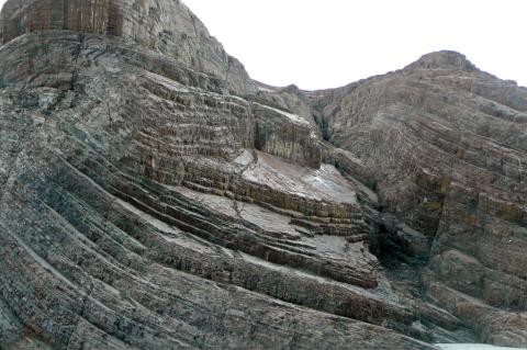
Tectonic Integration: How Latin American Plates Interact
The tectonic plates underlying Latin America and the Caribbean operate as an integrated system where the motion and interaction of each plate influences geological processes throughout the region. Understanding these plates individually provides crucial insights, but recognizing their interconnected relationships reveals how plate tectonics creates the geological unity that defines Latin American geography, from the Andes Mountains to Caribbean volcanism.
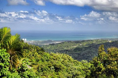
The Geography of Puerto Rico: A Comprehensive Analysis
Puerto Rico is one of the Caribbean's most geographically diverse and strategically located territories. Situated in the northeastern Caribbean Sea, this U.S. territory includes the main island of Puerto Rico along with several smaller islands, such as Vieques, Culebra, and many uninhabited cays. Its geography features dramatic topographical differences, from mountain interiors to coastal plains, creating a complex mosaic of ecosystems and climate zones that have significantly influenced human settlement and economic growth throughout its history.
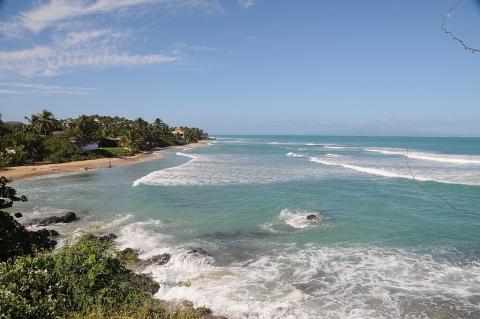
Vieques and Culebra: Puerto Rico's Eastern Islands
Vieques and Culebra, two remarkable islands located east of Puerto Rico's main island, are among the Caribbean's most pristine and ecologically significant territories. These islands are integral municipalities of Puerto Rico and, therefore, part of the United States territory. Their designation as "Passage Islands" reflects their geographical position in the Virgin Passage, the strait separating Puerto Rico from the U.S. Virgin Islands. Together, these islands offer an extraordinary combination of unspoiled natural beauty, complex historical narratives, and unique Caribbean ecosystems.
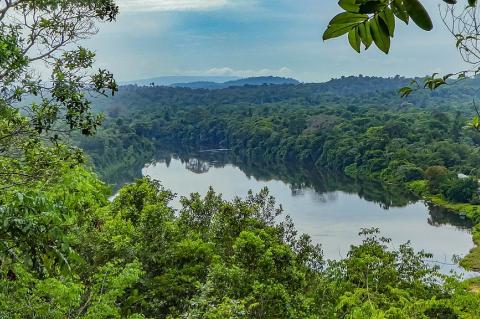
The Geography of Suriname: Nature's Pristine Laboratory in South America
Suriname is South America's smallest independent nation, but its geographic significance greatly exceeds its small size. This former Dutch colony boasts some of the most pristine and diverse landscapes on Earth. Located on the northeastern coast of South America, the country's strategic position places it at the crossroads of Caribbean and South American biogeographic regions, enhancing its ecological diversity. Much of the country is covered in natural tropical rainforests, making it a living laboratory for studying neotropical ecosystems and their complex relationships.
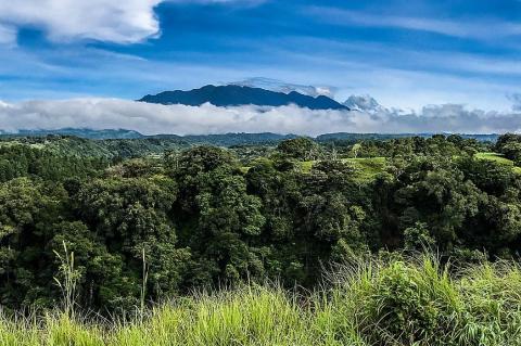
The Geography of Panama: Bridge Between Continents and Seas
Panama, the southernmost country in Central America, acts as a narrow land bridge connecting North and South America, separating the Atlantic and Pacific Oceans. Its S-shaped configuration links borders with Costa Rica and Colombia. Panama's geography exhibits remarkable diversity, including the Caribbean Lowlands, Pacific Lowlands, Central Mountain Range, and Eastern Highlands. Its unique position has influenced significant biodiversity, varied climates, species migration, and human development, making it a crucial link for ecosystems and global trade routes throughout history.
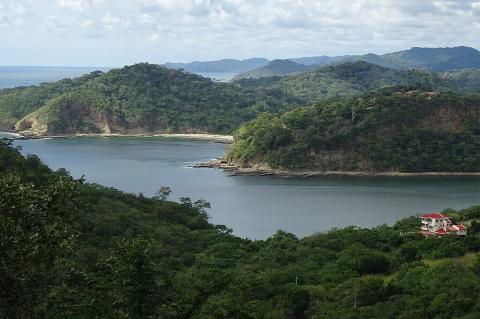
The Geography of Nicaragua: Land of Lakes and Volcanoes
Nicaragua is the largest country in Central America by land area. Situated at the center of the Central American isthmus, it acts as a vital link between North and South America. This strategic location has significantly influenced Nicaragua's geography, climate, biodiversity, and settlement patterns over time. Its landscape features volcanic peaks in the Cordillera Los Maribios and vast wetlands along the Mosquito Coast, illustrating a rich history of geological changes, climate variation, and ecological adaptation.
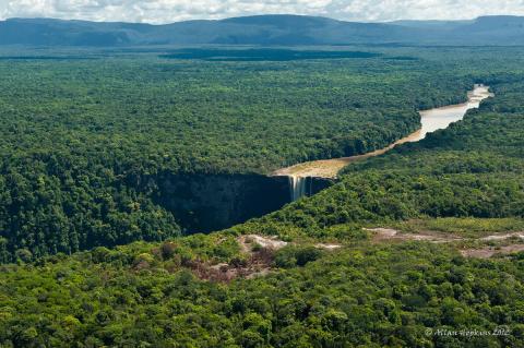
The Geography of Guyana: Where the Amazon Meets the Atlantic
Guyana represents one of South America's most geographically distinctive nations. This country occupies a unique position where the Caribbean cultural sphere meets the Amazon Basin. Strategically located on the northern coast of South America, Guyana possesses an extensive Atlantic coastline that has profoundly shaped its settlement patterns and economic development. The nation's remarkable geographic diversity, ranging from coastal plains below sea level to ancient mountain plateaus, creates distinct physiographic regions that support extraordinary biodiversity and a wide range of human activities.
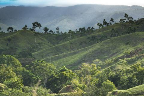
The Geography of Honduras: Land of Mountains and Two Seas
Honduras, often referred to as the "heart of Central America," boasts one of the most diverse and topographically complex landscapes in the region. Situated between Guatemala, El Salvador, and Nicaragua, it holds the unique distinction of having coastlines on both the Caribbean Sea and the Pacific Ocean. The country serves as a vital connection between North and South America, showcasing a diverse range of ecosystems, climate zones, and geological features that shape its natural environment and human development.
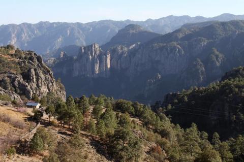
The Geography of Mexico: A Land of Remarkable Diversity
Mexico is one of the World's most geographically diverse nations, with a wide range of landscapes, climates, and ecosystems. It ranks as the 13th-largest country by land area, bridging North and Central America and serving as a vital biological and cultural crossroads. From snow-capped volcanoes to tropical rainforests, deserts, and Caribbean coastlines, Mexico's geography reflects geological forces, climatic diversity, and ecological richness that have shaped its natural heritage and human civilization.
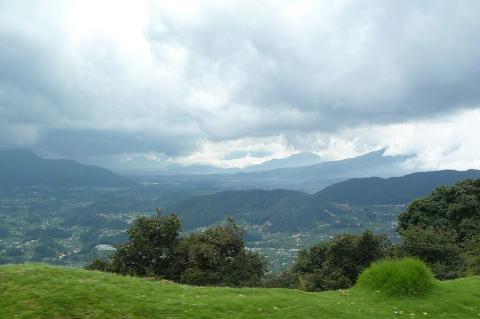
The Geography of Guatemala: Where Ancient Civilizations Meet Modern Conservation Challenges
Guatemala occupies a strategically important position in Central America, serving as a bridge between North and South America. This mountainous nation is bordered by Mexico to the north and west, Belize to the northeast, Honduras to the east, El Salvador to the southeast, the Pacific Ocean to the southwest, and the Caribbean Sea to the northeast. This strategic location has profoundly influenced Guatemala's history, culture, and economic development, while its dramatic topographic diversity has created one of the most biodiverse nations in Central America.
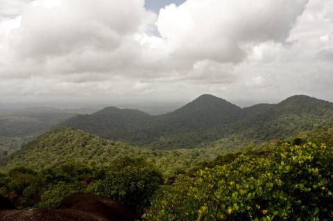
The Geography of French Guiana: Europe's Amazonian Territory at the Crossroads of Space and Conservation
French Guiana, officially an overseas collectivity of France, occupies a unique position in South America's geographic tapestry. Located on the northeastern coast of the continent, this territory serves as Europe's gateway to the Amazon Basin while maintaining its distinct French identity. Brazil borders French Guiana to the south and east, Suriname to the west, and the Atlantic Ocean to the northeast. This strategic location has not only shaped its political significance but also its remarkable geographic diversity, ranging from coastal mangroves to pristine Amazonian rainforests.
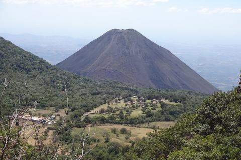
The Geography of El Salvador: From Pacific Shores to Highland Peaks
El Salvador, officially known as the Republic of El Salvador, stands as Central America's smallest and most densely populated nation. Despite its modest size, roughly equivalent to the state of Massachusetts, El Salvador presents a remarkably diverse geographic landscape that has profoundly shaped its history, culture, and economic development. Nestled between Guatemala to the west and north, Honduras to the northeast, and the Pacific Ocean to the south, this nation exemplifies how geographic factors can influence every aspect of a country's existence.
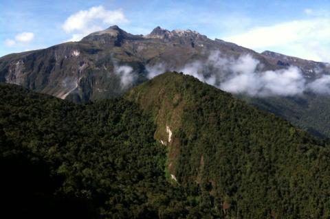
The Geography of Ecuador: Land of Four Worlds and the Equatorial Divide
Ecuador is one of the most geographically diverse and compact countries in South America, featuring an incredible variety of landscapes, climates, and ecosystems. Named for its location along the equator, Ecuador boasts a diverse geographical landscape that encompasses the snow-capped peaks of the Andes, the rich biodiversity of the Amazon rainforest, the dry coastal plains bordering the Pacific Ocean, and the volcanic islands of the Galápagos archipelago. This geographical diversity fosters high biodiversity and complex human settlement patterns.
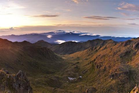
The Geography of Costa Rica: Land Between Oceans and Cradle of Biodiversity
Costa Rica is a notable geographic bridge between continents and oceans, holding a strategic position in Central America that has greatly influenced its natural environment and human development. This country shows how geographic diversity can exist within a relatively small area. Bordered by Nicaragua to the north, Panama to the south, the Pacific Ocean to the west, and the Caribbean Sea to the east, Costa Rica's location at the narrowest part of the Central American isthmus has created unique opportunities for biological exchange and ecological diversity.
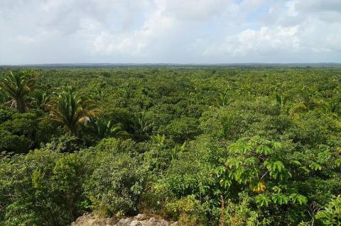
The Geography of Belize: From Blue Hole to Maya Peaks
Nestled along the Caribbean coast of Central America, Belize is a unique geographic gem that bridges the gap between North and South America. From the world's second-largest barrier reef system to ancient Maya mountains, and from dense tropical rainforests to vast wetlands, Belize offers an impressive mix of geographic features that defy its small size. The country's strategic location, bordered by Mexico, Guatemala, and the Caribbean Sea, has influenced both its natural environment and human settlement patterns throughout history.
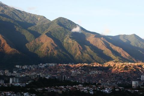
The Geography of Venezuela: A Land of Extraordinary Contrasts
Venezuela is one of South America's most geographically diverse nations. Located on the northern coast, it features towering mountains, tropical plains, rainforests, and extensive Caribbean coastlines. The landscape varies from snow-capped Andes peaks to wetlands and ancient formations dating back billions of years, creating diverse ecosystems and making Venezuela one of the world's megadiverse countries. Its strategic position bridges the Caribbean and South America, and its subsurface wealth includes the world's largest proven petroleum reserves, shaping its development.
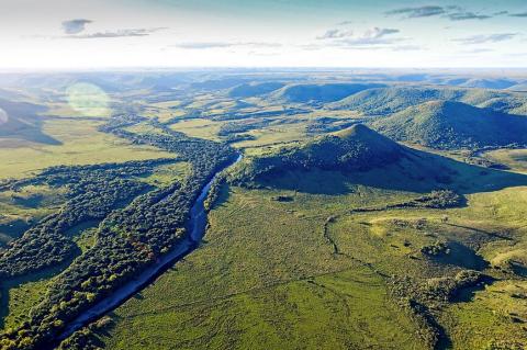
The Geography of Uruguay: From the Pampas to the Atlantic
Uruguay, officially known as the Oriental Republic of Uruguay, is one of South America's most geographically unique countries. Although it is the continent's second-smallest nation after Suriname, Uruguay's strategic position and distinct topography have significantly influenced its history, culture, and economy. Situated between the large countries of Brazil and Argentina, this nation offers a compelling example of how geography shapes a country's identity and future.
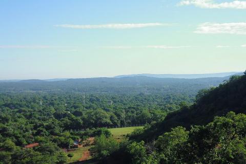
The Geography of Paraguay: A Landlocked Nation at the Heart of South America
Paraguay occupies a unique position in South America as one of only two landlocked countries on the continent, along with Bolivia. Located in the south-central part of the continent, the country's strategic position has significantly influenced its history, economy, and cultural development. Bordered by Brazil to the east and north, Bolivia to the northwest, and Argentina to the south and west, Paraguay sits at the meeting point of major river systems, serving as a natural crossroads for regional trade and migration patterns.
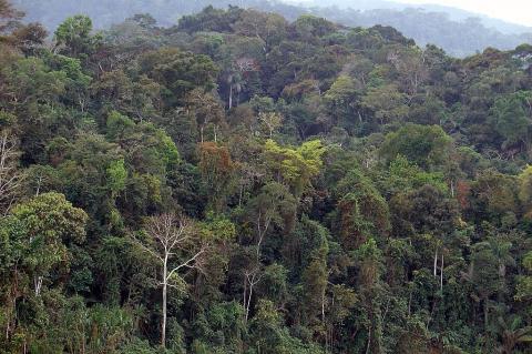
La Selva Unveiled: The Peruvian Amazon as Earth's Greatest Living Laboratory
The Peruvian Amazon, known as "La Selva" (The Jungle), is a remarkable natural treasure, a living cathedral of biodiversity that evolved over millions of years. It stretches from the eastern Andes foothills to borders with Ecuador, Colombia, Brazil, and Bolivia, covering Peru's largest part of the Amazon rainforest, the second-largest in the world after Brazil. La Selva is one of Peru's three main geographic regions, along with the arid Pacific coast (La Costa) and highland Andes (La Sierra).
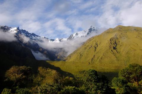
The Geography of Peru: A Journey Through Diverse Landscapes
Peru stands as one of South America's most geographically complex and ecologically diverse nations, encompassing dramatically varied terrain. Strategically positioned on the western coast of South America, Peru shares borders with Ecuador and Colombia to the north, Brazil and Bolivia to the east, and Chile to the south, facing the vast Pacific Ocean to the west. This remarkable nation is divided into three regions: the coastal desert, known as "la costa," the Andes, referred to as "la sierra," and the Amazon Basin, referred to as "la selva."
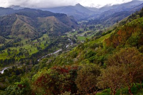
The Geography of Colombia: A Land Where Andes Meet Amazon
Colombia, located in the northwestern corner of South America, is one of the continent's most geographically diverse countries. It borders Venezuela and Brazil to the east, Peru and Ecuador to the south, Panama to the northwest, and the Caribbean Sea and Pacific Ocean to the north and west, respectively. Colombia's position at the meeting point of Central and South America gives it an exceptional variety of landscapes, including towering Andean peaks, vast tropical rainforests, sprawling grasslands, and extensive coastlines.
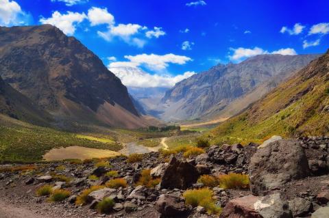
The Geography of Chile: Exploring a Nation of Contrasts
Chile stands as one of the world's most geographically unique nations, stretching like a narrow ribbon along South America's western edge between the Pacific Ocean and the Andes Mountains. This distinctive form creates an extraordinary range of climates and landscapes within a single national boundary. Bounded by the Pacific Ocean to the west and the formidable Andes Mountains to the east, Chile encompasses a diverse range of landscapes, from the world's driest desert to temperate rainforests and glacial fjords.
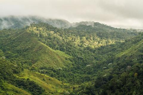
Central Atlantic Forest Ecological Corridor: A Lifeline for Brazil's Biodiversity
The Central Atlantic Forest Ecological Corridor (CAFEC) is one of Brazil's most ambitious and important conservation efforts. This ecological corridor acts as a crucial link, connecting fragmented pieces of the Atlantic Forest (Mata Atlântica), one of the world's most biodiverse and threatened biomes. Extending across the states of Espírito Santo and Bahia, it creates a network of protected areas that preserves unique biodiversity while enhancing ecosystem connectivity.
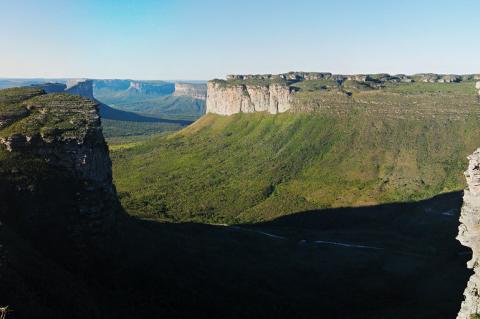
The Geography of Brazil: A Land of Diverse Landscapes
Brazil, the colossus of South America and the fifth-largest nation globally, spans from the equatorial Amazon Basin in the north to the temperate grasslands of Rio Grande do Sul in the south, encompassing one of Earth's most remarkable collections of biomes and geographical features. The country's vast expanse, spanning nearly 35 degrees of latitude, creates a natural laboratory of climatic zones, ranging from tropical rainforests and seasonal wetlands to highland savannas and coastal Atlantic forests.
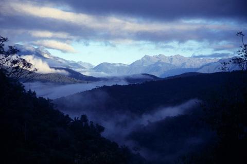
The Geography of Bolivia: A Nation of Many Landscapes
Bolivia, a landlocked country strategically located in the center of South America, is one of the most geographically diverse nations on the continent. Bolivia features dramatic differences in elevation, climate, and ecosystems that rival those of any country worldwide. From the snow-capped peaks of the Andes and the vast high-altitude plateaus of the Altiplano to the lush Amazonian rainforests teeming with life and the dry lowlands of the Gran Chaco, Bolivia's varied landscapes have profoundly influenced its cultural heritage, rich biodiversity, and complex economic development.
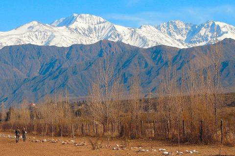
The Geography of Argentina: A Nation Shaped by Natural Diversity
Argentina, the second-largest country in South America and the eighth-largest nation in the world, presents a geographical tapestry of extraordinary complexity and beauty. From the subtropical north to the subantarctic south, Argentina's territory encompasses a remarkable range of landscapes, climates, and ecosystems that have profoundly influenced its development as a nation. This geographical diversity not only defines Argentina's physical character but also shapes its economic foundations, cultural identity, and environmental challenges in the 21st century.

The Caribbean's Aquatic Tapestry: Exploring the Region's Diverse Water Bodies
The Caribbean region is one of the world's most complex and diverse aquatic ecosystems. From turquoise waters lapping against pristine beaches to hidden freshwater lakes nestled in volcanic craters, the Caribbean's water bodies form an intricate network that has shaped the region's geography, ecology, and human civilization for thousands of years. These aquatic systems encompass everything from vast oceanic passages to intimate lagoons that serve as nurseries for countless marine species.
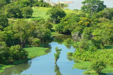
Venezuela's Aquatic Diversity: A Complete Guide to the Nation's Water Bodies
Venezuela boasts a diverse array of water bodies that significantly shape its geography and ecology. It stretches from the Caribbean Sea to the Amazon Basin, forming a complex hydrographic network. Its drainage relies mainly on two watersheds—one flows into the Atlantic Ocean, the other into the Caribbean Sea. From the mighty Orinoco River system to the ancient Lake Maracaibo, from pristine mountain lakes to extensive coastal wetlands, Venezuela's aquatic resources support diverse ecosystems, drive economic development, and sustain millions of inhabitants across varied geographical regions.
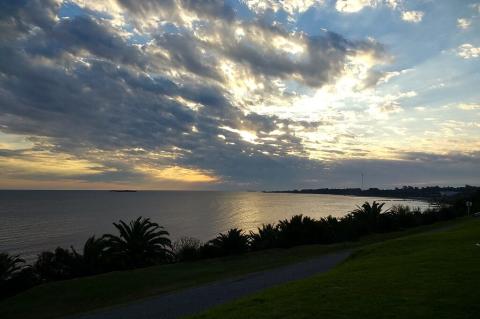
Uruguay's Diverse Aquatic Landscape: From Estuary to Highland Stream
Uruguay, South America's second-smallest nation, possesses a remarkably diverse and extensive network of water bodies that fundamentally shape its geography, economy, and cultural identity. Nestled between Brazil and Argentina, Uruguay benefits from its strategic position at the convergence of major river systems, most notably where the Uruguay and Paraná rivers merge to form the vast Río de la Plata estuary. Its water resources include groundwater from the Guarani Aquifer System, which is essential for agriculture, energy, transportation, recreation, and the preservation of natural beauty.
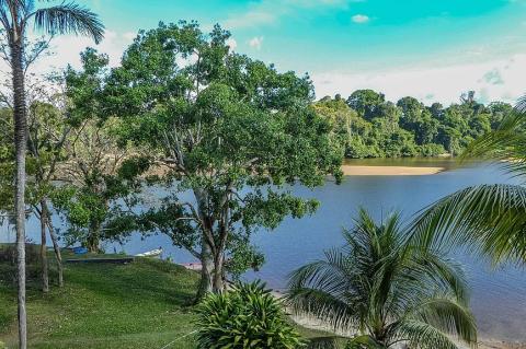
Suriname's Aquatic Heritage and Natural Wealth: Rivers of Gold
Nestled in the northeast corner of South America, Suriname stands as a nation intimately connected to its waterways. From the expansive rivers that define its international boundaries to the pristine reservoirs that power its industries, the country's aquatic landscape tells a story of natural abundance, cultural significance, and economic importance. The water bodies of Suriname represent far more than mere geographical features; they constitute the lifeblood of a nation where rivers serve as highways, wetlands nurture biodiversity, and artificial lakes generate prosperity.
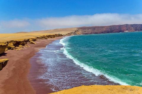
Peru's Hydrological Treasures: Exploring the Waters That Shape a Nation
Peru stands as one of South America's most hydrologically diverse nations, where the mighty Amazon River begins its transcontinental journey, glacial lakes dot the towering Andes and ancient civilizations once thrived along river valleys. The country's water bodies represent a complex network of rivers, lakes, and coastal features that have shaped both its natural landscape and human civilization for millennia. From the world's highest navigable lake to tributaries that feed the planet's largest river system, Peru's aquatic resources demonstrate remarkable diversity.
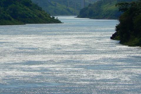
Paraguay's Aquatic Landscapes: From Pantanal to Paraná
Paraguay holds a unique position in South America as a landlocked country whose identity and economy are deeply influenced by its extensive river systems and strategic water resources. The country's geography is shaped by two of South America's most important rivers, which not only define its borders but also form the basis for one of the world's most ambitious hydroelectric projects. From the vast wetlands of the Pantanal that stretch into northern Paraguay to the powerful dams that have transformed the nation into a regional energy leader.
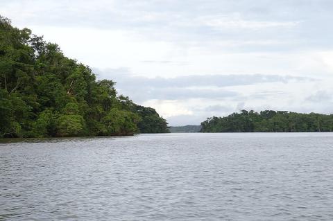
Panama's Aquatic Geography: From Canal to Coast
Panama holds a strategic position as a bridge between North and South America, connecting the Atlantic and Pacific oceans. Its unique geography boasts water bodies that influence its history, economy, and ecology. From the Panama Canal to pristine rivers in rainforests, water resources include large artificial lakes, extensive river networks, and diverse coastal ecosystems supporting rich marine life. This intersection of natural and human features highlights Panama's ecological and engineering significance.
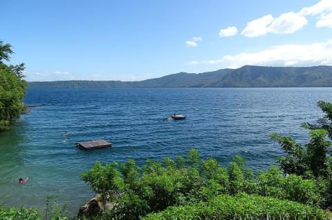
Nicaragua's Diverse Aquatic Ecosystems: From Volcanic Craters to Coastal Lagoons
Nicaragua, the largest country in Central America, has abundant water resources that have shaped its geography and ecology for millennia. From vast freshwater lakes to extensive river systems draining into both oceans, Nicaragua's hydrological features are among the most significant and diverse in the region. The country's location between two oceans, volcanic terrain, and tropical climate has created a complex network of aquatic ecosystems that support biodiversity and provide essential resources for the nation's population.
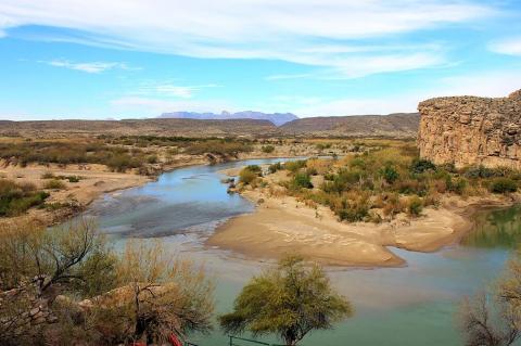
Mexico's Aquatic Treasures: A Journey Through the Nation's Diverse Water Bodies
Mexico's geographical position, situated between two major oceans and its complex topography, has blessed the nation with an extraordinary array of water bodies that shape both its natural landscape and cultural identity. From the pristine beaches of the Caribbean to the rugged Pacific coastline, from ancient crater lakes nestled in volcanic highlands to mighty rivers carving through tropical forests, Mexico's aquatic features represent some of the most diverse and ecologically significant water systems in North America.
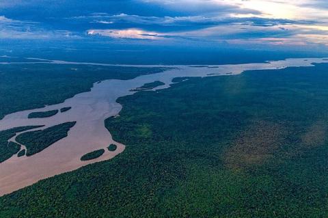
Guyana's Diverse Aquatic Landscapes: From Highlands to Coast
Guyana features a wide variety of landscapes, from Atlantic coastlands to Amazonian rainforests and highland savannas. This South American country is known as the "Land of Many Waters," a name that highlights its vast network of rivers, creeks, and waterways, which together influence the country's geography, economy, and cultural identity. Guyana's rivers, creeks, and streams form a complex hydrological system that supports diverse ecosystems, aids transportation, and underpins various economic activities, from agriculture to gold mining.
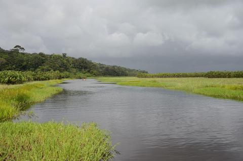
French Guiana's Pristine Aquatic Wilderness: Rivers of the Guiana Shield
French Guiana, on South America's northeast Atlantic coast, largely encompasses pristine Amazonian land. Its dense, mostly unexplored rainforest shelters an intricate network of rivers, coastal waters, and wetlands, forming one of the world's most biodiverse and ecologically vital aquatic ecosystems. Water bodies from the ancient Guiana Shield flow through rainforests to the Atlantic, serving as wildlife corridors, transportation routes for remote communities, and key components of the Amazon Basin's hydrology.
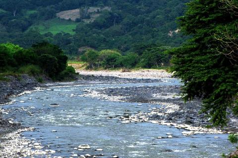
El Salvador's Aquatic Mosaic: Natural Lakes, Rivers, and Artificial Reservoirs
El Salvador, the smallest nation in Central America, possesses a remarkable diversity of water bodies that fundamentally shape its landscape, economy, and ecological systems. The country harbors an intricate network of natural lakes, meandering rivers, artificial reservoirs, and coastal waters that collectively sustain both human communities and diverse ecosystems. These aquatic features demonstrate the profound relationship between geography, geology, and human development in this densely populated Pacific coast nation.
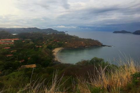
Costa Rica's Hydrographic Treasures: From Mountain Streams to Coastal Waters
Costa Rica, a small Central American country known for its remarkable biodiversity and environmental care, has an impressive network of water bodies that are vital to its ecosystems and communities. This tropical paradise features a complex system of rivers, lakes, wetlands, and coastal waters that support diverse ecosystems. Its unique location between two oceans, along with its mountainous terrain and heavy rainfall, creates a variety of aquatic environments, from pure mountain streams to extensive wetland areas.
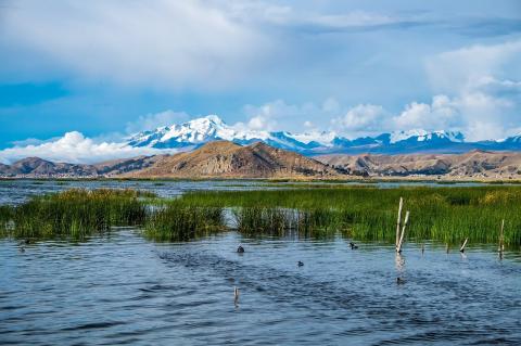
Bolivia's Liquid Landscapes: Navigating the Diverse Water Bodies of the Landlocked Giant
Bolivia, a landlocked nation nestled in the heart of South America, presents a remarkable paradox in its hydrographic landscape. Despite lacking direct access to oceanic waters, the country boasts an extraordinary diversity of water bodies that have shaped its geography, ecology, and cultural heritage for millennia. From the mystical heights of Lake Titicaca to the vast salt flats of Uyuni, Bolivia's aquatic treasures tell a compelling story of geological evolution, climatic adaptation, and human civilization.
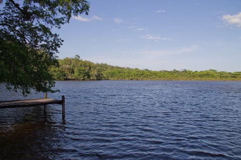
Belize's Comprehensive Water Landscape: From Mountains to Reef
Belize, positioned along the eastern coast of Central America, represents a unique confluence of terrestrial and marine environments where ancient Maya rivers meet the world's second-largest barrier reef system. This small nation encompasses an extraordinary diversity of aquatic landscapes, from crystalline mountain streams cascading through pristine rainforests to expansive coastal lagoons teeming with wildlife. These waters serve as ecological corridors, vital to the economy and culture, linking the highlands to the Caribbean and supporting communities.
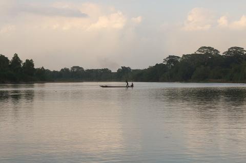
Honduras and Its Diverse Water Bodies: The Liquid Arteries of Central America
Honduras, situated in the heart of Central America, boasts a remarkable tapestry of aquatic landscapes that define both its geography and socioeconomic character. Spanning from the Caribbean Sea's turquoise expanse in the north to the Pacific Ocean's protected waters in the south, from mountain-fed rivers cascading through cloud forests to pristine lakes reflecting volcanic peaks, the nation's water bodies serve as vital lifelines supporting millions of inhabitants, diverse ecosystems, and economic activities.
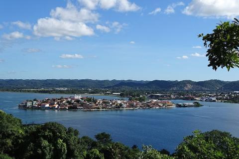
Guatemala's Diverse Water Bodies: Liquid Landscapes
Guatemala's location between two oceans and its rugged terrain have created one of Central America's most diverse and vital water systems. From volcanic crater lakes nestled in highland calderas to large freshwater bodies connected to Caribbean waters, Guatemala's water features are more than just geographic landmarks. These varied water sources are essential resources that support the country's environment, economy, and culture. Whether crater lakes near volcanoes or rivers flowing through jungles, these waters are central to the nation's identity.
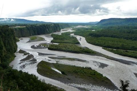
Ecuador's Extraordinary Aquatic Tapestry: Between Two Oceans and the Equator
Ecuador's small yet highly diverse territory includes some of the world's most remarkable aquatic environments. Located on the equator between the Pacific Ocean and the Amazon Basin, it features glacial lakes on volcanic peaks, pristine Amazon tributaries in primary rainforest, cloud forest streams on misty mountains, and coastal mangroves full of marine life. Its unique position at the crossroads of the Andes, Amazon rainforest, Pacific plain, and Galápagos Islands creates a vast diversity of water bodies supporting high biodiversity.
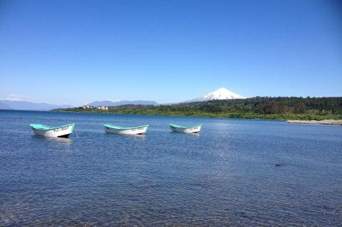
Chile's Diverse Aquatic Landscape: From Desert Springs to Glacial Lakes:
Chile's geography, stretching along South America's western coast, creates a highly diverse hydrological system. From the arid Atacama Desert in the north to the glacier-fed fjords of Patagonia in the south, the country's water bodies reflect geological forces, climatic extremes, and ecological adaptation across various latitudes and elevations. It includes high-altitude salt flats where flamingos feed, temperate rainforest rivers with ancient forests, and pristine glacial lakes reflecting snow-capped volcanoes.
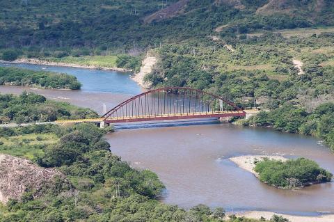
Colombia's Water Bodies: An Exploration of the Nation's Diverse Aquatic Landscapes
Colombia is one of South America's most water-rich nations, with rivers, lakes, wetlands, and coasts shaping its landscape and culture. From Amazon tributaries in the south to the Caribbean in the north, these waters support ecosystems, supply resources, and influence climate. Its strategic location and complex topography create diverse hydrology, making waterways vital for settlement, trade, and communities throughout history.
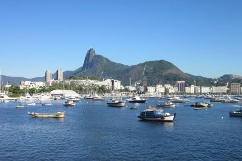
Brazil's Comprehensive Aquatic Landscape: From the Amazon to the Atlantic
Brazil is a nation defined by water. From the mighty Amazon River system that flows through its heart to the extensive Atlantic coastline that borders its eastern edge, water shapes the geography, ecology, economy, and culture of South America's largest country. As one of the most water-rich nations on Earth, Brazil's hydrological wealth includes vast river systems, numerous lakes, extensive wetlands, and a long coastline, creating a diverse aquatic landscape that supports both human civilization and remarkable biodiversity.
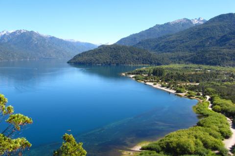
Argentina's Water Bodies: From Andean Lakes to Atlantic Shores
Argentina's territory stretches from the subtropical north to the sub-Antarctic south, featuring a variety of water bodies that shape the nation's geography, ecology, and human development. These aquatic systems, from powerful continent-draining rivers to pristine glacial lakes in the Andes, represent one of South America's most diverse hydrological landscapes. The country's water resources support diverse ecosystems, unique wildlife, millions of residents, and economic activity across multiple sectors.
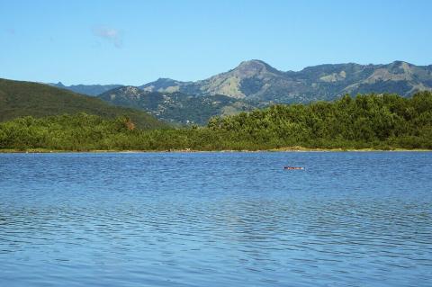
Puerto Rico's Mountain Ranges: Exploring the Rugged Backbone of the Caribbean
Puerto Rico's landscape rises dramatically from coastal plains to towering peaks, creating a topographical diversity that belies the island's compact size. The mountainous interior, locally known as "La Cordillera Central," forms the geological backbone of this Caribbean archipelago, hosting ecosystems found nowhere else on Earth and serving as the watershed for the island's vital freshwater resources. These ancient formations, sculpted by millions of years of volcanic activity and erosion, continue to shape the climate, culture, and economy of Puerto Rico.
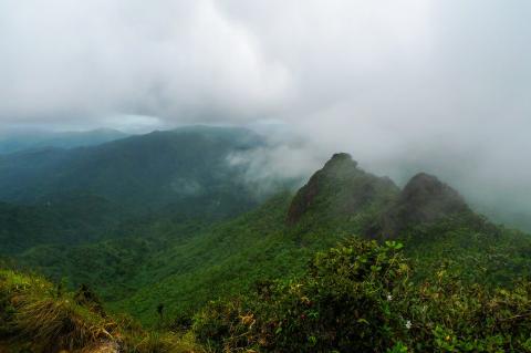
The Caribbean's Majestic Mountain Landscapes: From Sea to Summit
The Caribbean archipelago showcases a striking geological tapestry of volcanic peaks and ancient mountain ranges. Rising from crystalline waters, these landscapes represent millions of years of tectonic activity and eruptions. From Cuba's Sierra Maestra to Jamaica's Blue Mountains and Dominica's rainforests to the Dominican Republic's Cordillera Central, the Caribbean's mountains create microclimates that support rich biodiversity and serve as cultural landmarks shaping the history and identity of island nations.
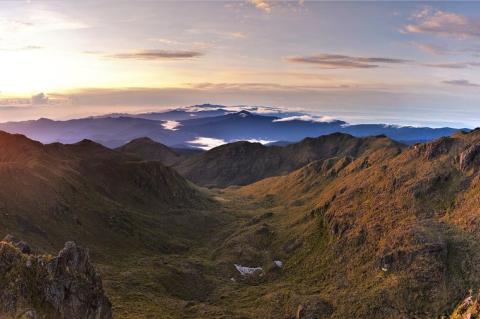
Central America's Mountain Heritage: From Volcanic Heights to Cloud Forests
Central America stands as one of the world's most geologically dynamic regions, where the collision of tectonic plates has sculpted a dramatic landscape of towering peaks, active volcanoes, and rugged mountain ranges. Stretching from Belize in the north to Panama in the south, these mountainous terrains form the backbone of the Central American isthmus, creating diverse ecosystems that harbor extraordinary biodiversity while shaping the climate, culture, and economy of seven nations.
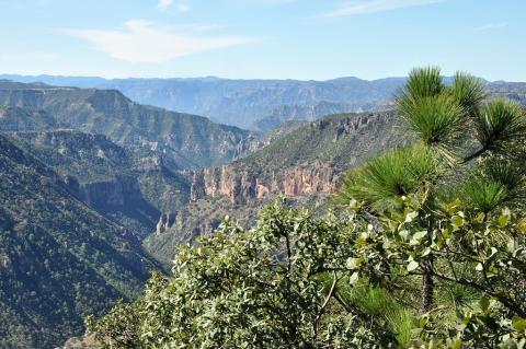
Mexico's Magnificent Mountain Systems: The Sierra Madre and Beyond
Mexico's dramatic landscape is defined by its magnificent mountain systems, which rise like ancient sentinels across the country's vast territory. From the rugged canyons of the north to the volcanic peaks of the south, these towering ranges have shaped not only the nation's geography but also its culture, history, and biodiversity. The Sierra Madre System, stretching like a backbone through the heart of Mexico, forms one of North America's most significant mountain complexes, while smaller ranges add their unique character to this land of stunning contrasts.
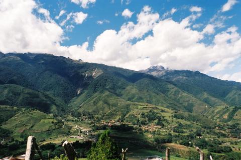
Venezuela's Majestic Mountain Ranges: A Geographic and Cultural Treasure
Venezuela, rich in geographic diversity, boasts some of South America's most spectacular mountain ranges. From the snow-capped peaks of the Andes in the west to the ancient tepuis of the Guiana Highlands in the south, these formations shape the country's landscape, climate, and culture. Venezuela's mountains serve as both barriers and water sources, supporting unique ecosystems, Indigenous communities, and geological wonders that have fascinated explorers and scientists for centuries.
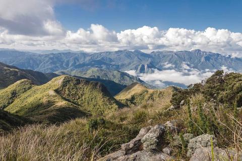
Brazil's Surprising Mountain Landscapes: Ancient Peaks in a Land of Plateaus
Brazil's vast territory, while commonly associated with the Amazon rainforest and coastal plains, harbors a remarkably diverse collection of mountain ranges that span geological time periods from the Precambrian era to relatively recent formations. These ancient peaks, dramatic escarpments, and isolated massifs form a complex topographical mosaic that spans all regions of South America's largest nation. Brazil's mountains range from the towering Pico da Neblina along the Venezuelan border to the rolling hills of the southern highlands, encompassing some of the world's oldest geological formations.
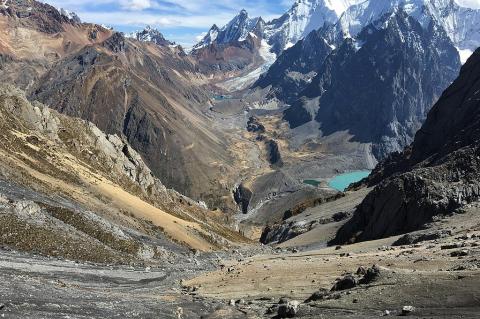
Peru's Majestic Mountain Ranges: Crown Jewels of the Andes
Peru's extraordinary mountain geography encompasses some of the most spectacular and diverse highland landscapes in South America. These magnificent ranges, ancient geological formations, and towering summits not only define Peru's physical character but also serve as the cultural and spiritual heartland of Andean civilization. Peru contains the longest continuous section of the Andes Mountains, with the Peruvian Andes forming the backbone of a nation whose history, culture, and economy have been shaped by these towering peaks for millennia.
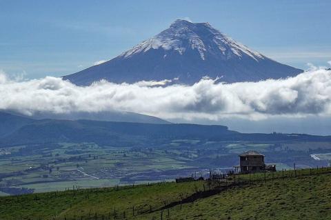
Ecuador's Towering Landscapes: Where Volcanoes Meet the Sky
Ecuador's compact territory encompasses some of South America's most spectacular and geologically active mountain ranges. These majestic peaks, active volcanoes, and ancient massifs not only define the country's physical character but also create a diverse array of microclimates and ecosystems. From the coastal Cordillera de la Costa to the towering stratovolcanoes of the main Andean ranges, Ecuador's mountains serve as crucial water sources, biodiversity refuges, and cultural landmarks.
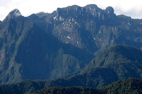
Colombia's Majestic Mountain Ranges: Guardians of Biodiversity and Culture
Colombia's dramatic topography is defined by its spectacular mountain ranges, which serve as the geological backbone of this South American nation. These towering peaks, deep valleys, and high plateaus not only shape the country's physical landscape but also influence its climate, biodiversity, and cultural heritage. Stretching from the Caribbean coast to the Ecuadorian border, Colombia's mountains encompass everything from active volcanoes and glaciated summits to mystical cloud forests and unique páramo ecosystems.
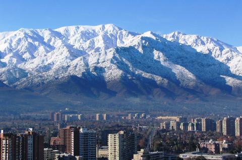
Chile's Mountain Ranges: Backbone of a Nation
Chile, a narrow ribbon along South America's west coast, features extraordinary mountain systems as its geological backbone. The towering Andes Mountains border the east, while the Coastal Range faces the Pacific, creating a diverse landscape of valleys, desert plateaus, and glaciated wilderness. From the highest volcanoes above the Atacama Desert in the north to Patagonia's icy granite spires in the south, Chile's mountains reveal ongoing tectonic forces, dramatic climate extremes, and remarkable human adaptation across some of Earth's most diverse and challenging terrain.
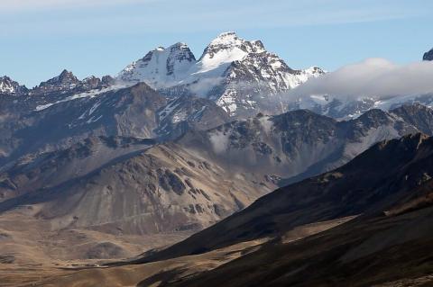
Bolivia's Sacred Summits: A Journey Through the Nation's Highest Peaks
Bolivia is one of the world's highest nations, with peaks piercing thin air and high-altitude plateaus stretching to the horizon. Its dramatic topography includes spectacular Andes mountain scenery, featuring volcanic summits, glacier-covered massifs, and pristine alpine environments that captivate explorers and mountaineers. From the volcanic giants of the Cordillera Occidental to the ridges of the Cordillera Real, Bolivia's mountains shape the nation's climate, culture, and character.
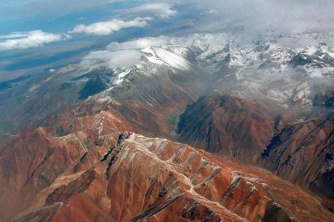
Argentina's Alpine World: A Comprehensive Guide to the Nation's Peaks and Ranges
Argentina's dramatic landscape is defined by some of South America's most spectacular mountain ranges, stretching from the tropical north to the windswept peaks of Patagonia. These geological formations not only shape the country's physical geography but also influence its climate, biodiversity, and cultural identity. From the soaring heights of Aconcagua to the jagged spires of the Andes, Argentina's mountains represent a breathtaking testament to the power of tectonic forces and the enduring beauty of the natural world.
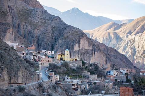
Argentina: Cultural Landscape
Argentina's cultural landscape is among the most complex and fascinating in Latin America, shaped by its vast geography, rich Indigenous heritage, massive European immigration, and unique historical trajectory. Spanning from the subtropical north to the subantarctic south, from the Andes Mountains to the Atlantic Ocean, this enormous nation has fostered cultural expressions that reflect both profound European influence and distinctly South American innovation.
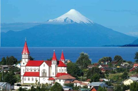
Chile: Cultural Landscape
Chile's cultural landscape is one of the most distinctive in South America, shaped by its geography, Indigenous heritage, colonial history, and global influences. From the Atacama Desert to the subantarctic regions, this narrow land fosters diverse cultural expressions reflecting the unity and diversity of the Chilean experience. The cultural identity emerges from pre-Columbian civilizations, Spanish colonial legacy, European immigration, and globalization, creating a society with strong traditional roots and modern innovation.
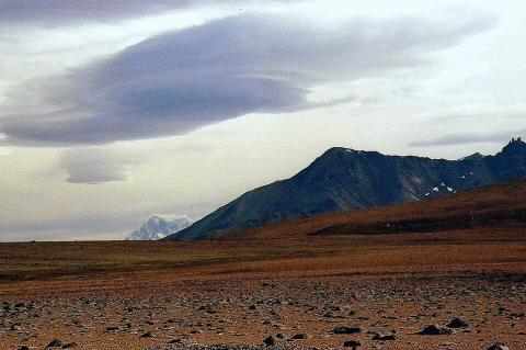
The Patagonian Steppe: Life in the Rain Shadow
The Patagonian Steppe, stretching across southern South America, is a significant temperate grassland ecosystem. This semi-arid landscape, shaped by the Andes and strong westerly winds, extends from the Colorado River in Argentina to the Strait of Magellan, covering parts of Argentina and Chile with windswept plains, volcanic plateaus, and shrublands. Often mischaracterized as barren, it supports rich biodiversity and unique ecological adaptations, serving as the economic backbone of South America's pastoral regions.
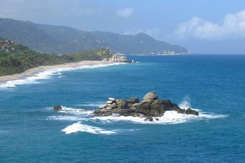
Colombia: Natural Landscape
Nestled in northwestern South America, Colombia shares its borders with Panama to the northwest, Venezuela and Brazil to the east, and Ecuador and Peru to the south. Colombia spans diverse ecosystems, climates, and topographies as the fourth-largest country in South America. From the snow-capped peaks of the Andes to the pristine beaches along the Caribbean and Pacific coasts, Colombia’s landscape is a tapestry of geographical extremes that form an impressive panorama of natural beauty.
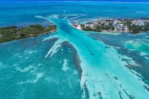
Belize Barrier Reef: A Jewel of Ecological Diversity and Conservation
The Belize Barrier Reef, a masterpiece of nature within the Mesoamerican Barrier Reef System, is a cornerstone of the Northern Hemisphere's marine biodiversity. As the second-largest coral reef system globally, it mesmerizes with its intricate ecosystems, rare coastal forests, and unique reef types. Influenced by the rise and fall of sea levels, natural karst topography, and crystal-clear waters, the reef boasts many kinds of reefs and atolls and distinctive features like the renowned Blue Hole and Rocky Point.
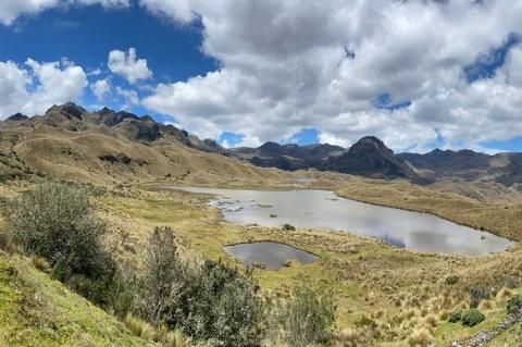
The Páramo: An Island in the Sky, Where Andean Winds Shape a Unique World
The Páramo, or Andean Moorland, is a distinctive high-mountain biome in the Neotropical realm, found in the upper reaches of the Andes Mountains in Colombia, Ecuador, Peru, and Venezuela. This remarkable grassland ecosystem, perched above the limits of continuous forest yet below the perpetual embrace of snow and ice, is globally renowned for its unique assemblage of flora and fauna, making it a cornerstone of the region's irreplaceable biodiversity.
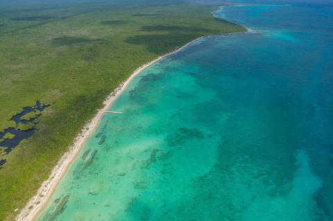
The Mesoamerican Barrier Reef System: A Deep Dive into the Western Hemisphere's Underwater Metropolis
Nestled within the cerulean embrace of the Caribbean Sea lies a submarine realm of breathtaking beauty and paramount ecological significance – the Mesoamerican Barrier Reef System (MBRS), often reverently termed the Great Mayan Reef. This extensive and intricate network of coral reefs, seagrass beds, mangrove forests, and associated coastal ecosystems represents the most expansive barrier reef system in the Western Hemisphere.
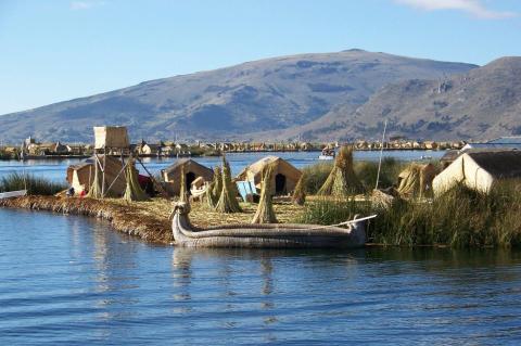
Guardians of the Land: Indigenous Peoples of South America
South America has been home to diverse Indigenous cultures for thousands of years, which have shaped the continent's history, traditions, and landscapes. From the vast empire of the Inca in the Andes to the complex societies of the Amazon, Indigenous peoples have developed unique ways of life adapted to their environments. Despite the impact of European colonization, Indigenous communities continue to preserve their languages, customs, and ancestral knowledge.
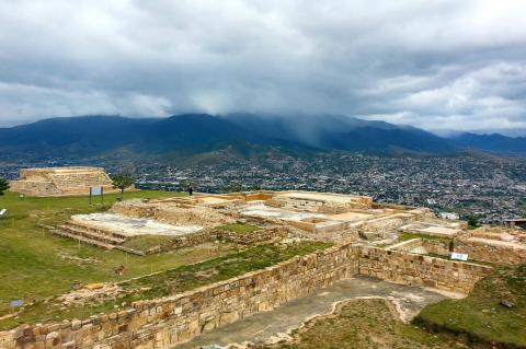
Legacies of the Ancestors: Indigenous Cultures of Mexico and Central America
Mexico and Central America have been home to influential Indigenous civilizations. Before Europeans arrived, these cultures developed complex societies, advanced agriculture, impressive architecture, and rich spiritual traditions that still shape the region. From the Maya pyramids to the Aztec empire and the traditions of Nahua and Lenca, Mesoamerican peoples have significantly impacted the cultural landscape.
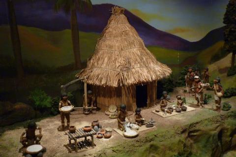
The Indigenous Peoples of the Caribbean: History, Culture, and Legacy
The Caribbean, a region known for its rich cultural diversity and stunning landscapes, was originally home to a variety of Indigenous peoples who played a crucial role in shaping its early history. Long before European exploration, civilizations such as the Taíno, Kalinago, and Guanahatabey thrived across the islands, developing complex societies, agricultural systems, and maritime traditions. These Indigenous groups left an enduring legacy that continues to influence Caribbean culture.
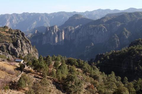
Mexico: Natural Landscape
Officially known as the United Mexican States, Mexico is in southern North America, sharing borders with the United States to the north and Guatemala and Belize to the southeast. The Pacific Ocean defines its expansive coastal boundaries to the west, the Gulf of Mexico and the Caribbean Sea to the east. The country's geographical diversity extends to various islands and archipelagoes scattered along its coastlines.
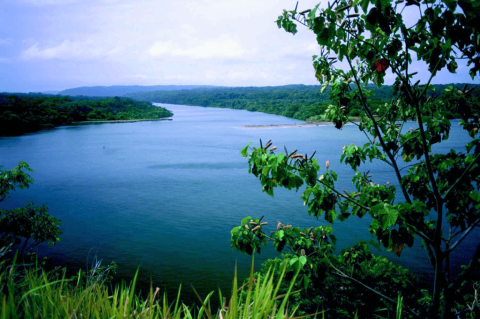
Panama: Natural Landscape
Panama, the southernmost nation in Central America, serves as a critical bridge between two continents. Bordered by Costa Rica to the northwest, Colombia to the southeast, the Caribbean Sea to the north, and the Pacific Ocean to the south, Panama is situated on the iconic S-shaped Isthmus of Panama. This slender landmass links North and South America, earning the country global recognition as the home of the Panama Canal, a pivotal artery for international maritime trade.
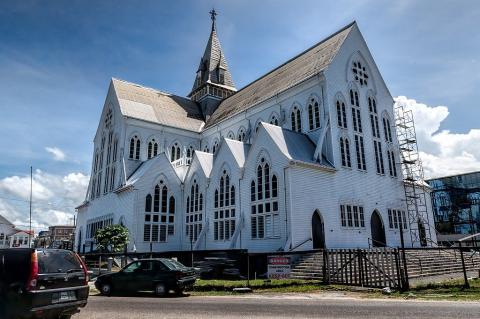
Guyana: Cultural Landscape
Situated on South America's northern coast and bordered by Venezuela, Brazil, and Suriname, Guyana stands apart with its distinctive identity shaped by a rich cultural and natural heritage. Along with French Guiana and Suriname, Guyana is one of the three nations comprising The Guianas. It shares historical and ecological ties but carves its unique path with its blend of Caribbean and South American influences.
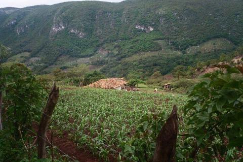
Honduras: Cultural Landscape
Honduras boasts a diverse and dynamic cultural landscape shaped by its indigenous roots, colonial history, African heritage, and contemporary expressions. The country's cultural heritage reflects a fascinating blend of traditions, customs, and beliefs that have evolved over centuries. From the ancient practices of indigenous peoples to the modern-day influences of globalization, the cultural landscape is a living testament to the country's complex history and evolving identity.
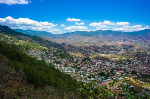
Honduras: Natural Landscape
Honduras, situated in northern Central America, is mostly mountainous. It shares borders with Nicaragua to the southeast, El Salvador and the Pacific Ocean to the southwest, Guatemala to the west, and the Caribbean Sea to the north. This strategic positioning places Honduras at the crossroads of diverse geographical and cultural influences. Most of the population resides in the central highlands, an economically important agricultural area.
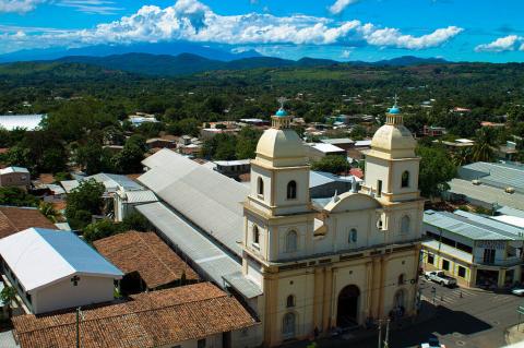
El Salvador: Cultural Landscape
El Salvador's cultural landscape is a vibrant and dynamic blend of Indigenous, European, and contemporary influences. Shaped by the ancient Pipil civilization, Spanish colonization, and modern global trends, the country's cultural identity is a rich tapestry of traditions, customs, language, cuisine, and artistic expression. Despite the challenges it faces, including political tensions and high levels of violence, El Salvador's cultural heritage remains resilient, evolving while preserving its essence.
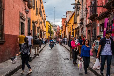
Mexico: Cultural Landscape
The cultural landscape of Mexico is a mesmerizing blend of ancient traditions, colonial legacies, and modern global influences, each layer adding depth to the country's rich identity. With roots that extend back thousands of years, Mexico's Indigenous communities—such as the Maya, Aztecs, Zapotecs, and Mixtecs—developed complex civilizations, leaving behind awe-inspiring architecture, intricate artistry, and profound spiritual beliefs that continue to shape the country today.
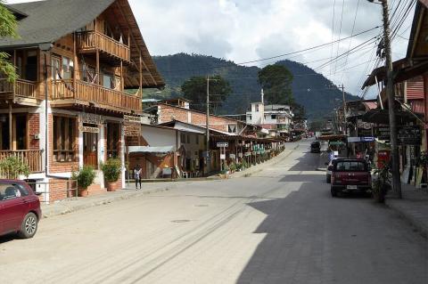
Ecuador: Cultural Landscape
Ecuador, a vibrant country in northwestern South America, boasts a diverse cultural landscape forged by its historical heritage, unique geography, and dynamic blend of Indigenous, Spanish, African, and modern global influences. Ecuador's culture reflects a profound connection to its natural environment, a rich tapestry of traditions, and a growing array of contemporary elements.
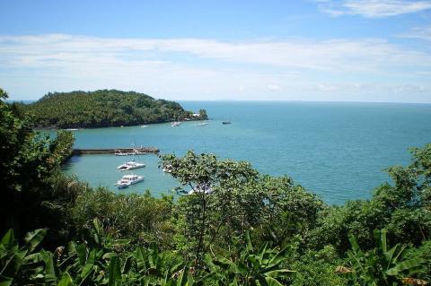
French Guiana: Natural Landscape
French Guiana, a French overseas department on South America's northeastern coast, borders Suriname, Brazil, and the Atlantic Ocean. It is primarily covered by dense rainforests and rivers, with most of its population concentrated along the coast near the capital, Cayenne. As the smallest mainland territory in South America, it remains one of the continent's most biodiverse and ecologically pristine landscapes.
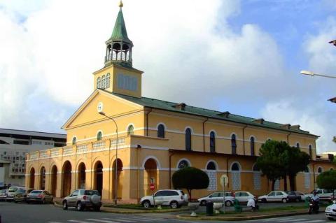
French Guiana: Cultural Landscape
French Guiana (Guyane) is an overseas department of France located on the northeastern coast of South America. It is part of a region called "The Guianas," which includes Guyana and Suriname. French Guiana's cultural landscape is an intricate tapestry woven from Indigenous, African, European, and Asian influences. Its unique blend reflects a vibrant history and the resilience of diverse communities amid challenges, blending deep-rooted customs with contemporary dynamics.
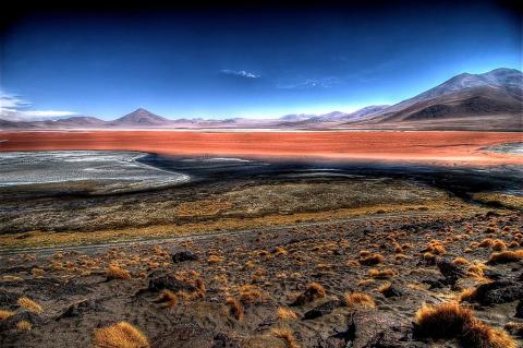
Bolivia: Natural Landscape
Bolivia, a landlocked nation situated in the heart of South America, offers one of the continent's most diverse and complex landscapes. Surrounded by five neighboring countries—Brazil to the north and east, Paraguay to the southeast, Argentina to the south, Chile to the southwest, and Peru to the northwest—Bolivia's varied geography is shaped by towering mountains, expansive lowlands, and diverse climatic zones that create a vibrant natural mosaic.
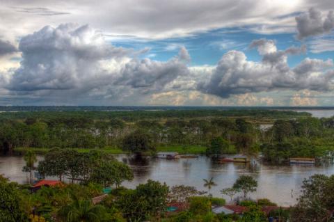
Brazil: Natural Landscape
Brazil is the largest country in the region and the fifth largest globally, occupying nearly half of the continent. Known for its geographical diversity, Brazil boasts ecosystems that range from rainforests and grasslands to mountains and savannas, contributing to its renowned natural beauty and status as a global leader in biodiversity. Brazil shares land borders with nearly every South American country, emphasizing its vast reach. This geographical expanse and strategic location result in a natural landscape as varied as it is breathtaking.
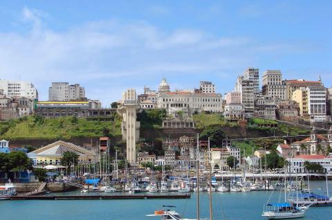
Brazil: Cultural Landscape
Brazil's cultural landscape is a vibrant fusion of Indigenous heritage, African traditions, European colonial influences, and contributions from diverse immigrant communities. Known for its captivating music, colorful festivals, dynamic arts, and religious diversity, Brazil has become a cultural beacon. Each region of Brazil adds its unique expression, contributing to a vast and complex cultural identity that reflects the country’s history, multicultural roots, and contemporary influences.
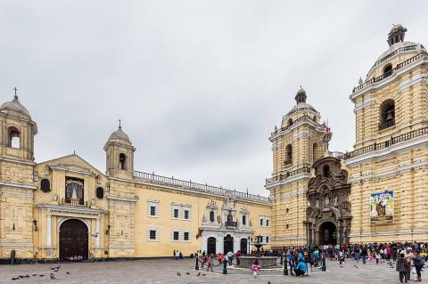
Peru: Cultural Landscape
Peru's cultural heritage is a complex tapestry woven from ancient civilizations, colonial influences, diverse indigenous traditions, and contemporary expressions. The country's cultural landscape reflects centuries of history and a vibrant mix of indigenous and European influences, enhanced by its renowned culinary scene, music, and thriving arts community. Peru's culture reflects resilience and adaptability, which continue to define its identity.
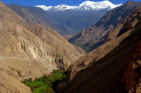
Peru: Natural Landscape
Peru, a South American country with breathtakingly diverse landscapes, occupies a central position along the continent's western coast. Renowned for its stunning geography, which ranges from the rugged Andes Mountains to the vast Amazon rainforest, Peru's natural beauty is as varied as its rich cultural heritage. From the arid coastal deserts along the Pacific Ocean to towering peaks and verdant rainforests, the country's landscapes support exceptional biodiversity and cultural history.
Suriname: Natural Landscape
Suriname, formerly known as "Dutch Guiana," is located on the northeastern Atlantic coast of South America. The country's Atlantic coastline offers a mix of coastal wetlands, river estuaries, and dense mangrove forests. Suriname is the smallest sovereign state on the continent, yet its geographical diversity and ecological significance are remarkable. Its rich biodiversity is primarily concentrated in its dense tropical rainforests, which cover approximately 90% of the country's total land area—the highest forest cover in the world.
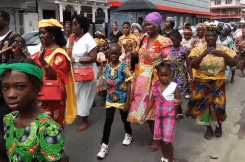
Suriname: Cultural Landscape
Suriname, situated on the northeast coast of South America, showcases a rich and diverse cultural landscape shaped by its indigenous heritage, colonial history, African roots, and an influx of immigrant communities from across the globe. This unique blend of influences is intertwined with the country's lush natural environment, contributing to a vibrant and multifaceted cultural identity.
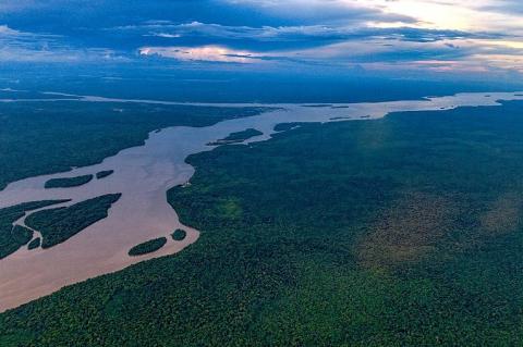
Guyana: Natural Landscape
Nestled in northeastern South America, Guyana, formerly known as British Guiana, is a nation defined by its unique geography and natural beauty. With a coastline stretching along the Atlantic Ocean, Guyana shares borders with Suriname to the east, Venezuela to the west, and Brazil to the west and south. Although it is the third-smallest country on the continent, Guyana boasts a remarkable array of ecosystems, from dense rainforests to sprawling savannas.
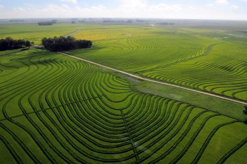
Uruguay: Natural Landscape
Uruguay, located on the southeastern Atlantic coast of South America's Southern Cone, is known for its unique natural beauty and ecological diversity. It boasts a surprisingly wide range of ecosystems, primarily characterized by its expansive grasslands, known as the Pampas. Additionally, Uruguay features a significant amount of inland water, which enhances its geographical diversity and contributes to the country's rich ecosystems and natural resources.
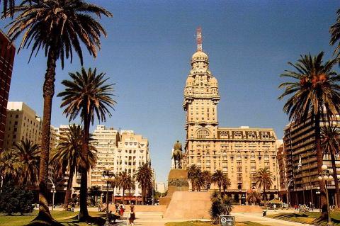
Uruguay: Cultural Landscape
Uruguay, a small yet dynamic South American country between Brazil and Argentina, boasts a rich and diverse cultural heritage. With influences spanning indigenous traditions, European heritage, rural life, vibrant festivals, intellectualism, and a strong love for sports and the arts, Uruguayan culture reflects the resilience and adaptability of its people. Uruguay’s cultural landscape is a vivid tapestry woven from history, tradition, and contemporary global influences.
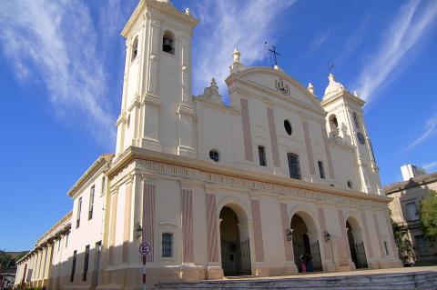
Paraguay: Cultural Landscape
Paraguay, located in the heart of South America, offers a unique and diverse cultural landscape shaped by its indigenous heritage, colonial history, and influences from various immigrant groups. This fusion of Indigenous, European, and modern influences has forged a distinct cultural identity, celebrated through music, dance, language, crafts, cuisine, and customs.
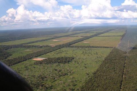
Paraguay: Natural Landscape
Paraguay, situated in the south-central heart of South America, is a landlocked country but possesses a strategic geographical advantage thanks to the Paraguay and Paraná rivers. These rivers provide crucial access to the Atlantic Ocean, enabling trade and regional connectivity that drive the nation's economy. Within its borders, Paraguay reveals diverse topographies and ecosystems, ranging from fertile plains to arid lowlands, that shape its population distribution, economy, and cultural heritage.
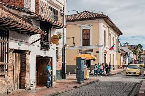
Colombia: Cultural Landscape
Colombia, situated at the northern tip of South America, has a rich and multifaceted cultural heritage. Its identity is deeply rooted in the blend of indigenous traditions, Spanish colonialism, African customs, and modern global influences. Colombian culture reflects the nation's dynamic history and evolving social fabric, from its vibrant arts scene to its diverse music and cuisine. As Colombia continues to develop and interact with global trends, its cultural landscape remains a fascinating panorama of traditional practices and contemporary expressions.
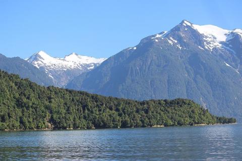
Chile: Natural Landscape
Chile's natural landscape is one of the most diverse and striking in the world, stretching along the southwestern coast of South America. Its unique geographical configuration, spanning 4,300 kilometers from north to south while averaging only 177 kilometers wide, provides an incredible array of climates and ecosystems. From arid deserts to fertile valleys, dense forests, and towering mountains, Chile's terrain is a mosaic of natural wonders, complemented by its Pacific island territories.
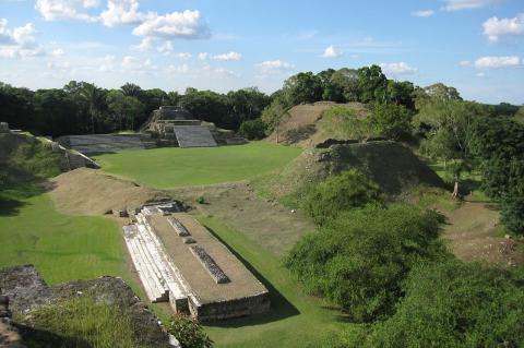
The Ancient Maya Sites of Belize: A Comprehensive Exploration
Belize is home to one of the most significant collections of ancient Maya archaeological sites, offering a window into the complex and sophisticated civilization that thrived for thousands of years. These sites span the Preclassic, Classic, and Postclassic periods, showcasing the Maya’s advancements in architecture, astronomy, agriculture, and social organization.
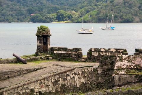
Panama: Cultural Landscape
Panama's cultural landscape is a vibrant mosaic reflecting its complex history, geographic location, and diverse population. The country's national identity is deeply rooted in the coexistence of indigenous heritage, African influences, colonial history, and contemporary global expressions. This cultural diversity is celebrated and preserved, with traditions and modern influences intertwined in the fabric of everyday life.
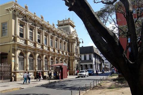
Costa Rica: Cultural Landscape
Costa Rica, a jewel of Central America, is a nation celebrated not only for its breathtaking natural beauty but also for its rich and diverse cultural landscape. Costa Rican culture is a unique blend of traditions, values, and contemporary influences, shaped by a history of indigenous heritage, Spanish colonialism, and an enduring commitment to environmental preservation. The nation’s cultural identity reflects its deep connection to its past while evolving with global trends and challenges.
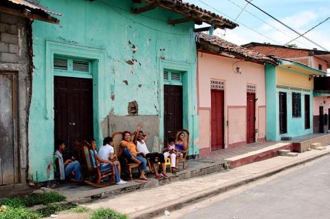
Nicaragua: Cultural Landscape
Nicaragua's cultural landscape is a vibrant mosaic shaped by centuries of Indigenous, Spanish, and African influences. This unique blend is reflected in the nation's traditions, cuisine, arts, music, and festivities, offering a glimpse into the country's rich and evolving cultural heritage. Despite challenges posed by political instability, economic hardship, and globalization, Nicaragua remains a land where cultural identity continues to thrive and adapt.
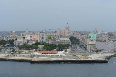
Cuba: An Indepth Exploration
Cuba, the largest island in the Caribbean, stands as a nation of contrasts and complexities. Cuba has long captivated the world's imagination because of its rich history, vibrant culture, and political distinctiveness. This exploration delves into the multifaceted aspects of Cuba, from its geography and history to its culture, economy, and global impact, revealing a country that continues to evolve while maintaining its unique identity in the face of numerous challenges and transformations.
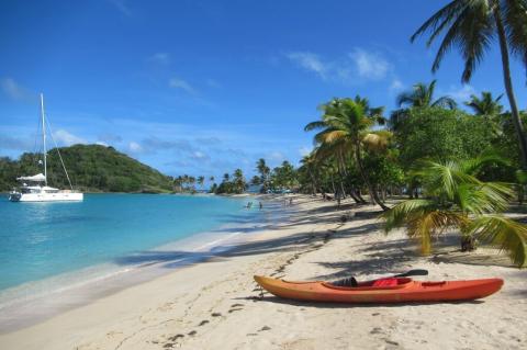
Saint Vincent and the Grenadines: The Jewel of the Windward Islands
Saint Vincent and the Grenadines, a stunning island nation in the Caribbean, is renowned for its diverse landscapes, vibrant culture, and rich historical legacy. Located within the Windward Islands of the Lesser Antilles, this archipelago comprises the main island of Saint Vincent and a southern chain of 32 smaller islands and cays known collectively as the Grenadines. As part of the Eastern Caribbean, Saint Vincent and the Grenadines is a sovereign state with a unique blend of cultural influences and geographical features.
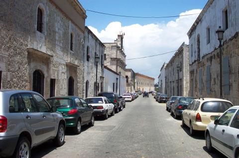
The Dominican Republic: From Pristine Beaches to Colonial Streets
The Dominican Republic, occupying the eastern two-thirds of the island of Hispaniola in the Greater Antilles, is a nation of remarkable diversity and allure. With its pristine beaches, lush mountains, and colonial architecture, the country offers a captivating blend of natural beauty and historical significance. This comprehensive exploration delves into the multifaceted aspects of the Dominican Republic, from its geography and history to its culture, economy, and global impact.
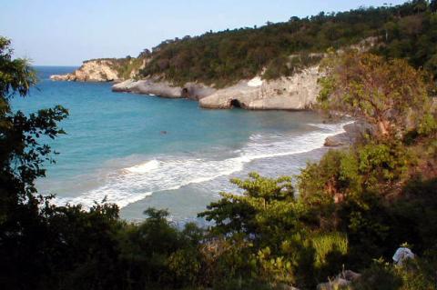
Haiti: Cradle of Revolution, Crucible of Resilience
Haiti, the western third of Hispaniola in the Caribbean, is a nation of contrasts and complexities shaped by its rich history, vibrant culture, and political distinctiveness. This exploration delves into Haiti's multifaceted aspects, from its geography and history to its culture, economy, and global impact, revealing a country that continues to evolve while maintaining its unique identity in the face of numerous challenges and transformations.
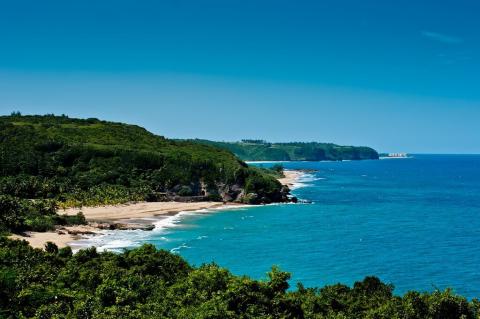
Puerto Rico: Caribbean Gem of Diversity, Culture, and Resilience
Puerto Rico, an archipelago in the Caribbean Sea, is a unique blend of natural beauty, rich history, and vibrant culture. As an unincorporated territory of the United States, Puerto Rico occupies a distinctive political and cultural space, bridging Latin American and North American influences. The multifaceted aspects of Puerto Rico, from its geography and history to its culture, economy, and global impact, reveal an island that continues to evolve while maintaining its unique identity.
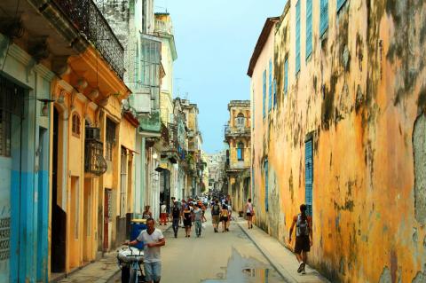
Cuba: Island of Revolution and Resilience
Cuba, the largest island in the Caribbean, stands as a nation of contrasts and complexities. Cuba has long captivated the world's imagination because of its rich history, vibrant culture, and political distinctiveness. This exploration delves into the multifaceted aspects of Cuba, from its geography and history to its culture, economy, and global impact, revealing a country that continues to evolve while maintaining its unique identity in the face of numerous challenges and transformations.
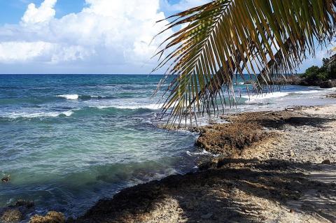
Jamaica: Where History Meets Paradise
Jamaica, an island nation in the Greater Antilles archipelago of the Caribbean Sea, captivates visitors and scholars with its rich cultural tapestry, complex history, and stunning natural landscapes. From its indigenous roots to its colonial past and vibrant present, Jamaica has emerged as a unique blend of African, European, and native influences. This exploration delves into Jamaica's multifaceted aspects, examining its geography, history, culture, economy, and global impact.
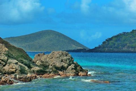
Virgin Islands: Where Azure Waters Meet Island Dreams
The Virgin Islands, a stunning archipelago in the Caribbean Sea, represent a captivating blend of natural splendor, rich history, and diverse cultures. Straddling the boundary between the Greater and Lesser Antilles, these islands have been shaped by volcanic activity, colonial ambitions, and the enduring spirit of their inhabitants. Divided politically between the United States, the United Kingdom, and Puerto Rico, the Virgin Islands offer a unique perspective on Caribbean identity.
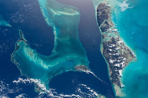
The Lucayan Archipelago: A Tapestry of Islands in the Western Atlantic
The Lucayan Archipelago, a captivating chain of islands and cays in the western Atlantic Ocean, is a testament to nature's splendor and human resilience. Encompassing The Bahamas and the Turks and Caicos Islands, this archipelago stretches from southeast Florida to northern Hispaniola. With its crystalline waters, immaculate beaches, and vibrant marine ecosystems, the Lucayan Archipelago has long been a source of wonder for explorers, settlers, and visitors alike.
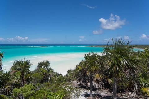
The Bahamas: Archipelagic Jewel of the Atlantic
The Commonwealth of The Bahamas, an archipelagic nation of extraordinary beauty and rich cultural heritage, lies scattered across the crystal-clear waters of the western Atlantic Ocean. This island nation, comprising over 700 islands and 2,400 cays, stretches from the coast of Florida to the edge of the Caribbean, offering a diverse tapestry of landscapes, from pristine beaches to lush tropical forests.
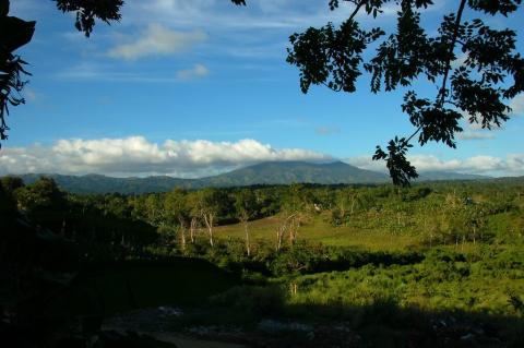
Hispaniola: A Caribbean Crucible of History, Culture, and Biodiversity
Nestled within the Greater Antilles, Hispaniola is a testament to the region's complex history, rich cultural tapestry, and extraordinary biodiversity. As the second-largest island in the Caribbean, Hispaniola encompasses a world of contrasts, from towering mountains to lush forests and sun-drenched beaches. This remarkable landmass, divided between two sovereign nations - Haiti and the Dominican Republic - offers a unique lens to explore the enduring impacts of colonialism, revolution, and nation-building in the Americas.
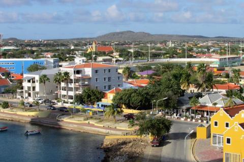
Bonaire: The Diver's Paradise of the Caribbean
Bonaire, a picturesque island in the southern Caribbean, is renowned for its stunning marine life, pristine beaches, and rich cultural heritage. Often celebrated as a diver's paradise, Bonaire offers a unique blend of natural beauty and historical depth that captivates visitors from around the globe. The island's tranquil atmosphere, diverse ecosystems, and commitment to conservation make it a must-visit destination for nature enthusiasts and adventure seekers alike.
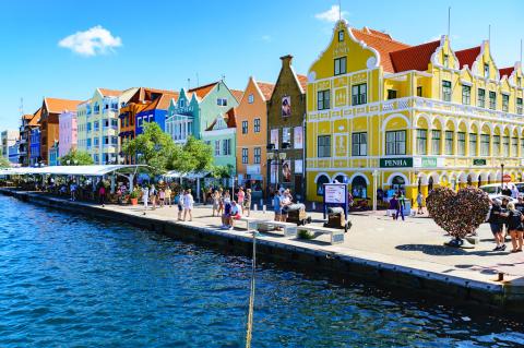
Curaçao: The Vibrant Heart of the Southern Caribbean
Curaçao, a vibrant island in the southern Caribbean Sea, is known for its rich cultural heritage, stunning natural beauty, and unique blend of influences from around the world. Part of the Kingdom of the Netherlands, Curaçao offers a captivating mix of European charm and Caribbean warmth. The island's colorful capital, Willemstad, is a UNESCO World Heritage site, and its diverse landscapes, vibrant coral reefs, and welcoming people make it a sought-after destination for travelers.
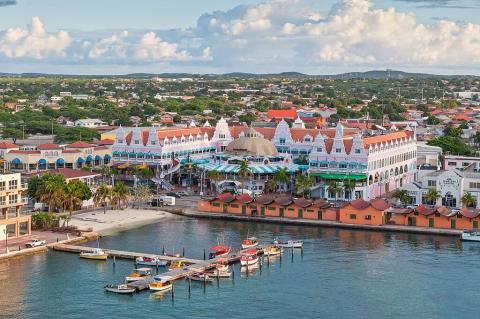
Aruba: A Blend of Dutch Heritage and Caribbean Charm
Aruba, a small island in the southern Caribbean Sea, is renowned for its stunning white-sand beaches, crystal-clear waters, and vibrant cultural heritage. Known as "One Happy Island," Aruba offers a unique blend of Dutch influence and Caribbean charm, making it a popular destination for tourists seeking relaxation and adventure. The island's arid climate, diverse landscapes, and rich history create a compelling narrative that attracts visitors worldwide.
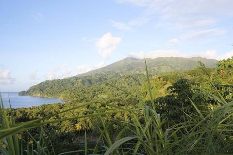
Saint Vincent: The Untamed Beauty of the Caribbean
Saint Vincent, the largest island in the nation of Saint Vincent and the Grenadines, is a captivating blend of rugged natural beauty, vibrant culture, and rich history. Often overshadowed by its more famous Caribbean neighbors, Saint Vincent offers a unique and authentic experience for those who venture to its shores. The island's dramatic landscapes, characterized by volcanic peaks, lush rainforests, and pristine beaches, are complemented by a rich cultural heritage that reflects its diverse historical influences.
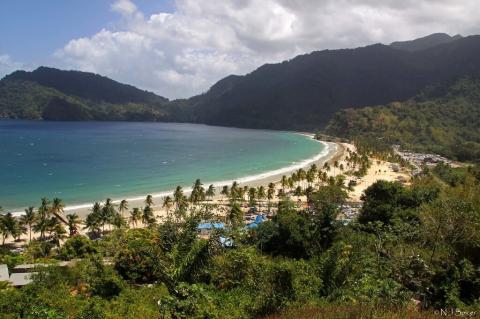
Trinidad and Tobago: A Dual Island Gem of the Caribbean
Trinidad and Tobago, a twin-island nation located at the southernmost end of the Caribbean, is a unique blend of rich cultural heritage, vibrant history, and diverse natural landscapes. Trinidad, the largest of the two islands, is renowned for its bustling cities, vibrant festivals, and economic vitality, while Tobago is celebrated for its serene beaches, lush rainforests, and tranquil ambiance.
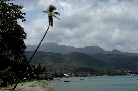
Dominica: The Nature Island of the Caribbean
Dominica, often called the "Nature Island of the Caribbean," is a lush, mountainous island nation in the Lesser Antilles region. Known for its unspoiled natural beauty, Dominica is a haven for eco-tourists and nature enthusiasts. The island boasts an array of volcanic peaks, dense rainforests, cascading waterfalls, and pristine rivers, making it a unique destination in the Caribbean.
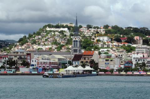
Martinique: The Fusion of French Elegance and Caribbean Splendor
Martinique, an island in the Lesser Antilles in the eastern Caribbean Sea, stands out with its unique blend of French culture and Caribbean charm. As an overseas department of France, Martinique seamlessly combines European sophistication with tropical allure, offering a rich tapestry of history, geography, environment, and culture. It is renowned for its picturesque landscapes, vibrant Creole traditions, and significant historical sites.
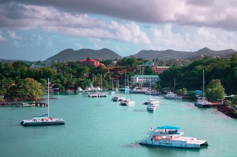
Saint Lucia: The Emerald of the Caribbean
Saint Lucia, a small island nation in the eastern Caribbean Sea, is renowned for its stunning natural beauty, vibrant culture, and rich history. Often referred to as the "Helen of the West Indies" due to its enchanting allure and strategic significance, Saint Lucia captivates visitors with its dramatic landscapes, pristine beaches, and warm, welcoming people. Exploring Saint Lucia reveals its geographical context, historical background, diverse landscapes, environmental significance, and cultural richness.
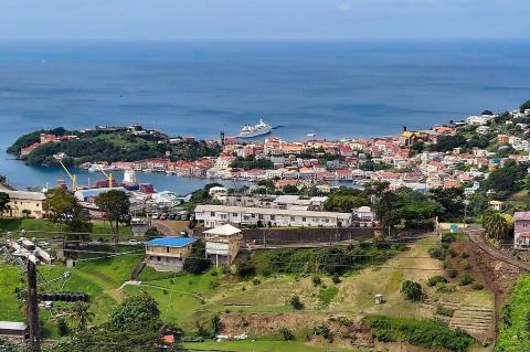
Grenada: The Spice Island of the Caribbean
Nestled in the southeastern Caribbean Sea, Grenada is a captivating island nation known for its lush landscapes, pristine beaches, and rich cultural heritage. Often referred to as the "Spice Island" due to its abundant production of nutmeg and mace, Grenada offers a unique blend of history, geography, environment, and culture, making it a fascinating destination in the Caribbean. With its main island and six smaller islands, this island nation captivates visitors with its warmth and beauty.
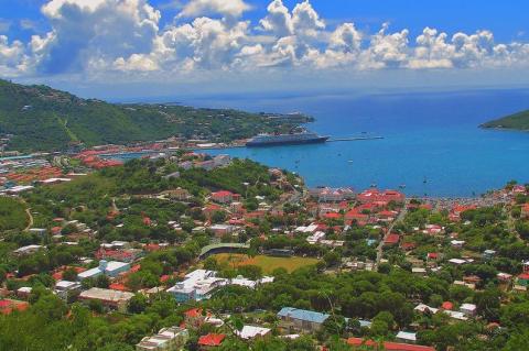
The U.S. Virgin Islands: Culture, Nature, and Adventure
The United States Virgin Islands (USVI) is a tropical paradise in the Caribbean. It comprises three major islands—St. Thomas, St. John, and St. Croix—along with Water Island and numerous smaller islets. The USVI is renowned for its stunning beaches, lush landscapes, and welcoming atmosphere. Each island has its distinct charm, from the bustling port and historic sites of St. Thomas to the unspoiled natural beauty of St. John and the cultural richness of St. Croix.
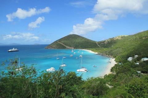
The British Virgin Islands: A Journey Through Paradise
Nestled in the heart of the Caribbean, the British Virgin Islands (BVI) are a treasure trove of stunning natural beauty, vibrant culture, and rich history. With over 60 enchanting islands and cays, each boasting its unique charm, the BVI captivates visitors with its pristine beaches, lush landscapes, and crystal-clear waters. From the bustling heart of Tortola to the tranquil shores of Anegada and the lively vibe of Jost Van Dyke, the British Virgin Islands offer a diverse and immersive experience.
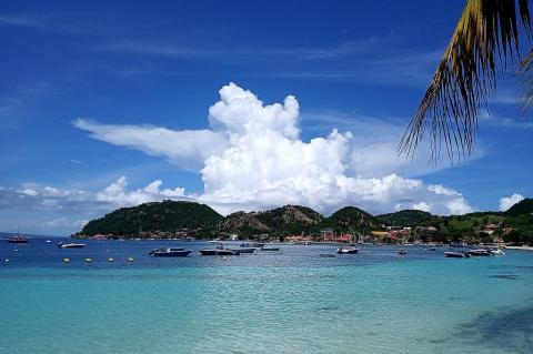
Guadeloupe: The Heart of the French Caribbean
Guadeloupe, an archipelago nestled in the eastern Caribbean Sea, captivates with its seamless blend of French elegance, Caribbean allure, and breathtaking natural beauty. As part of the Leeward Islands in the Lesser Antilles, Guadeloupe comprises two main islands, Basse-Terre and Grande-Terre, alongside several smaller islets. This comprehensive exploration delves into Guadeloupe’s rich geographical and cultural tapestry.
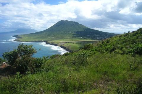
Sint Eustatius: The Golden Rock of the Caribbean
Sint Eustatius, affectionately known as Statia, is a small island in the Caribbean that offers a rich tapestry of history, natural beauty, and cultural vibrancy. Known for its volcanic landscapes and historical significance, Statia is a hidden gem within the Leeward Islands of the Lesser Antilles and is part of the Caribbean Netherlands. Its unique blend of Dutch colonial heritage and Caribbean charm makes it a fascinating destination.
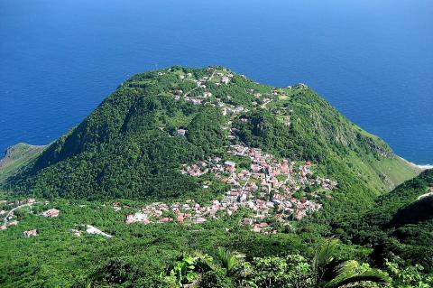
Saba: Discovering its History, Nature, and Culture
Saba is a small Caribbean island known for its natural beauty, rich history, and vibrant culture. Nestled in the Leeward Islands of the Lesser Antilles, it offers a unique experience for off-the-beaten-path travelers. Its rugged terrain, dominated by Mount Scenery, and pristine marine environments make it a haven for nature lovers and adventure seekers. Saba's commitment to environmental conservation and its historical and multicultural heritage create a compelling narrative that captivates visitors.
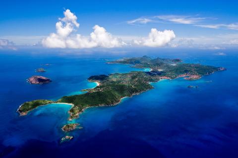
Saint Barthélemy: A Blend of French Elegance and Caribbean Charm
Saint Barthélemy, commonly known as St. Barts, is a small island in the Lesser Antilles that embodies a unique blend of French sophistication and Caribbean charm. Known for its pristine beaches, upscale resorts, and vibrant cultural scene, St. Barts offers visitors a luxurious yet culturally rich experience. From its colonial history to its stunning landscapes and vibrant festivals, exploring St. Barts provides a comprehensive understanding of its allure.
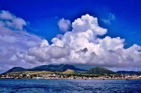
Saint Kitts and Nevis: Discovering Their Charms
Saint Kitts and Nevis, a two-island nation in the Eastern Caribbean, offer a unique blend of historical depth, natural beauty, and cultural vibrancy. These islands, known for their lush landscapes, historic sites, and welcoming atmosphere, provide a captivating experience for visitors and residents alike. Saint Kitts and Nevis stands out as a remarkable destination, from the imposing Brimstone Hill Fortress to the tranquil beaches and rich biodiversity.
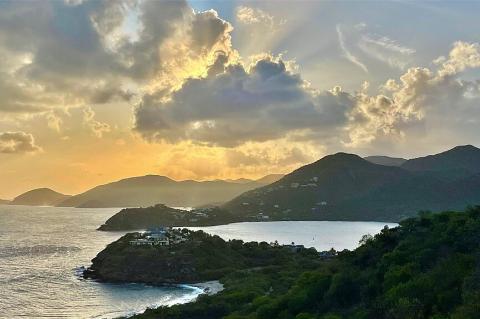
Antigua and Barbuda: A Journey Through Time and Nature
Antigua and Barbuda, a twin-island nation in the Eastern Caribbean, epitomizes the essence of a tropical paradise. These islands, known for their pristine beaches, rich historical tapestry, and vibrant cultural heritage, offer a unique blend of natural beauty and historical depth, from the colonial legacy of Nelson's Dockyard to the serene shores that dot the coastline, Antigua and Barbuda captivate visitors with their diverse attractions and warm hospitality.
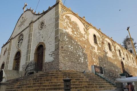
Bolivia: Cultural Landscape
Located in the heart of South America, Bolivia is known for its rich and diverse cultural heritage, which combines indigenous traditions, colonial influences, and a vibrant history. From the towering Andes mountains to the fertile Amazon basin, Bolivia's cultural landscape is a captivating fusion of ancient customs and contemporary influences, making it a fascinating destination for exploration and admiration.
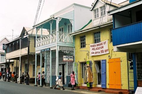
The Caribbean: Cultural Landscape
The Caribbean region boasts a rich and diverse cultural landscape shaped by Indigenous, African, European, and Asian influences. It encompasses numerous countries and territories, each with unique cultural expressions and historical narratives. While these aspects provide a general overview, the cultural landscape of the Caribbean is incredibly diverse and nuanced, with variations across countries, islands, and even within local communities.
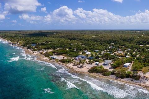
The Cayman Islands: A Blend of Opulence and Nature
Nestled like glistening gems in the turquoise embrace of the Caribbean Sea, the Cayman Islands beckon travelers to a world of unparalleled tropical luxury and pristine natural beauty. This British Overseas Territory in the Greater Antilles, comprising Grand Cayman, Cayman Brac, and Little Cayman, captivates the senses with its white sand beaches, crystal-clear waters, and a laid-back island lifestyle that epitomizes Caribbean charm.
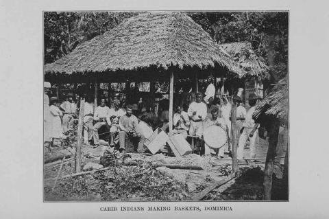
The Path of Human Settlement in the Caribbean
The Caribbean, a vibrant tapestry of islands woven with rich cultural heritage and diverse histories, has long captivated the imagination of explorers, colonists, and scholars alike. This idyllic region, nestled between the Atlantic Ocean and the Caribbean Sea, has witnessed a remarkable journey of human settlement, spanning centuries and encompassing various civilizations.
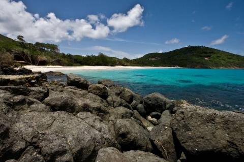
The Grenadines: An Archipelago of Wonders and Traditions
Spanning the azure waters of the eastern Caribbean Sea, the Grenadines archipelago beckons with an alluring tapestry of natural wonders and cultural riches. This scattered chain of islands between Grenada and St. Vincent unveils a world of breathtaking landscapes, vibrant marine ecosystems, and a captivating heritage woven over centuries. Embark on an immersive journey through this Caribbean gem, revealing a place where every island promises enchantment and discovery.
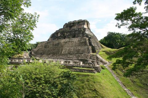
Belize: Cultural Landscape
Nestled in the heart of Central America, Belize is a cultural melting pot where diverse traditions and influences converge, creating a vibrant and captivating mosaic. From the ancient Maya civilizations to the colonial legacies and waves of immigration, this tiny nation boasts a rich tapestry woven with threads from across the globe.
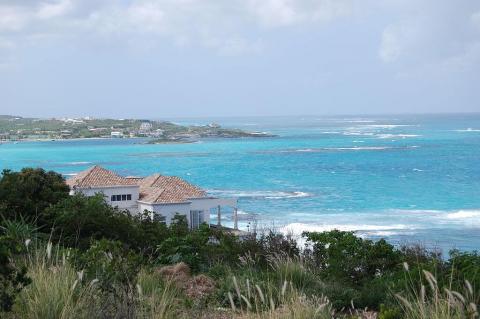
Anguilla: The Tranquil Jewel of the Caribbean
Nestled in the serene waters of the Caribbean Sea, Anguilla is a British Overseas Territory that entices visitors with its relaxed atmosphere, stunning beaches, and unspoiled natural beauty. As the most northerly of the Leeward Islands in the Lesser Antilles, Anguilla is a true jewel of the region. It offers a unique blend of rich cultural heritage, pristine landscapes, and a collection of small islets that add to its charm.
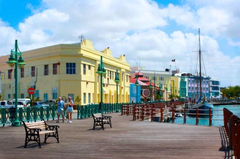
Barbados: Where the Caribean Meets Colonial Charm
Nestled in the western Atlantic Ocean and strategically positioned within the Lesser Antilles archipelago, Barbados is a beautiful island nation beckons travelers with its unique blend of natural splendor and rich cultural heritage. With its sun-drenched beaches, vibrant coral reefs, colonial architecture, and lively festivals, Barbados offers an enchanting tapestry of experiences that captivate the senses and ignite the spirit of adventure.
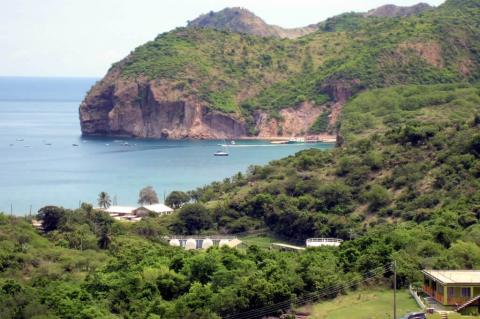
Montserrat: The Emerald Isle's Volcanic Legacy
Montserrat is a beautiful island in the West Indies, known as "The Emerald Isle of the Caribbean" due to its stunning landscapes and Irish heritage. Its lush mountains and rugged coastline offer a captivating blend of nature and culture. However, the island has a turbulent history shaped by the Soufrière Hills Volcano, which has left scars on the terrain. Through it all, Montserrat has shown its resilience in adversity.
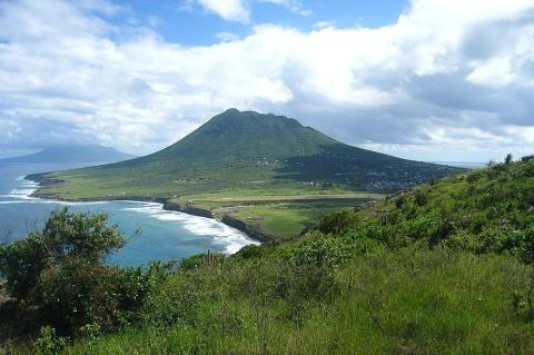
The Caribbean Netherlands: A Fusion of Culture and Nature
Nestled within the southern expanse of the Caribbean Sea, the Caribbean Netherlands, comprising the islands of Bonaire, Saba, and St. Eustatius, stands out as a fascinating region bursting with a diverse blend of cultural heritage and natural beauty. As integral components of the Kingdom of the Netherlands, these islands provide distinct experiences and attractions, drawing visitors to explore their varied landscapes and dynamic communities.
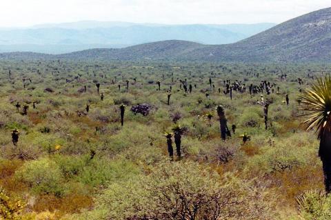
The Chihuahuan Desert: Discovering the Rich Landscape of North America's Largest Desert
The Chihuahuan Desert, North America's largest desert ecoregion, is bounded by the Sierra Madre Occidental and the Sierra Madre Oriental; it extends southward into Mexico. Recognized for its biological diversity, the Chihuahuan Desert is a rain shadow desert shaped by the surrounding mountain ranges. Home to unique endemic species, including plants and animals, the region showcases a mosaic of landscapes, from grasslands to shrublands.
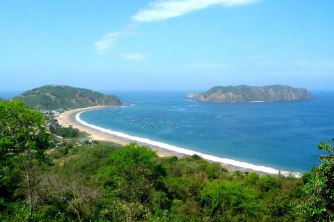
Islands and Archipelagos of Ecuador
Ecuador, renowned for its rich biodiversity and vibrant cultural heritage, boasts a remarkable collection of islands and archipelagos that dot its coastal waters. From the azure depths of the Pacific Ocean to the pristine shores of the Galápagos Islands, each island in Ecuador offers a unique mosaic of ecosystems, cultures, and experiences, reflecting the country's diverse natural wonders and cultural significance.
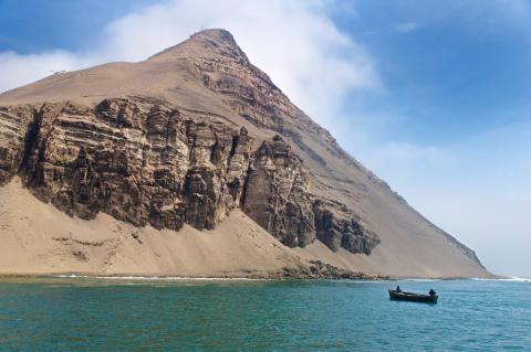
Islands and Archipelagos of Peru
Peru has islands and archipelagos along its Pacific coastline and lakes, which are not as well-known as other island destinations. However, they are hidden gems that showcase the country's remarkable biodiversity and cultural heritage. These islands and archipelagos contribute significantly to Peru's rich landscapes, wildlife, and cultural diversity.
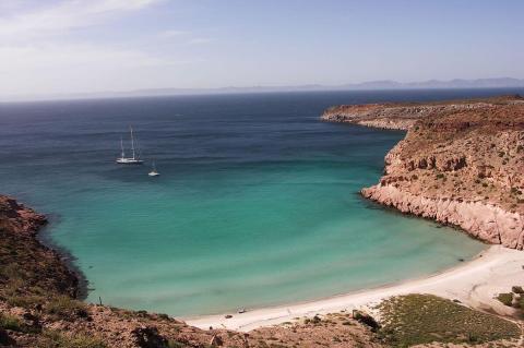
Islands and Archipelagos of Mexico
Mexico, a land of rich cultural heritage and breathtaking landscapes, extends its allure beyond its mainland borders to encompass a stunning array of islands and archipelagos scattered across its coastal waters. Nestled within the embrace of the Pacific Ocean and the Gulf of Mexico, these picturesque landmasses are evidence of the nation's diverse geography and vibrant heritage.
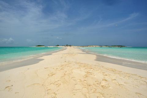
Islands and Archipelagos of Venezuela
Venezuela has stunning islands in the Caribbean Sea and the Gulf of Venezuela. Los Roques Archipelago, a national park with over 300 islands, is perfect for diving and snorkeling. Margarita Island is known for its palm-fringed beaches and cultural significance. These islands are important habitats for endangered fauna, including sea turtles. Venezuela's islands provide opportunities for relaxation amidst breathtaking landscapes and vibrant communities.
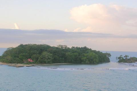
Islands and Archipelagos of Costa Rica
Costa Rica, renowned for its stunning biodiversity and commitment to conservation, boasts a treasure trove of islands and archipelagos scattered along its Pacific and Caribbean shores. These maritime jewels offer diverse experiences, ranging from biodiverse conservation areas teeming with wildlife to opportunities for cultural immersion and exhilarating outdoor activities.
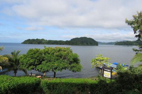
Islands and Archipelagos of Nicaragua
Nicaragua, nestled in the heart of Central America, boasts a mosaic of islands and archipelagos strewn across its Caribbean and Pacific shores, each a gem in the country's rich geographical crown. With a coastline stretching hundreds of miles, Nicaragua hosts a diverse array of islands, each with distinct character and allure.
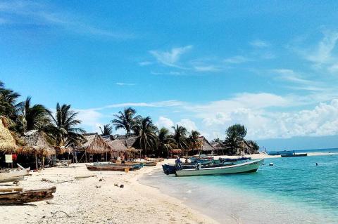
Islands and Archipelagos of Honduras
Nestled within the cerulean waters of the Gulf of Honduras and the Caribbean Sea, Honduras reveals a coastal paradise adorned with many islands and archipelagos, each boasting distinctive charm and allure. From the Bay Islands' rugged shores to the Caribbean's tranquil cays, Honduras beckons adventurers and seekers of natural beauty to embark on an unforgettable journey through its island treasures.
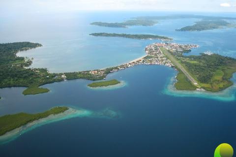
Islands and Archipelagos of Panama
Panama's islands on both coasts offer a mix of culture and nature. The San Blas Islands display traditional island life with turquoise waters and sandy beaches. Bocas del Toro Archipelago offers a laid-back Caribbean atmosphere, lush rainforests, and diving spots. Panama invites visitors to indulge in beach tourism, underwater adventures, and eco-tourism, with a rich variety of landscapes and cultures to discover.
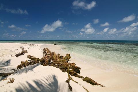
Cayes, Reefs, and Atolls of Belize
Nestled along the sparkling Caribbean Sea, Belize, a small yet remarkable country in Central America, boasts a coastline adorned with a treasure trove of cayes, reefs, and atolls that collectively form the renowned Belize Barrier Reef System. Stretching along the country's coastal expanse, these cayes are miniature paradises characterized by their pristine beaches, azure waters, and vibrant marine life.
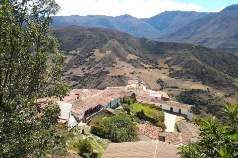
Venezuela: Cultural Landscape
Venezuela has a rich and diverse cultural landscape that reflects a blend of indigenous, Spanish, African, and Caribbean influences. The country's cultural expressions are shaped by its history, resulting in a fascinating and complex mix of traditions that continue to evolve today. From the colorful art and music to the delicious cuisine and festive celebrations, every aspect of Venezuela's culture embodies a unique identity deeply rooted in its heritage.
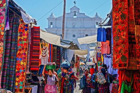
Guatemala: Cultural Landscape
Guatemala's cultural landscape is a vibrant mosaic, intricately woven from its rich Indigenous heritage, enduring Spanish colonial legacy, and evolving contemporary influences. Situated at the intersection of ancient civilizations and modern globalization, Guatemala boasts a wealth of traditions, artistic expressions, festivals, and historical landmarks that collectively showcase the depth and diversity of its cultural identity.
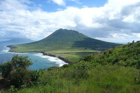
The Caribbean: Natural Landscape
The Caribbean, or West Indies, is a region of the Americas that consists of several groups of islands within or bordering the Caribbean Sea, plus The Bahamas and Turks and Caicos Islands, which are in the Atlantic Ocean. The region includes over 700 islands, islets, reefs, and cays. Renowned for its diverse landscapes, ranging from lush rainforests and pristine beaches to rugged mountains and vibrant coral reefs, its rich biodiversity is a testament to the region's unique ecosystems.
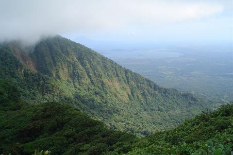
Nicaragua: Natural Landscape
Nicaragua is situated in Central America between Honduras in the north and Costa Rica in the south. Its geography divides the country into three major zones: the Pacific lowlands, the north-central highlands, and the Caribbean lowlands or Mosquito Coast.
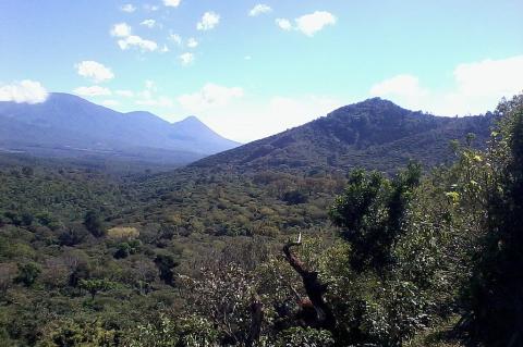
El Salvador: Natural Landscape
Nestled in northern Central America, El Salvador is strategically positioned, sharing borders with Honduras to the northeast and Guatemala to the northwest. Its geographic location grants it access to the Pacific Ocean and the Gulf of Fonseca. This unique positioning makes El Salvador the only country in Central America without a shoreline on the Caribbean Sea. El Salvador is the smallest country in Central America. Its compact size belies its remarkable diversity, with landscapes ranging from lush rainforests to towering volcanoes. It is also Central America's most densely populated country.
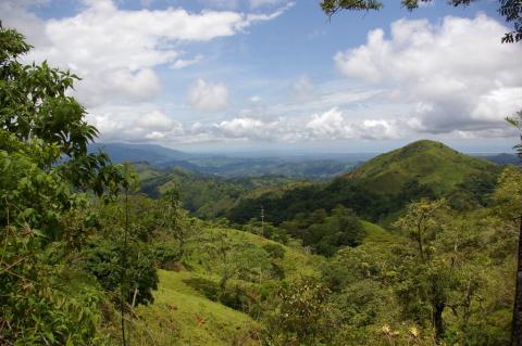
Costa Rica: Natural Landscape
Costa Rica is located in southern Central America, bordered by Nicaragua in the north and Panama in the southeast. The Caribbean Sea and the Pacific Ocean form its eastern and southwestern coastlines. Its geography features coastal plains and rainforests separated by rugged mountains and volcanoes.
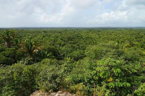
Belize: Natural Landscape
Nestled along the Caribbean coast of northeastern Central America, Belize unveils a captivating natural landscape that seamlessly blends terrestrial and marine wonders. Bordered by Mexico to the north, Guatemala to the west and south, and the azure waters of the Caribbean Sea to the east, this country, formerly known as British Honduras until 1973, carries a unique heritage as the last British colony on the American mainland.
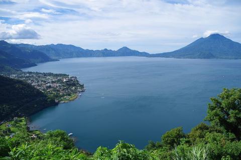
Guatemala: Natural Landscape
Guatemala is the third-largest country in Central America. Situated in a geologically active region, its geography is characterized by three major geographic regions or zones: the Petén lowlands, the Guatemalan highlands, and the Pacific coast flatlands. Nestled in Central America, Guatemala stands out for its extraordinary biodiversity, earning its status as one of the world's biodiversity hotspots.
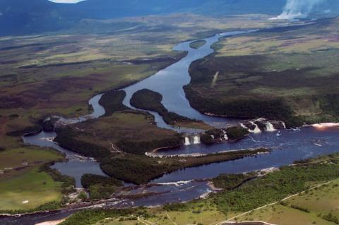
Venezuela: Natural Landscape
Venezuela is located on the northern coast of South America, bordering the Caribbean Sea and the Atlantic Ocean in the north and northeast. The country has four distinct geographical regions: the Venezuelan Highlands, the Maracaibo Lowlands, the Orinoco Plains, and the Guiana Highlands.
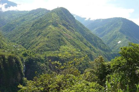
Ecuador: Natural Landscape
Ecuador encompasses a wide range of natural landscapes and climates, ranging from the arid Pacific coastal lowlands to the snow-capped peaks of the Andes Mountains and the lush eastern tropical plains of the Amazon Basin. Adding to Ecuador's natural allure are the Galápagos Islands, an archipelago of volcanic origin off the country's western coast in the Pacific Ocean.
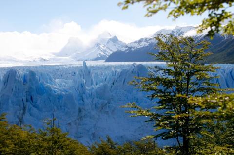
Argentina: Natural Landscape
Argentina is the second-largest country in South America after Brazil and the eighth-largest country in the world. With the Andes forming its western border with Chile, the country's varied geography can be grouped into five geographic regions or sectors and seven natural regions or ecosystems. These diverse landscapes contribute to Argentina's status as a country of immense ecological and climatic variety, making it a haven for unique flora and fauna.
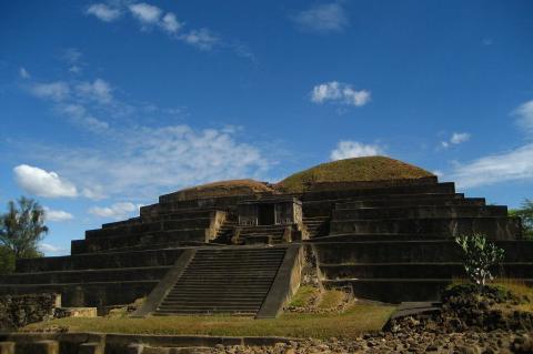
El Salvador: Pre-Columbian Maya Ruins and Archaeological Sites
El Salvador has five archaeological parks, plus a Mesoamerican site. The Yucatán Peninsula and the Petén Basin/Maya Forest region of Belize, Guatemala and Mexico have become synonymous with Maya ruins; however, several sites in El Salvador are important.
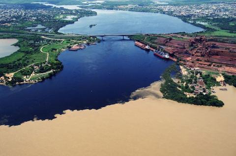
The Orinoco River: South America's Arc of Life
The Orinoco River rises in the Parima Mountains of southern Venezuela and sweeps in a great arc through Venezuela and Colombia before spreading into a vast delta on the Atlantic coast. It is the third-largest river on Earth by discharge and a homeland for peoples such as the Warao, Piaroa, Ye'kwana and Yanomami. Its basin shelters river dolphins, giant otters and the critically endangered Orinoco crocodile, and it now faces mining, mercury contamination and oil-industry pressures that put much of that richness at risk.
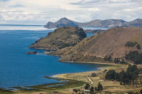
Lake Titicaca: Ancient Waters of the Andes
Lake Titicaca lies in the northern Altiplano, between Peru's Puno Region and Bolivia's La Paz Department, within the Central Andean wet puna. It covers 8,372 sq km and is the largest lake in South America by volume. It is often called the world's highest navigable lake, a title that refers to commercial vessels rather than altitude alone, and despite its elevation, it never freezes. The Andes that enclose the basin rise on both sides, and the lake itself occupies a tectonic depression.
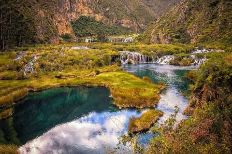
Central Andean Wet Puna: Where Mountains and Wetlands Converge
The Central Andean wet puna is a cold, moist, high-elevation grassland that runs along the Andes from northern Peru to northern Bolivia, above the tree line at roughly 3,500 m. It forms a long, narrow, often fragmented band between the dry Sechura Desert to the west and the wet Peruvian Yungas to the east, creating abrupt transitions over short distances. To the north, it gives way to the Cordillera Central páramo, and to the south to the Central Andean puna.
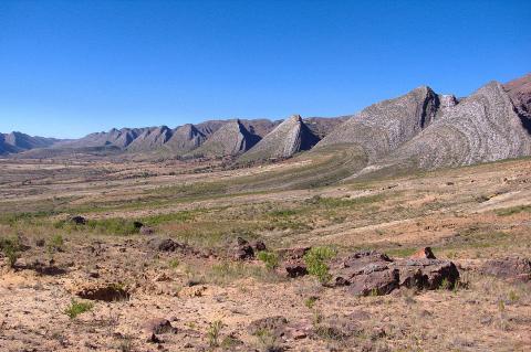
Central Andean Dry Puna: An Arid Haven in the High Andes
The Central Andean dry puna is a cold, arid grassland and shrubland that occupies the southern part of the central Andes along the Cordillera Occidental. It lies between the tree line and the permanent snow line, mostly above about 3,000 m, and is the driest of the three puna ecoregions, receiving less than 400 mm of rain a year and having an eight-month dry season. Its landscape includes snow-capped volcanoes, high plateaus, shallow lagoons, and salt flats.
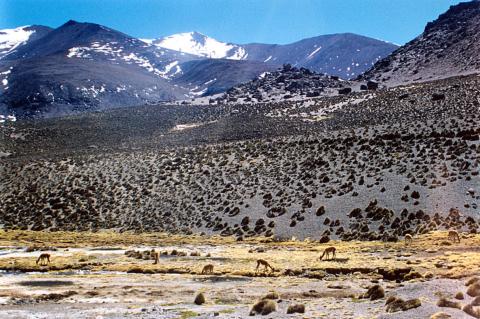
Lauca National Park and Biosphere Reserve: A Symphony of Nature
Lauca National Park lies in the northernmost Chilean Andes, in the commune of Putre in the Arica y Parinacota Region, along the border with Bolivia. It covers 137,883 hectares of the Altiplano and the surrounding mountains, and borders Bolivia's Sajama National Park. Together with Las Vicuñas National Reserve and the Salar de Surire Natural Monument, it forms the Lauca Biosphere Reserve. The landscape is part of the Central Andean dry puna.
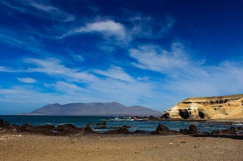
Morro Moreno National Park: A Fog Oasis on Chile's Desert Coast
Morro Moreno National Park occupies the southern end of the Mejillones Peninsula, in the Coastal Range of Chile's Antofagasta Region, in the communes of Antofagasta and Mejillones, and covers about 7,300 hectares. The peninsula it sits on is wider than it is long, reaching only about 20 km into the Pacific, and in the driest desert on Earth, the park's massif is where coastal fog, known as camanchaca, sustains an island of life.
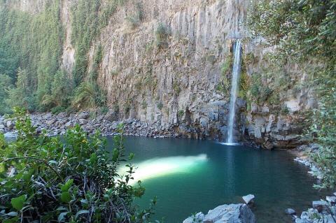
Radal Siete Tazas National Park: Seven Basalt Pools at the Edge of the Mediterranean Andes
Radal Siete Tazas National Park, in Chile's Maule Region, protects the Claro River's seven basalt pools and waterfalls, carved into ancient lava flows from volcanic activity in the area. The park's upper basin also marks an ecological transition between the drought-tolerant Mediterranean vegetation of central Chile and the moist evergreen forests farther south, creating a distinctive mix of plant and animal life.
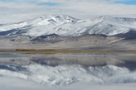
Salar del Huasco National Park: A Wetland Above 12,000 Feet, Declared Twice
Salar del Huasco National Park protects a high-Andean wetland that lies in the commune of Pica, in the Tarapacá Region of northern Chile, at about 3,800 m on the altiplano. The park covers the whole basin of the salar, about 1,500 sq km of steppe, bofedal wetlands, and shallow lagoons that Chile's environment ministry has described as one of the most pristine wetlands in the altiplano and an important water reserve in the driest desert on Earth.
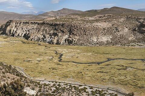
Volcán Isluga National Park: An Aymara Sacred Landscape in the High Altiplano
Volcán Isluga National Park lies in the Andes of northern Chile's Tarapacá Region, in the Tarapacá altiplano, and protects about 175,000 hectares of high puna around a sacred Aymara volcano, one of the world's highest geyser fields, and an 18th-century church that remains the ceremonial heart of Aymara life. Its landscape of volcanoes, lagoons, and bunchgrass steppe is the Central Andean dry puna.
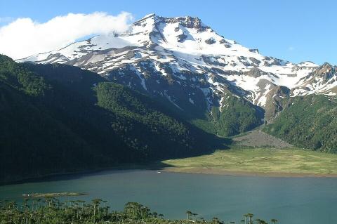
Tolhuaca National Park: Araucaria Forests Born from Chile's Oldest Reserve
Tolhuaca National Park lies in the Andean foothills of the Araucanía Region, in the commune of Curacautín, about 140 km from Temuco. It covers 6,374 hectares of araucaria and southern beech forest, lakes, and waterfalls, and is reached via a gravel road from Curacautín. The name Tolhuaca is Mapudungun and is usually translated as "cow's brow" or "cow's forehead," a reference to the shape of the volcano that dominates its skyline.